Category:Tollerton, Nottinghamshire
Jump to navigation
Jump to search
English: Tollerton is a village situated in Rushcliffe just to the south of Nottingham, United Kingdom. It is about 15 minutes from the center of Nottingham.
village and civil parish in Rushcliffe, Nottinghamshire, England .jpg) | |||||
| Upload media | |||||
| Instance of | |||||
|---|---|---|---|---|---|
| Location | Rushcliffe, Nottinghamshire, East Midlands, England | ||||
| Population |
| ||||
| official website | |||||
 | |||||
Subcategories
This category has the following 4 subcategories, out of 4 total.
N
- Nottingham Airport (24 F)
T
- St Peter's Church, Tollerton (7 F)
- Tollerton Hall (7 F)
Media in category "Tollerton, Nottinghamshire"
The following 200 files are in this category, out of 298 total.
(previous page) (next page)-
 198, Tollerton Lane.jpg 4,015 × 2,677; 1.74 MB
-
 A misty morning on Little Lane - geograph.org.uk - 4172054.jpg 1,024 × 768; 765 KB
-
 A view into the Vale - geograph.org.uk - 4172079.jpg 1,024 × 768; 815 KB
-
 A52 at Junction with A606 - geograph.org.uk - 4228363.jpg 640 × 480; 248 KB
-
 A52 Gamston Lings Bar Road - geograph.org.uk - 4228358.jpg 640 × 480; 245 KB
-
 A52 Gamston Lings Bar Road at Gamston - geograph.org.uk - 6025381.jpg 800 × 613; 117 KB
-
 A52 near Edwalton - geograph.org.uk - 3465449.jpg 2,256 × 1,504; 1.38 MB
-
 A52 railway bridge - geograph.org.uk - 3465453.jpg 2,256 × 1,504; 1.68 MB
-
 A52 south east of Edwalton - geograph.org.uk - 4495884.jpg 1,024 × 768; 161 KB
-
 A52, Gamston - geograph.org.uk - 4228118.jpg 640 × 480; 268 KB
-
 Air Training Corps unit - geograph.org.uk - 2697157.jpg 1,280 × 947; 251 KB
-
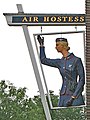
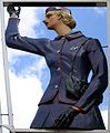 AirHostessSign.jpg 1,868 × 2,264; 2.09 MB
-
 Approaching the site of Bridge No. 9 - geograph.org.uk - 6005748.jpg 1,024 × 768; 174 KB
-
 Approaching Tollerton - geograph.org.uk - 4172052.jpg 1,024 × 768; 1,013 KB
-

-
 Aqueduct on the Grantham Canal - geograph.org.uk - 5157957.jpg 800 × 600; 150 KB
-
 Bales and a view to Tollerton - geograph.org.uk - 4172090.jpg 1,024 × 768; 1,023 KB
-
 Barn at Bassingfield House - geograph.org.uk - 2696628.jpg 1,280 × 959; 411 KB
-
 Bassingfield House - geograph.org.uk - 2696629.jpg 1,280 × 959; 321 KB
-
 Bassingfield next to the Grantham Canal - geograph.org.uk - 5602440.jpg 800 × 600; 127 KB
-
 Bassingfield, Notts. - geograph.org.uk - 3793943.jpg 3,395 × 2,010; 1.64 MB
-
 Bassingfield, towards the Wolds - geograph.org.uk - 4553041.jpg 1,024 × 731; 776 KB
-
 Beet-en track - geograph.org.uk - 983145.jpg 480 × 640; 159 KB
-
 Bench by a bridge - geograph.org.uk - 2192596.jpg 640 × 427; 98 KB
-
 Bench Mark, Melton Rd railway bridge, Tollerton - geograph.org.uk - 3825887.jpg 1,280 × 960; 484 KB
-
 Bench mark, ^41 Melton Road, Tollerton - geograph.org.uk - 3825895.jpg 1,280 × 960; 474 KB
-
 Bridge 6a crossing the Grantham Canal - geograph.org.uk - 5603106.jpg 800 × 593; 204 KB
-
 Bridge ^7 on the Grantham Canal - geograph.org.uk - 5156009.jpg 800 × 600; 213 KB
-
 Bridleway to Tollerton - geograph.org.uk - 4172133.jpg 1,024 × 768; 779 KB
-

-

-

-
 Bus shelter along Tollerton Lane - geograph.org.uk - 6025625.jpg 800 × 512; 107 KB
-
 Bus Shelter on Tollerton Lane - geograph.org.uk - 940031.jpg 640 × 480; 95 KB
-
 Canal repair - geograph.org.uk - 6005668.jpg 1,024 × 768; 134 KB
-
 Castellated gateway - geograph.org.uk - 6005542.jpg 1,024 × 768; 296 KB
-
 Chestnut Mews - geograph.org.uk - 2696655.jpg 1,280 × 959; 264 KB
-
 Concrete marker pillar with a 9 on it - geograph.org.uk - 6380501.jpg 640 × 539; 153 KB
-
 Control tower at Nottingham Airport - geograph.org.uk - 2697149.jpg 1,280 × 953; 334 KB
-
 Cotgrave Lane - geograph.org.uk - 2696647.jpg 1,280 × 959; 290 KB
-
 Cotgrave Lane - geograph.org.uk - 940060.jpg 640 × 480; 77 KB
-
 Cotgrave Lane junction - geograph.org.uk - 2696632.jpg 1,280 × 959; 277 KB
-

-
 Cotgrave Lane postbox ref NG12 186 - geograph.org.uk - 2696642.jpg 959 × 1,280; 281 KB
-
 Cotgrave Lane Sewage Pumping Station - geograph.org.uk - 2696653.jpg 1,280 × 959; 500 KB
-
 Cotgrave Lane towards Tollerton - geograph.org.uk - 6380410.jpg 640 × 440; 98 KB
-
 Cotgrave Lane, Tollerton - geograph.org.uk - 2192606.jpg 640 × 427; 92 KB
-
 Cotgrave Lane, Tollerton - geograph.org.uk - 2696651.jpg 1,280 × 959; 379 KB
-
 Cotgrave Lane, Tollerton - geograph.org.uk - 2697164.jpg 1,280 × 959; 365 KB
-
 Cotgrave Place Golf Club - geograph.org.uk - 748544.jpg 640 × 427; 105 KB
-
 Cotgrave Road - geograph.org.uk - 2696474.jpg 1,280 × 959; 272 KB
-
 Cotgrave Road north of Normanton - geograph.org.uk - 4487432.jpg 1,024 × 768; 156 KB
-
 Cottages on Tollerton Lane - geograph.org.uk - 2696602.jpg 1,280 × 959; 313 KB
-
 Crop field off Cotgrave Lane - geograph.org.uk - 3573835.jpg 640 × 480; 88 KB
-
 Dads looking after the kids - geograph.org.uk - 6452635.jpg 1,280 × 819; 486 KB
-
 East end of Burnside Grove, Tollerton - geograph.org.uk - 4495856.jpg 1,024 × 768; 131 KB
-
 Entering Tollerton - geograph.org.uk - 3573802.jpg 640 × 480; 74 KB
-
 Entrance to Tollerton Hall from the churchyard - geograph.org.uk - 6005574.jpg 768 × 1,024; 227 KB
-
 Entrance to Tollerton Park - geograph.org.uk - 5179706.jpg 1,024 × 768; 139 KB
-
 Farm building conversion, Tollerton - geograph.org.uk - 2696619.jpg 1,280 × 959; 226 KB
-
 Farm buildings at Tollerton - geograph.org.uk - 2696596.jpg 1,280 × 882; 233 KB
-
 Farm equipment and bales - geograph.org.uk - 6380393.jpg 640 × 381; 56 KB
-
 Farm track near Tollerton - geograph.org.uk - 2696663.jpg 1,280 × 959; 320 KB
-
 Farm track north of Tollerton - geograph.org.uk - 5179677.jpg 1,024 × 768; 175 KB
-
 Farm track off Cotgrave Lane - geograph.org.uk - 3573832.jpg 640 × 480; 90 KB
-

-

-
 Farmland near Nottingham City Airport - geograph.org.uk - 6025664.jpg 800 × 506; 133 KB
-
 Farmland off Melton Road - geograph.org.uk - 3573806.jpg 640 × 480; 44 KB
-

-
 Field beside Tollerton Lane - geograph.org.uk - 3348215.jpg 640 × 427; 45 KB
-
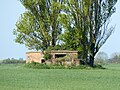
 Field track and derelict barn - geograph.org.uk - 2696649.jpg 1,280 × 959; 298 KB
-
 Footbridge over stream east of Tollerton - geograph.org.uk - 4495842.jpg 1,024 × 768; 311 KB
-
 Footpath and rape crop - geograph.org.uk - 2696591.jpg 1,280 × 959; 383 KB
-
 Footpath from Lothian Road - geograph.org.uk - 3348209.jpg 640 × 427; 64 KB
-
 Footpath from Tollerton to Edwalton - geograph.org.uk - 4171860.jpg 1,024 × 768; 979 KB
-
 Footpath off Tollerton Lane - geograph.org.uk - 3573822.jpg 640 × 480; 76 KB
-
 Footpath to Edwalton - geograph.org.uk - 3825869.jpg 960 × 1,280; 464 KB
-
 Footpath to Tollerton - geograph.org.uk - 2696588.jpg 1,280 × 959; 246 KB
-
 Footpath to Tollerton - geograph.org.uk - 2696592.jpg 1,280 × 959; 385 KB
-
 Footpath towards Edwalton - geograph.org.uk - 6380394.jpg 640 × 452; 69 KB
-
 Footpath towards Tollerton - geograph.org.uk - 6380395.jpg 640 × 458; 70 KB
-
 Former farm cottages, Tollerton - geograph.org.uk - 2696625.jpg 1,280 × 959; 247 KB
-
 Gamston Lings Bar Road - geograph.org.uk - 4228119.jpg 640 × 480; 266 KB
-

-
 Gate House on Cotgrave Lane - geograph.org.uk - 940056.jpg 640 × 480; 73 KB
-
 Gate on north side of Little Lane - geograph.org.uk - 6401749.jpg 640 × 468; 65 KB
-
 Gate on north side of Little Lane - geograph.org.uk - 6401750.jpg 640 × 497; 88 KB
-
 Gated area east of Cotgrave Lane - geograph.org.uk - 6380411.jpg 640 × 444; 49 KB
-

-
 Gates into area south of Little Lane - geograph.org.uk - 6401751.jpg 640 × 451; 60 KB
-
 Gates into area south of Little Lane - geograph.org.uk - 6401752.jpg 640 × 443; 51 KB
-
 Glebe Farm - geograph.org.uk - 983144.jpg 640 × 480; 110 KB
-
 Grantham Canal - geograph.org.uk - 1948722.jpg 640 × 480; 78 KB
-
 Grantham Canal - geograph.org.uk - 3133457.jpg 640 × 427; 106 KB
-
 Grantham Canal - geograph.org.uk - 51950.jpg 640 × 480; 100 KB
-
 Grantham Canal - geograph.org.uk - 5276262.jpg 3,072 × 1,728; 1.03 MB
-
 Grantham Canal - geograph.org.uk - 5276294.jpg 5,376 × 3,024; 2.57 MB
-
 Grantham Canal and towpath - geograph.org.uk - 3133550.jpg 640 × 427; 115 KB
-
 Grantham Canal at Bassingfield - geograph.org.uk - 5602434.jpg 800 × 563; 131 KB
-
 Grantham Canal near Bassingfield - geograph.org.uk - 1948736.jpg 640 × 480; 107 KB
-
 Grantham Canal near Bassingfield - geograph.org.uk - 1948739.jpg 640 × 480; 68 KB
-
 Grantham Canal near Bassingfield - geograph.org.uk - 1948754.jpg 640 × 480; 91 KB
-
 Grantham Canal near Bassingfield - geograph.org.uk - 5602426.jpg 800 × 600; 123 KB
-
 Grantham Canal near Bassingfield - geograph.org.uk - 6451977.jpg 1,280 × 851; 514 KB
-
 Grantham Canal near Gamston, Nottingham - geograph.org.uk - 5602444.jpg 800 × 532; 131 KB
-
 Grantham Canal towpath - geograph.org.uk - 3133451.jpg 640 × 427; 133 KB
-
 Grantham Canal towpath - geograph.org.uk - 3134672.jpg 640 × 427; 109 KB
-
 Grantham Canal towpath - geograph.org.uk - 6607383.jpg 1,280 × 853; 543 KB
-
 Grantham Canal towpath - geograph.org.uk - 6607384.jpg 1,280 × 853; 564 KB
-
 Grantham Canal towpath near Bassingfield (1) - geograph.org.uk - 5175688.jpg 1,024 × 768; 156 KB
-
 Grantham Canal towpath near Bassingfield (2) - geograph.org.uk - 5175692.jpg 1,024 × 768; 148 KB
-
 Grantham Canal ^ Cotgrave Place Golf Club, Notts. - geograph.org.uk - 3793725.jpg 3,868 × 2,770; 2.07 MB
-
 Grantham Canal, Bassingfield Vicinity, Nottingham 12 - geograph.org.uk - 3793355.jpg 3,816 × 2,578; 1.97 MB
-
 Grantham Canal, Tollerton Bridge, Nottingham 2 - geograph.org.uk - 3793288.jpg 3,279 × 2,260; 1.9 MB
-
 Hoe Hill Sewage Pumping Station - geograph.org.uk - 2696479.jpg 1,280 × 959; 285 KB
-
 Houses along Melton Road - geograph.org.uk - 3825896.jpg 1,280 × 953; 304 KB
-
 Houses on Tollerton Lane - geograph.org.uk - 2696600.jpg 1,280 × 959; 287 KB
-
 Houses on Tollerton Lane - geograph.org.uk - 3573814.jpg 640 × 480; 77 KB
-
 Icy farm track near Tollerton - geograph.org.uk - 2192602.jpg 640 × 427; 105 KB
-
 Inscribed stones at North End Cottages - geograph.org.uk - 2696658.jpg 1,280 × 959; 289 KB
-
 Layby and Café on A52 near Tollerton - geograph.org.uk - 4228121.jpg 640 × 480; 295 KB
-
 Lenton Avenue - geograph.org.uk - 1614766.jpg 640 × 479; 84 KB
-
 Linking arcade - geograph.org.uk - 6005549.jpg 1,024 × 768; 141 KB
-
 Little Lane (track) - geograph.org.uk - 3573827.jpg 640 × 480; 100 KB
-
 Little Lane - geograph.org.uk - 2696631.jpg 1,280 × 959; 315 KB
-
 Little Lane eastwards - geograph.org.uk - 6380397.jpg 640 × 466; 80 KB
-
 Little Lane goes to Homestead Farm - geograph.org.uk - 6380398.jpg 640 × 464; 82 KB
-
 Looking across the Grantham Canal to Bassingfield - geograph.org.uk - 5276674.jpg 3,072 × 1,728; 922 KB
-
 Lothian Road, Tollerton - geograph.org.uk - 3827999.jpg 1,280 × 849; 232 KB
-
 Lothian Road, Tollerton - geograph.org.uk - 4495876.jpg 1,024 × 768; 112 KB
-
 Lots of signs along Cotgrave Road - geograph.org.uk - 6025672.jpg 800 × 489; 117 KB
-
 Medina Drive - geograph.org.uk - 2696604.jpg 1,280 × 959; 286 KB
-
 Medina Drive postbox ref NG12 166 - geograph.org.uk - 2696606.jpg 1,280 × 959; 313 KB
-
 Melton Road (A606), Tollerton - geograph.org.uk - 3573808.jpg 640 × 480; 50 KB
-
 Member of Parliament Appointments - geograph.org.uk - 6380531.jpg 640 × 635; 56 KB
-
 Memorial to Susanna Falkner Neale - geograph.org.uk - 6005555.jpg 768 × 1,024; 97 KB
-
 Memorial to Susanna Pendock Barry - geograph.org.uk - 6005552.jpg 1,024 × 768; 119 KB
-
 Near Tollerton Lake - geograph.org.uk - 1095981.jpg 640 × 480; 101 KB
-
 Nearing Hoyland's Farm - geograph.org.uk - 4172102.jpg 1,024 × 768; 1,018 KB
-

-
 Normanton-on-the-Wolds from the air - geograph.org.uk - 2723149.jpg 480 × 640; 67 KB
-
 North End Cottages - geograph.org.uk - 2696657.jpg 1,280 × 959; 306 KB
-
 Not yet marked - geograph.org.uk - 983147.jpg 480 × 640; 146 KB
-

-
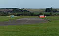
 Nottingham (Tollerton) Airport - geograph.org.uk - 2697139.jpg 1,280 × 959; 232 KB
-
 Nottingham Airport (Tollerton) - geograph.org.uk - 2697154.jpg 1,280 × 969; 345 KB
-
 Nottingham City Airport - geograph.org.uk - 6025636.jpg 800 × 494; 79 KB
-
 Nottingham City Airport, Tollerton, Notts. - geograph.org.uk - 3793932.jpg 2,701 × 1,346; 980 KB
-
 Nottingham City skyline - geograph.org.uk - 6025619.jpg 800 × 518; 109 KB
-
 Nottingham County Council Noticeboard - geograph.org.uk - 6380503.jpg 640 × 632; 114 KB
-

-

-
 Old airfield buildings at Tollerton - geograph.org.uk - 2697130.jpg 1,280 × 959; 398 KB
-
 Old barn in a field near Tollerton - geograph.org.uk - 2192584.jpg 640 × 427; 86 KB
-
 Old Barton bus stop, Tollerton - geograph.org.uk - 2696623.jpg 1,280 × 959; 320 KB
-

-
 Old frontage, Nottingham Airport - geograph.org.uk - 5179691.jpg 1,024 × 768; 197 KB
-
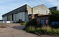 Old hangar at Nottingham City Airport - geograph.org.uk - 6025642.jpg 800 × 515; 102 KB
-
 Only high vehicles allowed - geograph.org.uk - 1614753.jpg 640 × 479; 102 KB
-
 Pillbox (2), Tollerton Airfield.jpg 1,280 × 960; 561 KB
-
 Pillbox (3), Tollerton Airfield.jpg 1,280 × 960; 707 KB
-
 Pillbox (4), Tollerton Airfield.jpg 1,280 × 812; 383 KB
-
 Pillbox (5), Tollerton Airfield.jpg 1,280 × 872; 551 KB
-
 Pillbox (6), Tollerton Airfield.jpg 1,280 × 960; 426 KB
-
 Pillbox (7), Tollerton Airfield.jpg 1,280 × 960; 399 KB
-
 Pillbox (8), Tollerton Airfield.jpg 1,280 × 806; 462 KB
-
 Pillbox (9), Tollerton Airfield.jpg 1,280 × 960; 850 KB
-

-
 Pillbox at Tollerton Airfield - geograph.org.uk - 2697127.jpg 1,280 × 959; 343 KB
-
 Pillbox, Tollerton Airfield.jpg 1,280 × 960; 629 KB
-
 Polser Brook aqueduct - geograph.org.uk - 6451988.jpg 1,280 × 960; 785 KB
-
 Poplar trees in a field of oilseed rape - geograph.org.uk - 6006087.jpg 1,024 × 768; 173 KB
-

-

-
 Postbox NG12 150 on Cotgrave Lane - geograph.org.uk - 6380534.jpg 640 × 488; 109 KB
-
 Postbox number NG12 1850 - geograph.org.uk - 6380504.jpg 639 × 640; 146 KB
-

-
 Postbox number NG12 1850 id plate - geograph.org.uk - 6380506.jpg 640 × 368; 38 KB
-

-
 Pub sign in Tollerton - geograph.org.uk - 186204.jpg 480 × 640; 113 KB
-

-

-
 Railway Bridge, Lings Bar Road - geograph.org.uk - 3825874.jpg 1,280 × 1,058; 310 KB
-
 Railway embankment - geograph.org.uk - 1614758.jpg 640 × 479; 82 KB
-

-
 Shops on Burnside Grove, Tollerton - geograph.org.uk - 4495862.jpg 1,024 × 768; 122 KB
-
 Sign in hedge - geograph.org.uk - 6380523.jpg 640 × 558; 92 KB
-
 Signs by Jubilee Wood-Little Lane 0001 - geograph.org.uk - 6380524.jpg 640 × 526; 120 KB
-

-

-

-

-

-

-

-

-

-

-


_-_geograph.org.uk_-_5175688.jpg)
_-_geograph.org.uk_-_5175692.jpg)


_-_geograph.org.uk_-_3573827.jpg)


,_Tollerton_-_geograph.org.uk_-_3573808.jpg)


_Airport_-_geograph.org.uk_-_2697139.jpg)
_-_geograph.org.uk_-_2697154.jpg)


,_Tollerton_Airfield.jpg)
,_Tollerton_Airfield.jpg)
,_Tollerton_Airfield.jpg)
,_Tollerton_Airfield.jpg)
,_Tollerton_Airfield.jpg)
,_Tollerton_Airfield.jpg)
,_Tollerton_Airfield.jpg)
,_Tollerton_Airfield.jpg)
_-_geograph.org.uk_-_6451926.jpg)


