Category:Borough of Rushcliffe
Jump to navigation
Jump to search
borough in Nottinghamshire, England | |||||
| Upload media | |||||
| Instance of | |||||
|---|---|---|---|---|---|
| Location | Nottinghamshire, East Midlands, England | ||||
| Capital | |||||
| Legislative body |
| ||||
| Inception |
| ||||
| Population |
| ||||
| Area |
| ||||
| official website | |||||
 | |||||
Subcategories
This category has the following 62 subcategories, out of 62 total.
A
B
C
- Clipston, Nottinghamshire (137 F)
E
F
G
H
K
L
M
N
- Normanton-on-the-Wolds (122 F)
P
R
S
- Saxondale, Nottinghamshire (95 F)
T
- Thorpe in the Glebe (63 F)
U
W
Media in category "Borough of Rushcliffe"
The following 200 files are in this category, out of 1,400 total.
(previous page) (next page)-
'Brooke House', 71 Milford Lane - geograph.org.uk - 5796997.jpg 667 × 1,024; 198 KB
-
'Nottingham Prince' near Meadow Lane Lock - geograph.org.uk - 6271323.jpg 1,024 × 768; 759 KB
-
A bend in the Trent - geograph.org.uk - 2888235.jpg 1,024 × 768; 861 KB
-
A Bridgford sunset - geograph.org.uk - 4140357.jpg 1,024 × 768; 859 KB
-
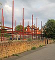
A building site on Wilford Lane - geograph.org.uk - 4975080.jpg 1,024 × 732; 957 KB
-
A changed riverside view - geograph.org.uk - 3442980.jpg 1,200 × 1,200; 1.52 MB
-
A changed view from Trent Bridge - geograph.org.uk - 5362737.jpg 1,024 × 819; 685 KB
-
A changed view on Loughborough Road - geograph.org.uk - 5825833.jpg 1,024 × 682; 917 KB
-
A changing view from Trent Bridge - geograph.org.uk - 6847450.jpg 1,024 × 768; 645 KB
-
A coot and child - geograph.org.uk - 5857281.jpg 1,280 × 1,280; 591 KB
-
A derelict lock and The City Ground - geograph.org.uk - 6957811.jpg 1,200 × 1,200; 1.68 MB
-
A disappearing landmark - geograph.org.uk - 3767540.jpg 1,280 × 792; 248 KB
-
A good crowd on Bridgford Road - geograph.org.uk - 4106036.jpg 1,024 × 801; 1.12 MB
-
A grey May morning by the Trent - geograph.org.uk - 6847617.jpg 1,200 × 900; 1.2 MB
-
A grey morning by the Trent - geograph.org.uk - 3411310.jpg 1,200 × 867; 1,017 KB
-
A grey September morning by the Trent - geograph.org.uk - 4675941.jpg 1,024 × 732; 943 KB
-
A jogger on the Embankment Steps - geograph.org.uk - 4907956.jpg 819 × 1,024; 1.05 MB
-
A May evening by the Trent - geograph.org.uk - 3443074.jpg 1,200 × 886; 1.16 MB
-
A May evening in Lady Bay Road - geograph.org.uk - 4001393.jpg 1,024 × 839; 1.05 MB
-
A May evening on Bridgford Road - geograph.org.uk - 4956141.jpg 800 × 534; 513 KB
-
A May evening on Radcliffe Road - geograph.org.uk - 4482599.jpg 1,024 × 732; 747 KB
-
A May morning by the Trent - geograph.org.uk - 4960056.jpg 1,024 × 732; 1.15 MB
-
A May morning by the Trent - geograph.org.uk - 5409509.jpg 1,024 × 731; 704 KB
-
A new building next to Welbeck Hall - geograph.org.uk - 4044913.jpg 936 × 1,024; 1.1 MB
-
A scent of new mown grass - geograph.org.uk - 3070314.jpg 1,280 × 960; 416 KB
-
A September evening by the Trent - geograph.org.uk - 3640953.jpg 1,200 × 871; 1.11 MB
-
A September evening on the Embankment Steps - geograph.org.uk - 3137628.jpg 1,024 × 768; 1.06 MB
-
A September morning in Fox Road - geograph.org.uk - 5922167.jpg 819 × 1,024; 1.24 MB
-
A stinkpipe and the TBI - geograph.org.uk - 6847559.jpg 1,200 × 1,200; 1.32 MB
-
A summer evening on the river - geograph.org.uk - 5520860.jpg 819 × 1,024; 915 KB
-
A swan and six cygnets on the Grantham Canal - geograph.org.uk - 5408884.jpg 1,024 × 768; 1.11 MB
-
A view from Trent Bridge on an August morning - geograph.org.uk - 2569818.jpg 1,024 × 754; 875 KB
-
A West Bridgford twitchel - geograph.org.uk - 6213251.jpg 731 × 1,024; 855 KB
-
A wet afternoon in Bridgford - geograph.org.uk - 3997599.jpg 768 × 1,024; 922 KB
-
A wet Sunday by the Trent - geograph.org.uk - 3979529.jpg 1,024 × 768; 829 KB
-
A52 Lings Bar Road - geograph.org.uk - 7041177.jpg 1,280 × 960; 270 KB
-
A52 near Edwalton - geograph.org.uk - 3320329.jpg 2,256 × 1,504; 819 KB
-
A52 near Gamston - geograph.org.uk - 3465248.jpg 2,256 × 1,504; 1.25 MB
-
A52 towards Grantham - geograph.org.uk - 3573800.jpg 640 × 480; 82 KB
-
Acacia Way, Edwalton - geograph.org.uk - 7079668.jpg 1,280 × 960; 272 KB
-
Across the river - geograph.org.uk - 1163812.jpg 640 × 479; 169 KB
-
Across the river to Trent Basin - geograph.org.uk - 6272043.jpg 1,024 × 768; 857 KB
-
Across the river to Trent Bridge Quays - geograph.org.uk - 6958127.jpg 1,200 × 900; 1.28 MB
-
Across the Trent - geograph.org.uk - 3645590.jpg 839 × 1,024; 1.13 MB
-
Across the Trent and round the bend - geograph.org.uk - 6890822.jpg 1,200 × 900; 1.05 MB
-
Across the Trent at sunset - geograph.org.uk - 6088287.jpg 732 × 1,024; 967 KB
-
Across the Trent on a June afternoon - geograph.org.uk - 4509246.jpg 819 × 1,024; 981 KB
-
Across the Trent to County Hall - geograph.org.uk - 5766524.jpg 1,024 × 768; 854 KB
-
Across the Trent to County Hall - geograph.org.uk - 6278580.jpg 1,024 × 768; 697 KB
-
Across the Trent to Meadow Lane - geograph.org.uk - 6265651.jpg 1,024 × 768; 913 KB
-
Across the Trent to Meadow Lane Lock - geograph.org.uk - 6271329.jpg 1,024 × 768; 989 KB
-
Adbolton Grove, West Bridgford - geograph.org.uk - 7041019.jpg 1,280 × 875; 302 KB
-
Alford Road - geograph.org.uk - 3573786.jpg 640 × 480; 61 KB
-
Along Radcliffe Road - geograph.org.uk - 5766518.jpg 1,024 × 1,024; 1.14 MB
-
Alongside Coronation Avenue - geograph.org.uk - 3921681.jpg 1,280 × 960; 272 KB
-
Alongside The Becket School - geograph.org.uk - 3816918.jpg 1,280 × 960; 279 KB
-
Alongside The Becket School - geograph.org.uk - 3816919.jpg 1,280 × 960; 343 KB
-
Alongside the old railway embankment - geograph.org.uk - 4261414.jpg 1,280 × 960; 206 KB
-
Alongside the playing fields - geograph.org.uk - 3816920.jpg 1,280 × 960; 238 KB
-
Alterations on Edward Road - geograph.org.uk - 4442420.jpg 1,024 × 731; 1.09 MB
-
An April evening by the Trent - geograph.org.uk - 3923996.jpg 1,200 × 880; 1.11 MB
-
An April morning in Radcliffe Road - geograph.org.uk - 2889888.jpg 1,024 × 721; 843 KB
-
An August evening on Edward Road - geograph.org.uk - 4633720.jpg 640 × 800; 435 KB
-
An evening stroll by the Trent - geograph.org.uk - 3138374.jpg 640 × 480; 109 KB
-
An invitation to ski^ - geograph.org.uk - 1146394.jpg 640 × 396; 52 KB
-
Approaching Wilford - geograph.org.uk - 2888222.jpg 1,024 × 751; 808 KB
-
Ash tree alongside the Grantham Canal - geograph.org.uk - 7041171.jpg 960 × 1,280; 612 KB
-
At the corner of Radcliffe Road - geograph.org.uk - 6201696.jpg 1,024 × 819; 994 KB
-
At the going down of the sun - geograph.org.uk - 3638649.jpg 787 × 1,024; 756 KB
-
At the start of the 2017 Trent Bridge Test Match - geograph.org.uk - 5462357.jpg 768 × 1,024; 955 KB
-
Autumn is with us – 1 - geograph.org.uk - 6989022.jpg 1,280 × 960; 665 KB
-
Autumn is with us – 2 - geograph.org.uk - 6989023.jpg 1,280 × 960; 596 KB
-
Autumn is with us – 3 - geograph.org.uk - 6989028.jpg 1,280 × 960; 610 KB
-
Avenue of yew trees in Southern Cemetery - geograph.org.uk - 5919950.jpg 640 × 480; 118 KB
-
Balancing pond, Edwalton Fields - geograph.org.uk - 7079674.jpg 1,280 × 960; 307 KB
-
Barton Moor - geograph.org.uk - 292572.jpg 640 × 430; 86 KB
-
Barton Moor - geograph.org.uk - 302341.jpg 640 × 480; 58 KB
-
Beauty and the beast - geograph.org.uk - 2420513.jpg 640 × 474; 67 KB
-
Beckett School Floodgate - geograph.org.uk - 4456790.jpg 1,024 × 768; 234 KB
-
Bench mark, Lings Bar Road - geograph.org.uk - 3825866.jpg 1,280 × 960; 434 KB
-
Bench mark, Lings Bar Road railway bridge - geograph.org.uk - 3825876.jpg 1,280 × 1,280; 504 KB
-
Benchmark on Abbey Road Depot - geograph.org.uk - 5998650.jpg 1,024 × 683; 180 KB
-
Benchmark on brick gatepost of 89a Melton Road - geograph.org.uk - 6024592.jpg 1,024 × 683; 280 KB
-
Benchmark on chimney breast of ^111 Wilford Lane - geograph.org.uk - 5797013.jpg 1,024 × 683; 257 KB
-
Benchmark on Lutterell Hall, Church Drive - geograph.org.uk - 5998388.jpg 683 × 1,024; 245 KB
-
Benchmark on outbuilding at ^28 Valley Road - geograph.org.uk - 5998884.jpg 1,024 × 683; 236 KB
-
Benchmark on wall corner outside ^16 Selby Road - geograph.org.uk - 6001127.jpg 668 × 1,024; 281 KB
-
Benchmark on wall in front of ^44A Albert Road - geograph.org.uk - 5997576.jpg 1,024 × 683; 266 KB
-
Benchmark on wall outside ^113 Melton Road - geograph.org.uk - 5999199.jpg 674 × 1,024; 300 KB
-
Benchmark on ^110 Exchange Road - geograph.org.uk - 6024510.jpg 1,024 × 683; 277 KB
-
Benchmark on ^114 Wilford Lane - geograph.org.uk - 5797030.jpg 1,024 × 683; 285 KB
-
Benchmark on ^148 Trent Boulevard - geograph.org.uk - 5997529.jpg 1,024 × 683; 202 KB
-
Benchmark on ^162 Radcliffe Road - geograph.org.uk - 5997562.jpg 1,024 × 683; 205 KB
-
Benchmark on ^18 Blake Road - geograph.org.uk - 5998416.jpg 683 × 1,024; 232 KB
-
Benchmark on ^37 Stamford Road - geograph.org.uk - 5998732.jpg 1,024 × 683; 277 KB
-
Benchmark on ^4 Hilton Crescent - geograph.org.uk - 5998849.jpg 1,024 × 683; 239 KB
-
Benchmark on ^57 Alford Road - geograph.org.uk - 6307871.jpg 683 × 1,024; 244 KB
-
Benchmark on ^62 Holme Road - geograph.org.uk - 5997237.jpg 1,024 × 736; 272 KB
-
Benchmark on ^71 Wilford Lane - geograph.org.uk - 5796986.jpg 1,024 × 669; 191 KB
-
Benchmark on ^80 Stamford Road - geograph.org.uk - 6005359.jpg 666 × 1,024; 313 KB
-
Benchmark on ^89 Loughborough Road - geograph.org.uk - 6032017.jpg 1,024 × 683; 177 KB
-
Bike on the canal towpath - geograph.org.uk - 5857260.jpg 1,280 × 719; 430 KB
-
Birdlife on the Grantham Canal, Lady Bay - geograph.org.uk - 7041041.jpg 1,280 × 960; 579 KB
-
Blue sky, blue building and blue water - geograph.org.uk - 6265646.jpg 819 × 1,024; 1.06 MB
-
Boat clubs and a building project - geograph.org.uk - 6133533.jpg 1,024 × 1,024; 1.06 MB
-
Boat on the River Trent - geograph.org.uk - 4866696.jpg 800 × 545; 54 KB
-
Boathouses along the River Trent - geograph.org.uk - 6989843.jpg 1,280 × 960; 285 KB
-
Boats moored at Trent Embankment - geograph.org.uk - 2150378.jpg 800 × 588; 118 KB
-
Boost Your Body and Bridge Grove Motors - geograph.org.uk - 5112259.jpg 903 × 1,024; 1.03 MB
-
Boundary Road - geograph.org.uk - 3573568.jpg 640 × 480; 83 KB
-
Bressingham Drive off Landmere Lane - geograph.org.uk - 6588274.jpg 1,600 × 1,065; 396 KB
-
Bridge over the Trent - geograph.org.uk - 6186395.jpg 1,600 × 900; 229 KB
-
Bridge under the railway near Edwalton - geograph.org.uk - 7079696.jpg 1,280 × 960; 486 KB
-
Bridgford Hall - geograph.org.uk - 6993607.jpg 4,032 × 3,024; 3.49 MB
-
Bridgford Hall in West Bridgford - geograph.org.uk - 6904918.jpg 640 × 480; 79 KB
-
Bridgford Lock - geograph.org.uk - 3133076.jpg 640 × 427; 88 KB
-
Bridgford Lock - geograph.org.uk - 3133079.jpg 640 × 427; 105 KB
-
Bridgford Park, tree planting - geograph.org.uk - 3411524.jpg 1,200 × 900; 1.21 MB
-
Bridgford Road - geograph.org.uk - 2036399.jpg 640 × 465; 91 KB
-
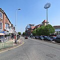
Bridgford Road and the Co-op - geograph.org.uk - 4980117.jpg 1,024 × 731; 702 KB
-
Bridgford Road and The New Stand - geograph.org.uk - 3978046.jpg 1,024 × 808; 919 KB
-
Bridgford Road on an August evening - geograph.org.uk - 5077847.jpg 732 × 1,024; 874 KB
-
Bridgford Road sunset - geograph.org.uk - 4936996.jpg 640 × 640; 458 KB
-
Bridgford Road, new flats - geograph.org.uk - 3618079.jpg 1,200 × 866; 1.25 MB
-
Bridgford Road, on the way to the 2013 Test Match - geograph.org.uk - 3549527.jpg 1,018 × 1,200; 1.22 MB
-
Bridgford Road, on the way to the match - geograph.org.uk - 5004595.jpg 732 × 1,024; 916 KB
-
Bridgford Road, on the way to the Test Match - geograph.org.uk - 6922403.jpg 1,200 × 960; 1.18 MB
-
Bridgford Road, waiting for the lights - geograph.org.uk - 3311524.jpg 1,200 × 901; 1.38 MB
-
Bridgford rooftops - geograph.org.uk - 1855296.jpg 800 × 600; 242 KB
-
Bridgford rooftops - geograph.org.uk - 2037977.jpg 800 × 581; 142 KB
-
Bridgford's changing riverside - geograph.org.uk - 4974713.jpg 1,024 × 732; 915 KB
-
Bridleway crossing the A52 - geograph.org.uk - 5919934.jpg 640 × 480; 90 KB
-
Bridleway near Welldale Farm - geograph.org.uk - 748134.jpg 640 × 480; 248 KB
-
Broken bricks and Rivermead flats - geograph.org.uk - 3442971.jpg 1,200 × 900; 1.16 MB
-
Buckfast Way allotments - geograph.org.uk - 5156022.jpg 800 × 600; 139 KB
-
Building at Nottinghamshire County Council Depot - geograph.org.uk - 5998699.jpg 1,024 × 679; 229 KB
-
Building by the A6011 - geograph.org.uk - 6847543.jpg 1,200 × 1,200; 1.45 MB
-
Building houses on Wilford Lane - geograph.org.uk - 5853350.jpg 1,024 × 683; 797 KB
-
Building on Musters Road - geograph.org.uk - 5521716.jpg 1,024 × 1,024; 1.02 MB
-
Building on the corner of Rutland Road - geograph.org.uk - 3645596.jpg 1,200 × 838; 1.14 MB
-
Building River View Court - geograph.org.uk - 4974695.jpg 819 × 1,024; 1,012 KB
-
Building Wilford Fields - geograph.org.uk - 5899734.jpg 1,024 × 768; 1,017 KB
-
Building work at Wilford Fields - geograph.org.uk - 6121297.jpg 1,024 × 768; 971 KB
-
Building work on Edward Road - geograph.org.uk - 4482591.jpg 1,024 × 683; 775 KB
-
Building work on Musters Road - geograph.org.uk - 5800486.jpg 1,024 × 1,024; 1.16 MB
-
Building work on the Radcliffe Road End - geograph.org.uk - 5362085.jpg 1,024 × 1,024; 1.17 MB
-
Bus parade - geograph.org.uk - 4385006.jpg 1,280 × 843; 210 KB
-
Canada geese and goslings on the Trent - geograph.org.uk - 2422853.jpg 1,024 × 768; 561 KB
-
Canal-side summerhouse - geograph.org.uk - 7041143.jpg 1,280 × 960; 359 KB
-
Canoeing on the Trent - geograph.org.uk - 5079214.jpg 1,024 × 768; 1.06 MB
-
Canoeists and scullers near Trent Bridge - geograph.org.uk - 4162280.jpg 1,024 × 768; 854 KB
-
Canoeists at Trent Bridge - geograph.org.uk - 4961043.jpg 819 × 1,024; 952 KB
-
Car Park, County Hall - geograph.org.uk - 4473390.jpg 640 × 480; 135 KB
-
Central Avenue on a Test Match morning - geograph.org.uk - 4064448.jpg 1,024 × 749; 932 KB
-
Central Avenue on Sunday evening - geograph.org.uk - 5044638.jpg 768 × 1,024; 1.16 MB
-
Chamomile or Mayweed - geograph.org.uk - 4042291.jpg 1,280 × 960; 266 KB
-
Changes at County Hall - geograph.org.uk - 5391508.jpg 1,024 × 682; 726 KB
-
Changes on Melton Road - geograph.org.uk - 5408531.jpg 1,024 × 643; 705 KB
-
Charity runners on Victoria Embankment - geograph.org.uk - 4960114.jpg 1,024 × 768; 1.08 MB
-
Children's playground, Bridgford Park - geograph.org.uk - 3305882.jpg 640 × 427; 105 KB
-
Church Lane - geograph.org.uk - 750299.jpg 480 × 640; 152 KB
-
Cleared embankment, Wilford Lane (1) - geograph.org.uk - 2885475.jpg 1,280 × 960; 258 KB
-
Cleared embankment, Wilford Lane - geograph.org.uk - 3015004.jpg 1,280 × 814; 171 KB
-
Clearing the embankment - geograph.org.uk - 3140175.jpg 1,280 × 947; 263 KB
-
Colwick Road and The City Ground - geograph.org.uk - 4938310.jpg 1,024 × 732; 962 KB
-
Colwick Woods revealed - geograph.org.uk - 3443006.jpg 1,200 × 882; 1.14 MB
-
Compton Acres junction on Wilford Lane - geograph.org.uk - 3280037.jpg 1,024 × 768; 112 KB
-
Compton Acres pond - geograph.org.uk - 3014844.jpg 1,280 × 921; 341 KB
-
Converted school - geograph.org.uk - 337312.jpg 640 × 480; 81 KB
-
Converting the council offices - geograph.org.uk - 5823820.jpg 682 × 1,024; 844 KB
-
Converting the former Rushcliffe Council Offices - geograph.org.uk - 5772721.jpg 819 × 1,024; 1,017 KB
-
Converting The Grantham Hotel - geograph.org.uk - 6215486.jpg 1,024 × 1,024; 1.12 MB


