Category:Strone, Cowal
Jump to navigation
Jump to search
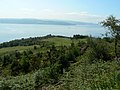
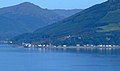
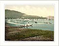
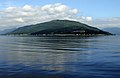
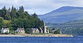
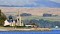
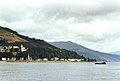
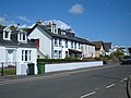
English: Strone is a village on in Argyll in south-west Scotland at the point where the north shore of the Holy Loch becomes the west shore of the Firth of Clyde.
village in Argyll and Bute, Scotland, UK  | |||||
| Upload media | |||||
| Instance of | |||||
|---|---|---|---|---|---|
| Location |
| ||||
| Different from | |||||
 | |||||
Subcategories
This category has the following 4 subcategories, out of 4 total.
D
- Dunselma (7 F)
S
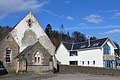
- Strone Church (6 F)
- Strone Point (20 F)
Media in category "Strone, Cowal"
The following 103 files are in this category, out of 103 total.
-
 A Cross Off Strone Point - geograph.org.uk - 3057441.jpg 3,448 × 4,592; 3.97 MB
-
 Anchor (3661090248).jpg 1,200 × 900; 267 KB
-
 Argyll hotel, Strone - geograph.org.uk - 117250.jpg 640 × 480; 87 KB
-
 B8004 Passing Strone - geograph.org.uk - 1053655.jpg 640 × 480; 79 KB
-
 Blairmore and Strone Golf Course - geograph.org.uk - 459000.jpg 640 × 480; 118 KB
-
 Boat (5790750143).jpg 1,200 × 833; 1,020 KB
-
 Bro Nordby entering Loch Long - geograph.org.uk - 6306031.jpg 1,024 × 617; 194 KB
-
 Caribbean Princess passing Strone Point - geograph.org.uk - 5484297.jpg 640 × 396; 105 KB
-
 Clyde (5791307774).jpg 3,519 × 2,639; 3.71 MB
-
 Dunselma jetty - geograph.org.uk - 6321625.jpg 1,024 × 881; 456 KB
-
 Dunselma jetty - geograph.org.uk - 6321628.jpg 1,024 × 586; 262 KB
-
 Dunselma jetty - geograph.org.uk - 6321629.jpg 1,024 × 587; 300 KB
-
 Dunselma jetty - geograph.org.uk - 6321630.jpg 768 × 1,024; 469 KB
-
 Dunselma jetty - geograph.org.uk - 6321631.jpg 1,024 × 518; 227 KB
-
 Dunselma jetty - geograph.org.uk - 6321632.jpg 1,024 × 626; 267 KB
-
 Fast boats in the Holy Loch - geograph.org.uk - 3080614.jpg 640 × 480; 157 KB
-

-
 Fields above Strone - geograph.org.uk - 460837.jpg 640 × 430; 96 KB
-
 Firth of Clyde from Berfern - geograph.org.uk - 1075439.jpg 640 × 480; 75 KB
-
 Firth of Clyde from Berfern - geograph.org.uk - 1075443.jpg 640 × 480; 59 KB
-
 Gibb's Point - geograph.org.uk - 6312451.jpg 1,024 × 455; 180 KB
-
 Highgate Hall, Strone - geograph.org.uk - 3410377.jpg 5,184 × 3,456; 6.97 MB
-
 Holy Loch - geograph.org.uk - 2463720.jpg 640 × 442; 70 KB
-
 Holy Loch - geograph.org.uk - 2463789.jpg 640 × 251; 42 KB
-
 Holy Loch and Glen Massan - geograph.org.uk - 6316757.jpg 1,024 × 555; 180 KB
-
 Houses on Holy Loch - geograph.org.uk - 6302796.jpg 1,024 × 607; 284 KB
-
 Looking across the mouth of Holy Loch - geograph.org.uk - 2533643.jpg 1,500 × 1,125; 248 KB
-
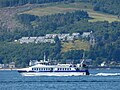 MV Argyll Flyer - geograph.org.uk - 5878407.jpg 1,024 × 768; 331 KB
-
 MV Saturn in November 2010.jpg 2,992 × 1,682; 3.4 MB
-
 MV Sleat in the Holy Loch - geograph.org.uk - 6312463.jpg 1,024 × 718; 307 KB
-
 Pier at Strone - geograph.org.uk - 2533593.jpg 1,500 × 1,125; 292 KB
-

-
 Rainbow over Strone - geograph.org.uk - 5593406.jpg 640 × 432; 81 KB
-
 Red Box - geograph.org.uk - 765306.jpg 640 × 480; 97 KB
-
 RFA Argus (A135) in the Firth of Clyde - geograph.org.uk - 6309420.jpg 1,024 × 514; 170 KB
-
 RFA Argus (A135) in the Firth of Clyde - geograph.org.uk - 6309423.jpg 1,024 × 513; 168 KB
-
 Royal Navy Rescue helicopter - geograph.org.uk - 2156763.jpg 640 × 421; 101 KB
-
 Sheep On The Road - geograph.org.uk - 765331.jpg 640 × 480; 51 KB
-
 Shore Road, Strone - geograph.org.uk - 6312439.jpg 1,024 × 768; 327 KB
-
 Shore Road, Strone - geograph.org.uk - 6312442.jpg 1,024 × 768; 341 KB
-
 Shore Road, Strone - geograph.org.uk - 6312488.jpg 1,024 × 456; 211 KB
-

-
 Strone , Holy Loch - geograph.org.uk - 213238.jpg 640 × 480; 72 KB
-
 Strone and Strone Point - geograph.org.uk - 2458675.jpg 640 × 378; 77 KB
-
 Strone buoy at the entrance to the Holy Loch - geograph.org.uk - 3552686.jpg 4,000 × 3,000; 2.12 MB
-
 Strone from Gourock - geograph.org.uk - 3755329.jpg 640 × 429; 158 KB
-
 Strone from Gourock - geograph.org.uk - 3755332.jpg 640 × 296; 91 KB
-
 Strone from Hunter's Quay, Scotland LOC 3449502057.jpg 1,024 × 773; 212 KB
-
 Strone from Hunter's Quay, Scotland-LCCN2002695062.jpg 3,655 × 2,758; 3.13 MB
-
 Strone from Hunter's Quay, Scotland-LCCN2002695062.tif 3,655 × 2,758; 28.84 MB
-
 Strone from Hunters Quay Scotland.jpg 1,064 × 840; 149 KB
-
 Strone from Inverkip - geograph.org.uk - 3440398.jpg 640 × 429; 116 KB
-
 Strone from the sea - geograph.org.uk - 6316585.jpg 1,024 × 657; 347 KB
-
 Strone from the sea - geograph.org.uk - 6316743.jpg 1,024 × 768; 388 KB
-
 Strone from the sea - geograph.org.uk - 6316748.jpg 1,024 × 520; 210 KB
-
 Strone Hill from the Firth of Clyde - geograph.org.uk - 1000964.jpg 640 × 494; 32 KB
-
 Strone Hill from the Firth of Clyde - geograph.org.uk - 1000969.jpg 640 × 551; 30 KB
-
 Strone Hill from the Firth of Clyde - geograph.org.uk - 1000977.jpg 640 × 496; 28 KB
-
 Strone Hill from the Firth of Clyde - geograph.org.uk - 1000995.jpg 640 × 480; 29 KB
-
 Strone House (3660285415).jpg 1,200 × 900; 334 KB
-
 Strone Inn - geograph.org.uk - 6312445.jpg 528 × 1,024; 279 KB
-
 Strone Pier (derelict) - geograph.org.uk - 865180.jpg 640 × 480; 89 KB
-
 Strone Pier - geograph.org.uk - 1191140.jpg 640 × 480; 46 KB
-
 Strone Pier - geograph.org.uk - 5125074.jpg 800 × 599; 123 KB
-
 Strone Pier - geograph.org.uk - 6312048.jpg 1,024 × 651; 240 KB
-
 Strone Pier - geograph.org.uk - 6312419.jpg 1,024 × 661; 392 KB
-
 Strone Pier - geograph.org.uk - 6312424.jpg 1,024 × 642; 355 KB
-
 Strone Pier - geograph.org.uk - 6312447.jpg 1,024 × 768; 345 KB
-
 Strone Pier - geograph.org.uk - 6312450.jpg 1,024 × 610; 339 KB
-
 Strone Pier - geograph.org.uk - 6312454.jpg 1,024 × 596; 275 KB
-
 Strone Pier Holy Loch - geograph.org.uk - 2806576.jpg 2,525 × 1,894; 1.84 MB
-
 Strone Pier, Holy Loch - geograph.org.uk - 213234.jpg 640 × 480; 71 KB
-
 Strone Pier, Holy Loch - geograph.org.uk - 4108708.jpg 640 × 481; 56 KB
-
 Strone Point - geograph.org.uk - 2915190.jpg 640 × 370; 87 KB
-
 Strone Point - geograph.org.uk - 3080513.jpg 640 × 416; 86 KB
-
 Strone Point - geograph.org.uk - 3080568.jpg 640 × 480; 104 KB
-
 Strone Point - geograph.org.uk - 4456722.jpg 640 × 321; 48 KB
-
 Strone Point - geograph.org.uk - 5878095.jpg 1,024 × 388; 150 KB
-
 Strone Point - geograph.org.uk - 5878373.jpg 1,024 × 442; 180 KB
-
 Strone Point - geograph.org.uk - 6203145.jpg 1,024 × 447; 172 KB
-
 Strone Point - geograph.org.uk - 6203150.jpg 1,024 × 768; 262 KB
-
 Strone Point - geograph.org.uk - 6203295.jpg 1,024 × 464; 124 KB
-
 Strone Point - geograph.org.uk - 6206501.jpg 1,024 × 485; 206 KB
-
 Strone Point - geograph.org.uk - 6206520.jpg 1,024 × 536; 208 KB
-
 Strone Point - geograph.org.uk - 6302800.jpg 1,024 × 585; 285 KB
-
 Strone Point - geograph.org.uk - 6316536.jpg 1,024 × 401; 107 KB
-
 Strone Point - geograph.org.uk - 6316746.jpg 1,024 × 407; 118 KB
-
 Strone Point and Strone Hill - geograph.org.uk - 6302769.jpg 1,024 × 768; 221 KB
-
 Strone Point from Cloch Point - geograph.org.uk - 3092864.jpg 640 × 341; 121 KB
-
 Strone Point from Gourock to Dunoon ferry - geograph.org.uk - 2215215.jpg 1,024 × 695; 141 KB
-
 Strone Point from Inverkip - geograph.org.uk - 3440392.jpg 640 × 382; 112 KB
-
 Strone Point.jpg 640 × 398; 93 KB
-
 Strone Terrace - geograph.org.uk - 865190.jpg 640 × 480; 64 KB
-
 The Holy Loch - geograph.org.uk - 3087134.jpg 640 × 284; 76 KB
-
 The pier at Strone - geograph.org.uk - 3398791.jpg 1,024 × 682; 215 KB
-
 The pier, Strone - geograph.org.uk - 2534359.jpg 2,000 × 1,508; 468 KB
-
 The Sea Wall and Steps - geograph.org.uk - 418188.jpg 640 × 480; 103 KB
-
 The Strone Point south cardinal buoy - geograph.org.uk - 1873013.jpg 640 × 474; 104 KB
-

-

-
 View Towards Loch Long - geograph.org.uk - 766635.jpg 640 × 480; 50 KB
-
 Yacht off Strone Point - geograph.org.uk - 5878349.jpg 1,024 × 594; 248 KB
-
 Yacht off Strone Point - geograph.org.uk - 5878351.jpg 1,024 × 768; 348 KB

.jpg)


.jpg)


.jpg)


_in_the_Firth_of_Clyde_-_geograph.org.uk_-_6309420.jpg)
_in_the_Firth_of_Clyde_-_geograph.org.uk_-_6309423.jpg)


.jpg)

_-_geograph.org.uk_-_865180.jpg)


