Category:Street signs in the London Borough of Wandsworth
Jump to navigation
Jump to search
Media in category "Street signs in the London Borough of Wandsworth"
The following 35 files are in this category, out of 35 total.
-
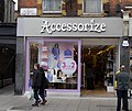
Accessorize, Putney, London.JPG 3,746 × 3,155; 5.58 MB
-
Balham Hill - geograph.org.uk - 1014057.jpg 640 × 480; 80 KB
-
Battersea Square SW11 and Penfold post box. (4318738294).jpg 1,447 × 1,296; 620 KB
-
Blue Plaque, Arundel Terrace, Trinity Road - geograph.org.uk - 5223785.jpg 3,706 × 4,805; 4.22 MB
-
Bollard At Junction With Lower Richmond Road.jpg 4,032 × 3,024; 7.75 MB
-
Bubbling Well Square, Wandsworth.jpg 4,032 × 3,024; 4.14 MB
-
Dingwall Road SW18 (4149928457).jpg 2,896 × 1,944; 644 KB
-
Earlsfield cemetery - geograph.org.uk - 768208.jpg 640 × 480; 120 KB
-
Filament Walk SW18. (25571822121).jpg 3,264 × 2,448; 1.29 MB
-
Jews Row SW18. (31480940111).jpg 3,264 × 2,448; 1.67 MB
-
John Archer Way sign.jpg 4,032 × 3,024; 5.73 MB
-
Lavender Hill street sign.jpg 2,734 × 1,293; 276 KB
-
Lisle Close - geograph.org.uk - 1012867.jpg 640 × 480; 112 KB
-
London agglomeration - panoramio.jpg 2,592 × 1,936; 2.64 MB
-
London, UK - panoramio (296).jpg 3,552 × 2,000; 1.41 MB
-
Old enamel fingerpost on Keble Street, Earlsfield - geograph.org.uk - 3994682.jpg 2,304 × 1,728; 795 KB
-
Old street name and direction signs - geograph.org.uk - 2275359.jpg 1,600 × 1,200; 526 KB
-
Ram Quarter, Wandsworth Town, September 2021 02.jpg 4,032 × 3,024; 6.33 MB
-
Ram Quarter, Wandsworth Town, September 2021 04.jpg 3,024 × 4,032; 4.34 MB
-
Roads named after Afghanistan War in SW11 - geograph.org.uk - 5683738.jpg 576 × 1,024; 171 KB
-
Sopwith Way SW8 (8256778247).jpg 3,359 × 2,630; 1.27 MB
-
Southolm Street SW11. (8403154040).jpg 3,648 × 2,736; 1.56 MB
-
Spring Passage SW15 and a blue bollard. (8228631265).jpg 2,830 × 2,439; 2.3 MB
-
Street sign, Pirbright Road SW18 - geograph.org.uk - 3337896.jpg 640 × 480; 47 KB
-
The Balham Tup - geograph.org.uk - 1014046.jpg 640 × 480; 103 KB
-
The Captain Cook pub on Upper Richmond Road, SW15 (8364741476).jpg 2,523 × 2,007; 1.61 MB
-
Tideway Walk - geograph.org.uk - 3347067.jpg 640 × 480; 91 KB
-
Token Yard SW15. (7528310386).jpg 2,272 × 1,704; 724 KB
-
Tooting Broadway Underground Station - geograph.org.uk - 674884.jpg 640 × 480; 99 KB
-
William Henry Walk - geograph.org.uk - 2324678.jpg 640 × 454; 173 KB
-
William Henry Walk Nine Elms London - geograph.org.uk - 2568143.jpg 4,000 × 3,000; 2.4 MB
-
William Henry Walk, London, SW8 - geograph.org.uk - 2063484.jpg 1,024 × 768; 299 KB


