Category:Street signs in the London Borough of Haringey
Jump to navigation
Jump to search

Media in category "Street signs in the London Borough of Haringey"
The following 79 files are in this category, out of 79 total.
-
 Prospect Place Church Road Tottenham Covid-19 pandemic lock down London England 1.jpg 3,217 × 4,021; 10.69 MB
-
 Amber Mews Street Sign.jpg 3,700 × 2,776; 1.6 MB
-
 Ancient and modern, Myddleton Road, N22 - geograph.org.uk - 4592651.jpg 640 × 480; 104 KB
-
 Arnold Road Streetname Signs.jpg 1,354 × 1,200; 504 KB
-
 Barkham Road, Tottenham - geograph.org.uk - 2869013.jpg 1,024 × 768; 114 KB
-
 Barry Avenue, Tottenham - geograph.org.uk - 1975442.jpg 640 × 480; 87 KB
-
 Bridge renewal, Seven Sisters N15.jpg 3,264 × 2,448; 1.4 MB
-
 Broke Street - 1 - ► Update.jpg 3,872 × 2,592; 1.47 MB
-
 Broke Street - 2.jpg 3,872 × 2,592; 1.36 MB
-
 Brook Street - still unsigned on 14 October 2015.jpg 3,200 × 2,825; 1.42 MB
-
 Brook Street Sign - 4 July 2015.jpg 3,000 × 2,250; 2.05 MB
-
 Carbuncle Passage, N17.jpg 1,600 × 2,133; 487 KB
-
 Chandos Road streetname sign.jpg 1,750 × 1,600; 464 KB
-
 Chaplin Road N17 - streetname sign - 1.jpg 3,000 × 4,000; 3.23 MB
-
 Chaplin Road N17 - streetname sign - 2.jpg 3,000 × 4,000; 2.73 MB
-
 Chaplin Road N17. Unreadable street nameplates. ►UPDATE October 2016.jpg 4,000 × 3,000; 2.04 MB
-
 Chaplin Road Streetname signs.jpg 2,000 × 2,600; 933 KB
-
 Chaplin Road Streetsign 24 November 2015 - 1.jpg 3,000 × 2,250; 1.11 MB
-
 Chaplin Road Streetsign 24 November 2015 - 2.jpg 3,000 × 2,250; 924 KB
-
 Chaplin Road streetsigns - Update 27 September 2016.jpg 4,000 × 2,500; 1.64 MB
-

-
 Close-up - Chaplin Rd streetsign 27 September 2016.jpg 4,000 × 3,000; 1.85 MB
-
 Crouch Hill sign (10335760534).jpg 1,600 × 1,200; 563 KB
-
 Damaged Streetname sign - Ladysmith Road N17.jpg 2,069 × 1,553; 580 KB
-
 Dayburner- ID Tag.jpg 926 × 695; 119 KB
-
 Dayburner.jpg 2,435 × 2,891; 1.09 MB
-
 Devon Close - Missing Street nameplate 26 August 2013.jpg 1,800 × 1,800; 856 KB
-
 Dimple-Glazing Road N17 ?.jpg 1,600 × 1,200; 598 KB
-
 Dowsett Road - Sign.jpg 1,200 × 900; 234 KB
-
 Effingham bagging 'em.jpg 3,400 × 2,850; 1.61 MB
-
 Endymion Road.jpg 5,184 × 3,888; 10.47 MB
-
 Felixstowe Road N17 - street nameplate.jpg 4,000 × 3,000; 3.12 MB
-
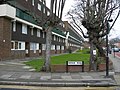 Flats on West Green Road, N15 - geograph.org.uk - 755954.jpg 640 × 480; 105 KB
-
 Former White Hart Pub, Devonshire Hill Lane, N17.jpg 2,133 × 1,600; 686 KB
-
 Harringay Passage Cladding.jpg 2,133 × 1,600; 486 KB
-
 Harringay Passage.jpg 2,263 × 2,208; 742 KB
-
 Is this Greyhound Road ?.jpg 1,200 × 1,600; 524 KB
-
 Looking for Chaplin Road?.jpg 4,000 × 3,000; 2.3 MB
-
 Mary Neuner Road sign 2024-06-07.jpg 5,776 × 4,336; 10.38 MB
-
 Maybe Loxwood Road?.jpg 2,640 × 1,981; 1.18 MB
-
 Missing Street nameplate - Devon Close.jpg 3,000 × 2,250; 1.62 MB
-
 Mystery Street N17.jpg 3,648 × 2,736; 2.07 MB
-
 N17 corner house.jpg 1,600 × 2,133; 566 KB
-
 N22 doorway and former shop?.jpg 1,600 × 2,133; 828 KB
-
 Nelson Mandela Close - geograph.org.uk - 910258.jpg 640 × 480; 87 KB
-
 New streetname sign. At last.jpg 3,100 × 2,300; 901 KB
-
 No through road sign - geograph.org.uk - 4128540.jpg 2,304 × 1,728; 1.32 MB
-
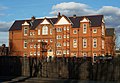 Noel Park School.JPG 3,261 × 2,255; 2.86 MB
-
 Old enamel sign, Cissbury Road N15 - geograph.org.uk - 2247284.jpg 1,600 × 1,200; 543 KB
-
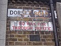 Old enamel sign, Dorset Road Tottenham - geograph.org.uk - 2247285.jpg 1,600 × 1,200; 577 KB
-
 Old sign for Coningsby Road, N4 - geograph.org.uk - 4581387.jpg 640 × 480; 104 KB
-
 Old sign for Hillfield Avenue, N8 - geograph.org.uk - 4590977.jpg 640 × 360; 71 KB
-
 Old sign for Queen's Road, N11 - geograph.org.uk - 4692537.jpg 640 × 480; 79 KB
-
 Old signs on Felix Avenue - geograph.org.uk - 3870850.jpg 2,304 × 1,728; 832 KB
-
 Prince Arthur Road, Hampstead.jpg 2,260 × 2,019; 1.03 MB
-
 Road name and dachshund on Muswell Hill Broadway - geograph.org.uk - 5352775.jpg 2,304 × 1,728; 850 KB
-
 Road Sign, Cheshire Road, Bowes Park, London N22 - geograph.org.uk - 4471856.jpg 1,100 × 825; 1.15 MB
-
 Rokesly Avenue sign and Lime bike 2024-03-07.jpg 5,130 × 3,420; 10.89 MB
-
 Rutland Gardens.001 - London.JPG 3,264 × 2,448; 2.54 MB
-
 Signless, Hopeless.jpg 2,100 × 2,100; 696 KB
-
 South Tottenham - road sign, Black Boy Lane (geograph 6510053).jpg 1,600 × 1,160; 529 KB
-
 Street sign slowly vanishes.jpg 3,690 × 2,768; 1.88 MB
-
 Street sign, Wood Green Road N15 - geograph.org.uk - 3857855.jpg 640 × 480; 158 KB
-
 Street signs - corner of Forster Road & Chaplin Road.jpg 3,271 × 2,626; 1.42 MB
-
 Street UnSign - Corner of Brook Street & High Road Tottenham.jpg 320 × 240; 66 KB
-
 Street-name signs Napier Road.jpg 1,833 × 2,776; 1.32 MB
-
 Streetname sign on west side of Chaplin Road.jpg 2,400 × 3,200; 1.76 MB
-
 Thackeray Avenue N17 - streetname.jpg 2,976 × 1,543; 1.1 MB
-
 The Broadway High Road.001 - London.JPG 3,264 × 2,448; 2.66 MB
-
 The Sign of Three.jpg 1,369 × 1,028; 316 KB
-
 Town Hall Approach Road - 15457142915.jpg 3,000 × 2,250; 1.27 MB
-
 Town Hall Approach Road N15.jpg 2,323 × 1,832; 1.28 MB
-
 Town Hall Approach Road.jpg 3,700 × 2,776; 2.23 MB
-
 Umfreville Road sign.jpg 3,000 × 3,581; 6 MB
-
 Un-Signed.jpg 2,350 × 1,950; 1,006 KB
-

-
 White Hart Lane - geograph.org.uk - 2166320.jpg 3,872 × 2,592; 1.15 MB
-
 White Hart Lane N17. (6953345498).jpg 2,816 × 2,112; 1.36 MB
-
 Wightman Road sign.jpg 3,691 × 2,461; 4.65 MB


.jpg)

.jpg)


.jpg)


.jpg)
