Category:Stirling (council area)
Jump to navigation
Jump to search
Council areas (municipalities) of Scotland: Aberdeen · Aberdeenshire · Angus · Argyll and Bute · Clackmannanshire · Dumfries and Galloway · Dundee · East Ayrshire · East Dunbartonshire · East Lothian · East Renfrewshire · Edinburgh · Falkirk · Fife · Glasgow · Highland · Inverclyde · Midlothian · Moray · North Ayrshire · North Lanarkshire · Outer Hebrides · Orkney Islands · Perth and Kinross · Renfrewshire · Scottish Borders · Shetland Islands · South Ayrshire · South Lanarkshire · Stirling · West Dunbartonshire · West Lothian
council area of Scotland | |||||
| Upload media | |||||
| Instance of |
| ||||
|---|---|---|---|---|---|
| Location |
| ||||
| Capital | |||||
| Population |
| ||||
| Area |
| ||||
| official website | |||||
 | |||||
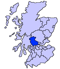
English: Stirling is one of the 32 unitary local government council areas of Scotland. The administrative centre of the area is the city of Stirling.
Subcategories
This category has the following 33 subcategories, out of 33 total.
Media in category "Stirling (council area)"
The following 200 files are in this category, out of 869 total.
(previous page) (next page)-
A bend in the road - geograph.org.uk - 6181279.jpg 1,024 × 768; 267 KB
-
A grave in the priory - geograph.org.uk - 5136354.jpg 640 × 480; 132 KB
-
A misty day on Loch Lubnaig - geograph.org.uk - 5570653.jpg 640 × 480; 273 KB
-
A Narrow Part of the Whangie - geograph.org.uk - 951768.jpg 440 × 640; 75 KB
-
A walk by Loch Katrine - geograph.org.uk - 5325741.jpg 1,024 × 680; 276 KB
-
A821 beside Loch Venachar - geograph.org.uk - 4626050.jpg 3,504 × 2,336; 3.73 MB
-
Aircraft wreckage - geograph.org.uk - 199293.jpg 480 × 640; 105 KB
-
Allt a Mhuitinn reaches Loch Lomond - geograph.org.uk - 1727163.jpg 640 × 480; 135 KB
-
Allt a' Choire Bhain - geograph.org.uk - 1722062.jpg 1,200 × 1,600; 600 KB
-
Allt a' Chuilinn meets the River Larig - geograph.org.uk - 1535711.jpg 480 × 640; 111 KB
-
Allt Coire Chaorach - geograph.org.uk - 1616553.jpg 480 × 640; 125 KB
-
Alt Coire Laoigh - geograph.org.uk - 1270203.jpg 640 × 480; 89 KB
-
Am Priosan - geograph.org.uk - 2168086.jpg 2,560 × 1,920; 891 KB
-
Amphibian seaplane - geograph.org.uk - 2931447.jpg 2,048 × 1,536; 1.02 MB
-
An impressive oak tree - geograph.org.uk - 6857742.jpg 1,366 × 1,600; 785 KB
-
Approaching Stronachlachar - geograph.org.uk - 2676147.jpg 640 × 590; 83 KB
-
Arable land and A905 - geograph.org.uk - 1743362.jpg 640 × 480; 88 KB
-
Archway - geograph.org.uk - 972757.jpg 426 × 640; 116 KB
-
Archway to the Nave, Inchmahome Priory - geograph.org.uk - 4583496.jpg 1,920 × 1,280; 1.85 MB
-
Arrochymore Point - geograph.org.uk - 3991220.jpg 4,320 × 3,240; 3.71 MB
-
Arrochymore Point - geograph.org.uk - 5035880.jpg 640 × 480; 333 KB
-
Arrochymore Point, Loch Lomond - geograph.org.uk - 7073608.jpg 1,024 × 768; 255 KB
-
Ashfield village - geograph.org.uk - 1104104.jpg 640 × 480; 64 KB
-
At Milarrochy – ripples on the surface of Loch Lomond - geograph.org.uk - 4070779.jpg 4,608 × 3,456; 3.91 MB
-
Auchineden Hill Trig Point - geograph.org.uk - 956041.jpg 640 × 480; 73 KB
-
Autumnal trees beside Loch Katrine - geograph.org.uk - 5185341.jpg 640 × 360; 313 KB
-
B818 beside Carron Valley Reservoir - geograph.org.uk - 5478875.jpg 1,600 × 1,067; 334 KB
-
Balquhidder Churchyard - geograph.org.uk - 1014852.jpg 640 × 534; 74 KB
-
Balquhidder Glen - geograph.org.uk - 6692897.jpg 1,024 × 683; 106 KB
-
Bay on Carron Valley Reservoir - geograph.org.uk - 4715207.jpg 1,600 × 1,200; 482 KB
-
Beach and alders, Port Bawn - geograph.org.uk - 7073873.jpg 1,024 × 768; 438 KB
-
Beach on Bucinch - geograph.org.uk - 4641741.jpg 4,608 × 3,456; 4.5 MB
-
Beach, Loch Coulter - geograph.org.uk - 1125297.jpg 640 × 359; 109 KB
-
Beach, Port Bawn - geograph.org.uk - 7073861.jpg 1,024 × 768; 335 KB
-
Beginning of the Sallochy Trail - geograph.org.uk - 1725729.jpg 640 × 480; 178 KB
-
Beinn Each, Luss - geograph.org.uk - 7073595.jpg 1,024 × 768; 184 KB
-
Beinn Narnain over Lochan - panoramio.jpg 2,560 × 1,920; 2.22 MB
-
Below Beinn Uird - geograph.org.uk - 1063462.jpg 640 × 359; 125 KB
-
Ben Glas - geograph.org.uk - 1163619.jpg 640 × 480; 93 KB
-
Ben Glas - geograph.org.uk - 1336816.jpg 640 × 480; 89 KB
-
Ben Venue from Loch Katrine - geograph.org.uk - 4925185.jpg 1,024 × 768; 339 KB
-
Bend on the River Forth at Stirling - geograph.org.uk - 5380891.jpg 640 × 480; 87 KB
-
Blue Sunset (154710241).jpeg 1,365 × 2,048; 718 KB
-
Bluebells beside the West Highland Way - geograph.org.uk - 3998838.jpg 4,320 × 3,240; 5.75 MB
-
Bluebells in Oak Woodland, Inchcailloch - geograph.org.uk - 6690441.jpg 1,024 × 768; 374 KB
-
Boathouse and pier, Loch Katrine - geograph.org.uk - 6858409.jpg 1,600 × 1,200; 582 KB
-
Boats moored near Loch Lomond Sailing Club - geograph.org.uk - 4641890.jpg 4,517 × 2,336; 2.69 MB
-
Boats on Loch Lomond - geograph.org.uk - 4643296.jpg 4,387 × 3,211; 3.78 MB
-
Bog, Bealach nan Corp - geograph.org.uk - 1537459.jpg 640 × 480; 97 KB
-
Boulder by the West Highland Way - geograph.org.uk - 5036103.jpg 640 × 480; 353 KB
-
Boulder on the beach - geograph.org.uk - 5036131.jpg 640 × 480; 333 KB
-
Bracken below Meall Odhar - geograph.org.uk - 891240.jpg 640 × 480; 89 KB
-
Bracklinn Falls - geograph.org.uk - 1350996.jpg 640 × 480; 117 KB
-
Bracklinn Falls - geograph.org.uk - 1351014.jpg 640 × 480; 121 KB
-
Brenachoile Lodge - geograph.org.uk - 2168149.jpg 2,560 × 1,920; 1.15 MB
-
Brenachoile Lodge - geograph.org.uk - 2537101.jpg 4,000 × 3,000; 4.13 MB
-
Brenachoile Lodge, Loch Katrine - geograph.org.uk - 6746787.jpg 4,000 × 3,000; 2.36 MB
-
Bridge at Badour - geograph.org.uk - 1281798.jpg 640 × 480; 62 KB
-
Bridge over the River Larig - geograph.org.uk - 1534985.jpg 640 × 480; 85 KB
-
Bridge under the M80 - geograph.org.uk - 1122920.jpg 640 × 480; 112 KB
-
Bruach Caorainn Burn - geograph.org.uk - 1056426.jpg 640 × 480; 219 KB
-
Buccinch, Loch Lomond - geograph.org.uk - 7073606.jpg 1,024 × 768; 171 KB
-
Bucinch and Conic Hill - geograph.org.uk - 6693650.jpg 1,024 × 683; 151 KB
-
Buildings at Strone - geograph.org.uk - 2168582.jpg 2,560 × 1,920; 850 KB
-
Bull by the shore - geograph.org.uk - 2927502.jpg 2,048 × 1,536; 753 KB
-
Buoy on Loch Lomond - geograph.org.uk - 4641729.jpg 4,608 × 3,456; 4.15 MB
-
Burial ground, Inchcailloch - geograph.org.uk - 4619713.jpg 4,608 × 3,456; 7.04 MB
-
Burn Near Frenich - geograph.org.uk - 1035221.jpg 640 × 480; 218 KB
-
Burn under Parlan Hill - geograph.org.uk - 1537258.jpg 640 × 480; 129 KB
-
Burning Bush carving, Logie Parish Church, Stirling.jpg 2,835 × 2,448; 1.53 MB
-
By Loch Chon - geograph.org.uk - 1356623.jpg 640 × 480; 182 KB
-
Callander Meadows - geograph.org.uk - 1074146.jpg 640 × 481; 114 KB
-
Callander Meadows - geograph.org.uk - 827254.jpg 640 × 481; 127 KB
-
Cameron Muir - geograph.org.uk - 1716835.jpg 640 × 480; 97 KB
-
Car park, Queen's Crescent - geograph.org.uk - 1714603.jpg 640 × 480; 142 KB
-
Carron Valley Reservoir - geograph.org.uk - 5183996.jpg 640 × 480; 73 KB
-
Carron Valley Reservoir - geograph.org.uk - 6725336.jpg 1,024 × 768; 189 KB
-
Carron Valley Reservoir - geograph.org.uk - 7122970.jpg 4,160 × 3,120; 2.07 MB
-
Carron Valley Reservoir from the air - geograph.org.uk - 5228774.jpg 640 × 480; 112 KB
-
Carron Valley Reservoir near its west end - geograph.org.uk - 4715179.jpg 1,600 × 1,200; 401 KB
-
Cashel woodlands - geograph.org.uk - 6693652.jpg 1,024 × 683; 201 KB
-
Ceardach Island - geograph.org.uk - 4641711.jpg 1,596 × 937; 401 KB
-
Cloichran rock , Loch Tay - geograph.org.uk - 2391769.jpg 640 × 360; 73 KB
-
Coire Ghaordaidh - geograph.org.uk - 1064715.jpg 640 × 480; 47 KB
-
Coire Ghaordaidh - geograph.org.uk - 1069203.jpg 640 × 480; 52 KB
-
Coldstream Guard at Stirling Castle - geograph.org.uk - 794970.jpg 640 × 480; 83 KB
-
Conglomerate exposure, Inchcailloch - geograph.org.uk - 7073588.jpg 1,024 × 768; 552 KB
-
Conic Hill - geograph.org.uk - 7073915.jpg 1,024 × 769; 199 KB
-
Coppiced Trees on the West Highland Way - geograph.org.uk - 3998832.jpg 4,320 × 3,240; 4.96 MB
-
Cottage and boathouse on Loch Katrine - geograph.org.uk - 6746793.jpg 3,797 × 2,847; 2.76 MB
-
Crags above Gleann Dubh - geograph.org.uk - 1515009.jpg 640 × 480; 77 KB
-
Crags of Meall Sgallachd - geograph.org.uk - 1157970.jpg 640 × 480; 97 KB
-
Craigintier Wood - geograph.org.uk - 6181238.jpg 1,024 × 768; 321 KB
-
Craigintier Wood - geograph.org.uk - 6181267.jpg 1,024 × 768; 247 KB
-
Craigintier Wood - geograph.org.uk - 6886530.jpg 1,600 × 1,192; 539 KB
-
Crannog in Loch Tay - geograph.org.uk - 915464.jpg 426 × 640; 67 KB
-
Crantullich, Loch Katrine - geograph.org.uk - 6857761.jpg 1,600 × 728; 134 KB
-
Creag Bhocan from the Cononish track - geograph.org.uk - 1273651.jpg 640 × 480; 111 KB
-
Critreoch - geograph.org.uk - 4641835.jpg 2,082 × 2,108; 1.21 MB
-
Cruising Loch Katrine - geograph.org.uk - 6858397.jpg 1,600 × 1,200; 449 KB
-
Cruising on Loch Katrine - geograph.org.uk - 7080693.jpg 1,280 × 871; 336 KB
-
Cycle path under the A91 - geograph.org.uk - 1748554.jpg 640 × 480; 138 KB
-
Cycle path, Fallin - geograph.org.uk - 1748521.jpg 640 × 480; 108 KB
-
Cycle path, Polmaise mineral line - geograph.org.uk - 1748544.jpg 640 × 480; 112 KB
-
Dalmary - Buchlyvie road - geograph.org.uk - 1556675.jpg 640 × 480; 174 KB
-
Dalmary - Riding School - geograph.org.uk - 1320287.jpg 600 × 450; 144 KB
-
Dalmary, Bridge over Kelty Water - geograph.org.uk - 1320280.jpg 600 × 450; 262 KB
-
Dalmary, farmland with buttercups - geograph.org.uk - 1320432.jpg 600 × 450; 198 KB
-
Dalmary, Pasture Land - geograph.org.uk - 1320787.jpg 600 × 450; 121 KB
-
Dam of the Glen Finglas Reservoir - geograph.org.uk - 1004782.jpg 640 × 426; 72 KB
-
Dead Tree on the north bank of Loch Tay - geograph.org.uk - 5784475.jpg 3,024 × 4,032; 2.88 MB
-
Deanston & Deanston Mill Lade, Stirling Council Area.jpg 4,896 × 2,752; 2.29 MB
-
Deanston & Deanston Mill, Stirling Council Area.jpg 4,692 × 2,602; 2.51 MB
-
Deanston & the Deanston Mill Lade, Stirling Council Area.jpg 4,896 × 2,752; 2.51 MB
-
Deanston Memorial Clock and distillery, Stirling.jpg 4,308 × 2,505; 1.7 MB
-
Derelict buildings - geograph.org.uk - 1435036.jpg 640 × 480; 104 KB
-
Descent to Bealach Buidhe - geograph.org.uk - 1339528.jpg 480 × 640; 120 KB
-
Distillery House - Glengoyne.jpg 1,289 × 860; 1.31 MB
-
Don't Call Me Babe - panoramio.jpg 2,496 × 1,664; 1.51 MB
-
Doorway to the Cloisters, Inchmahome Priory - geograph.org.uk - 4583494.jpg 1,920 × 1,280; 2.3 MB
-
Doune, Ardoch Burn near the Old Bridge - geograph.org.uk - 1320805.jpg 600 × 450; 264 KB
-
Doune, the Old Bridge over Ardoch Burn - geograph.org.uk - 1323494.jpg 600 × 450; 236 KB
-
Driftwood on a sandy beach and sailing boats on the water - geograph.org.uk - 4070768.jpg 4,608 × 3,456; 4.31 MB
-
Drymen Bridge - geograph.org.uk - 6886710.jpg 1,600 × 1,088; 432 KB
-
Earls Seat Summit - geograph.org.uk - 847949.jpg 640 × 480; 79 KB
-
East of Rubha Ban - geograph.org.uk - 2179322.jpg 2,560 × 1,920; 3.17 MB
-
Eclipse - panoramio.jpg 1,200 × 897; 625 KB
-
Eco lodges at Loch Katrine - geograph.org.uk - 6619491.jpg 4,000 × 3,000; 2.93 MB
-
Edra - geograph.org.uk - 2918664.jpg 640 × 480; 458 KB
-
Edra farm buildings - geograph.org.uk - 2168189.jpg 2,560 × 1,920; 703 KB
-
Edra Farm from Loch Katrine - geograph.org.uk - 6746796.jpg 4,000 × 3,000; 2.25 MB
-
Edra from Loch Katrine - geograph.org.uk - 2537454.jpg 1,024 × 918; 127 KB
-
Eilean Dharag - Factor's Island - geograph.org.uk - 2929952.jpg 2,048 × 1,536; 1.57 MB
-
Eilean Dharag - geograph.org.uk - 2159926.jpg 2,560 × 1,920; 3.16 MB
-
Eilean Molach (Ellen’s Isle) - geograph.org.uk - 6857723.jpg 1,600 × 1,200; 610 KB
-
Eilean Molach - geograph.org.uk - 2168095.jpg 2,560 × 1,920; 949 KB
-
Eilean Molach - geograph.org.uk - 2929676.jpg 2,048 × 1,536; 1.51 MB
-
Eilean nan Deargannan - geograph.org.uk - 3993347.jpg 4,320 × 3,240; 3.83 MB
-
Ellen's Isle, Loch Katrine - geograph.org.uk - 6746766.jpg 3,798 × 2,648; 1.82 MB
-
Ellen's Isle, Loch Katrine - geograph.org.uk - 6746774.jpg 4,000 × 3,000; 2.5 MB
-
Empty boathouse - geograph.org.uk - 2929682.jpg 2,048 × 1,536; 1.6 MB
-
Endrick Mouth - geograph.org.uk - 7073590.jpg 1,024 × 768; 222 KB
-
Eroded oak, Milarrochy Bay - geograph.org.uk - 4015339.jpg 3,776 × 2,520; 3.22 MB
-
Extracting water - geograph.org.uk - 2930117.jpg 2,048 × 1,536; 1.54 MB
-
Extreme Forestry - panoramio.jpg 3,460 × 2,607; 2.83 MB
-
Factor's Island - geograph.org.uk - 5582729.jpg 640 × 427; 40 KB
-
Fairy hill, Bealach nan Corp - geograph.org.uk - 1529291.jpg 640 × 480; 91 KB
-
Fallin Bing - geograph.org.uk - 1743490.jpg 640 × 480; 101 KB
-
Farm buildings at Cononish - geograph.org.uk - 1226070.jpg 640 × 442; 74 KB
-
Fence alongside Tenpence - geograph.org.uk - 1525202.jpg 640 × 480; 165 KB
-
Feur Lochan - geograph.org.uk - 1391248.jpg 640 × 480; 59 KB
-
Field gate - geograph.org.uk - 6181226.jpg 1,024 × 768; 230 KB
-
Field, South Church Street, Callander - geograph.org.uk - 954970.jpg 640 × 426; 76 KB
-
Field, South Church Street, Callander - geograph.org.uk - 954972.jpg 640 × 426; 66 KB
-
Finnich Glen - The Devils Pulpit - geograph.org.uk - 831079.jpg 640 × 480; 202 KB
-
Firebreak on SE flank of Meall Odhar - geograph.org.uk - 1238714.jpg 480 × 640; 72 KB
-
Fish Farm - geograph.org.uk - 5160200.jpg 2,985 × 2,061; 4.42 MB
-
Fishing Boat on Loch Lomond - geograph.org.uk - 4641843.jpg 3,434 × 2,573; 2.17 MB
-
Fishing on a spring afternoon - geograph.org.uk - 1231027.jpg 640 × 480; 62 KB
-
Flooded shoreline, Inchcruin - geograph.org.uk - 6693645.jpg 1,024 × 683; 448 KB
-
Following the fence back to the Whangie - geograph.org.uk - 1525973.jpg 640 × 480; 143 KB
-
Footpath to Ben Venue - geograph.org.uk - 975519.jpg 640 × 480; 42 KB
-
Ford at Cononish - geograph.org.uk - 1139653.jpg 3,472 × 2,346; 950 KB
-
Forest at the head of Strathendrick - geograph.org.uk - 1192270.jpg 640 × 359; 84 KB
-
Forest clearing above Loch Chon - geograph.org.uk - 1351161.jpg 640 × 480; 128 KB
-
Forest clearing above Loch Chon - geograph.org.uk - 1360112.jpg 640 × 480; 122 KB
-
Forest edge - geograph.org.uk - 1525998.jpg 640 × 480; 116 KB
-
Forest Track - geograph.org.uk - 1360137.jpg 640 × 480; 139 KB
-
Forest Track Near Frenich - geograph.org.uk - 1035225.jpg 480 × 640; 202 KB
-
Forest Track Near Loch Chon - geograph.org.uk - 1035214.jpg 480 × 640; 167 KB
-
Forest, Near Allt Coire Chaorach - geograph.org.uk - 825878.jpg 427 × 640; 108 KB
-
Forestry above Loch Chon - geograph.org.uk - 1360122.jpg 640 × 415; 137 KB
-
Forestry plantation, Sheriffmuir - geograph.org.uk - 1049166.jpg 640 × 480; 31 KB
-
Forestry road - geograph.org.uk - 2168620.jpg 2,560 × 1,920; 688 KB
-
Forestry track - geograph.org.uk - 1220706.jpg 640 × 426; 95 KB
-
From Dumyat towards the north - geograph.org.uk - 1113709.jpg 640 × 427; 86 KB
-
From Gillies Hill (48999938933).jpg 2,910 × 4,365; 11.4 MB
-
From Gillies Hill (49000477566).jpg 3,443 × 5,164; 11.28 MB
-
From Gillies Hill (49000678707).jpg 5,222 × 3,481; 14.91 MB
-
Frosty Campsie Fells (3141481778).jpg 4,272 × 2,848; 4.12 MB
-
Frosty Campsie Fells (3141507016).jpg 4,272 × 2,848; 3.67 MB
-
Frozen pond in Rowardennan Forest - geograph.org.uk - 1311975.jpg 640 × 467; 168 KB
-
Gate on footpath from Cameron Muir - geograph.org.uk - 919056.jpg 640 × 480; 81 KB
-
Giant hogweed, Manor Powis - geograph.org.uk - 1756265.jpg 640 × 480; 122 KB
-
Glacial deposits, Milton of Cambus - geograph.org.uk - 1119109.jpg 640 × 359; 86 KB
