Category:East Lothian
Jump to navigation
Jump to search
Council areas (municipalities) of Scotland: Aberdeen · Aberdeenshire · Angus · Argyll and Bute · Clackmannanshire · Dumfries and Galloway · Dundee · East Ayrshire · East Dunbartonshire · East Lothian · East Renfrewshire · Edinburgh · Falkirk · Fife · Glasgow · Highland · Inverclyde · Midlothian · Moray · North Ayrshire · North Lanarkshire · Outer Hebrides · Orkney Islands · Perth and Kinross · Renfrewshire · Scottish Borders · Shetland Islands · South Ayrshire · South Lanarkshire · Stirling · West Dunbartonshire · West Lothian
Traditional counties (shires) of Scotland: Aberdeenshire · Angus · Argyll · Ayrshire · Banffshire · Berwickshire · Buteshire · Caithness · Clackmannanshire · Cromartyshire · Dumbartonshire · Dumfriesshire · East Lothian · Fife · Inverness-shire · Kincardineshire · Kinross-shire · Kirkcudbrightshire · Lanarkshire · Midlothian · Moray · Nairnshire · Orkney Islands · Peeblesshire · Perthshire · Renfrewshire · Ross-shire · Roxburghshire · Selkirkshire · Shetland Islands · Stirlingshire · Sutherland · West Lothian · Wigtownshire
council area of Scotland; lieutenancy area    | |||||
| Upload media | |||||
| Instance of | |||||
|---|---|---|---|---|---|
| Location |
| ||||
| Capital | |||||
| Population |
| ||||
| Area |
| ||||
| Different from | |||||
| official website | |||||
 | |||||


Subcategories
This category has the following 24 subcategories, out of 24 total.
Media in category "East Lothian"
The following 200 files are in this category, out of 1,787 total.
(previous page) (next page)-
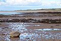
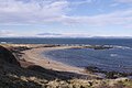
 A breaking wave at Peffer Sands - geograph.org.uk - 3217822.jpg 640 × 380; 236 KB
-
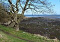
 A by-way of East Lothian - geograph.org.uk - 1301349.jpg 640 × 480; 86 KB
-
 A clear day at Seacliff - geograph.org.uk - 5361112.jpg 1,024 × 576; 301 KB
-
 A cove below Tantallon - geograph.org.uk - 352025.jpg 640 × 480; 188 KB
-
 A crinoid fossil at Skateraw - geograph.org.uk - 6393897.jpg 1,024 × 825; 493 KB
-
 A flooded picnic site at White Sands - geograph.org.uk - 2230902.jpg 4,416 × 3,312; 7.68 MB
-
 A good crop of field beans - geograph.org.uk - 895551.jpg 640 × 480; 107 KB
-
 A herring gull on the East Lothian coast - geograph.org.uk - 3404786.jpg 640 × 438; 210 KB
-

-
 A horse and rider at Seacliff - geograph.org.uk - 2956493.jpg 640 × 385; 255 KB
-
 A male eider duck at Great Car - geograph.org.uk - 2977474.jpg 640 × 442; 218 KB
-
 A microlight over the East Lothian coast - geograph.org.uk - 2290279.jpg 511 × 640; 163 KB
-

-
 A rocky bit, Seton Sands - geograph.org.uk - 6481685.jpg 1,024 × 768; 290 KB
-
 A rocky inlet at St Baldred's Cradle - geograph.org.uk - 2077738.jpg 800 × 530; 180 KB
-
 A sea angler at Thorntonloch - geograph.org.uk - 6408436.jpg 1,024 × 683; 461 KB
-
 A spring low water, Gullane - geograph.org.uk - 5256241.jpg 800 × 531; 163 KB
-
 A trio of islands from Broad Sands - geograph.org.uk - 2331961.jpg 800 × 530; 95 KB
-
 A view from the loo - geograph.org.uk - 556222.jpg 640 × 480; 86 KB
-
 A wave cut platform at Skateraw - geograph.org.uk - 3446174.jpg 480 × 640; 217 KB
-

-
 Aberlady Bay - geograph.org.uk - 2445079.jpg 424 × 640; 224 KB
-
 Aberlady Bay - geograph.org.uk - 2445152.jpg 640 × 426; 254 KB
-
 Aberlady Bay at high water - geograph.org.uk - 6559579.jpg 1,024 × 768; 334 KB
-
 Aberlady Bay from Aberlady Point - geograph.org.uk - 5512504.jpg 1,024 × 682; 222 KB
-
 Aberlady Bay intertidal - geograph.org.uk - 5762568.jpg 1,024 × 683; 231 KB
-
 Abseiling Barns Ness Lighthouse - geograph.org.uk - 2174366.jpg 3,000 × 4,000; 3.14 MB
-
 Action on the 4th tee - geograph.org.uk - 2596861.jpg 2,592 × 1,944; 1.74 MB
-
 Active dune front, Lochhouses Links - geograph.org.uk - 1226495.jpg 640 × 359; 41 KB
-

-
 An X-craft and the East Lothian coastline - geograph.org.uk - 5761387.jpg 1,600 × 1,136; 257 KB
-
 An X-craft under threatening skies - geograph.org.uk - 5754681.jpg 1,600 × 1,200; 183 KB
-
 Anglers on the Long Craig, Torness - geograph.org.uk - 6264631.jpg 1,600 × 1,065; 663 KB
-
 Anti-glider posts on Gullane Sands, East Lothian - geograph.org.uk - 6399655.jpg 2,182 × 1,219; 348 KB
-
-
 Anti-tank defences in Links Wood - geograph.org.uk - 4872011.jpg 640 × 480; 260 KB
-

-
 Approaching the shoreline, Aberlady Bay - geograph.org.uk - 6076999.jpg 1,024 × 576; 279 KB
-
 Arthur's Seat as seen from the Graveyard.jpg 1,200 × 900; 128 KB
-
 Artifacts in the church.jpg 1,200 × 1,600; 346 KB
-
 At the edge of the sea - geograph.org.uk - 2839698.jpg 640 × 480; 66 KB
-
 Auldhame House - geograph.org.uk - 921212.jpg 640 × 480; 80 KB
-
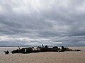
 Barnacle-encrusted X-craft remains - geograph.org.uk - 5761358.jpg 1,178 × 1,600; 588 KB
-
 Barns Ness Lighthouse - geograph.org.uk - 6350411.jpg 4,608 × 3,456; 3.33 MB
-
 Barns Ness Lighthouse - geograph.org.uk - 6685361.jpg 1,600 × 1,200; 383 KB
-
 Barns Ness Lighthouse Dunbar - geograph.org.uk - 6192599.jpg 4,592 × 3,448; 3.08 MB
-
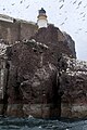
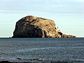
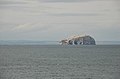
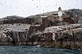
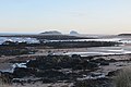
 Bass Rock - geograph.org.uk - 3790168.jpg 640 × 480; 233 KB
-
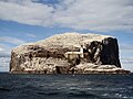
 Bass Rock - geograph.org.uk - 4520811.jpg 1,024 × 768; 106 KB
-
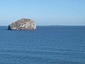
 Bass Rock - geograph.org.uk - 5337916.jpg 2,000 × 1,333; 1.51 MB
-
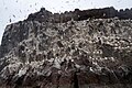
 Bass Rock - geograph.org.uk - 5422453.jpg 640 × 480; 506 KB
-
 Bass Rock - geograph.org.uk - 5517055.jpg 1,024 × 682; 134 KB
-
 Bass Rock - geograph.org.uk - 5517125.jpg 682 × 1,024; 183 KB
-
 Bass Rock - geograph.org.uk - 5517210.jpg 1,024 × 684; 145 KB
-
 Bass Rock - geograph.org.uk - 5666222.jpg 640 × 480; 180 KB
-
 Bass Rock - geograph.org.uk - 5689196.jpg 3,264 × 2,448; 1.97 MB
-
 Bass Rock - geograph.org.uk - 6683448.jpg 1,024 × 678; 663 KB
-
 Bass Rock across Canty Bay - geograph.org.uk - 2442376.jpg 2,304 × 1,728; 1.92 MB
-

-
 Bass Rock and St Baldreds Boat from Seacliff - geograph.org.uk - 5070617.jpg 1,024 × 682; 172 KB
-

-
 Bass Rock and the Isle of May - geograph.org.uk - 2903875.jpg 640 × 480; 51 KB
-
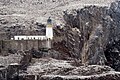
 Bass Rock castle - geograph.org.uk - 5517115.jpg 1,024 × 682; 234 KB
-
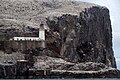
 Bass Rock Castle and Lighthouse - geograph.org.uk - 5515691.jpg 1,024 × 682; 198 KB
-
 Bass Rock from Broad Sands - geograph.org.uk - 5547573.jpg 1,024 × 768; 196 KB
-
 Bass Rock from Leckmoran Ness - geograph.org.uk - 3752963.jpg 1,024 × 678; 188 KB
-
 Bass Rock from Peffer Burn estuary - geograph.org.uk - 6516287.jpg 2,990 × 1,777; 515 KB
-
 Bass Rock from Seacliff - geograph.org.uk - 5070618.jpg 1,024 × 682; 199 KB
-
 Bass Rock from St Baldred's Cradle - geograph.org.uk - 2077764.jpg 800 × 530; 175 KB
-
 Bass Rock from St Baldred's Cradle - geograph.org.uk - 2077781.jpg 800 × 530; 73 KB
-
 Bass Rock from Tantallon Castle - geograph.org.uk - 5070899.jpg 1,024 × 682; 91 KB
-
 Bass Rock from Tantallon Castle - geograph.org.uk - 5070900.jpg 1,024 × 682; 145 KB
-
 Bass Rock From Tantallon Castle - geograph.org.uk - 5397612.jpg 1,600 × 1,201; 369 KB
-
 Bass Rock from the west - geograph.org.uk - 5547607.jpg 1,024 × 767; 209 KB
-
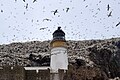
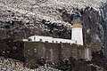
 Bass Rock lighthouse - geograph.org.uk - 5517048.jpg 1,024 × 682; 281 KB
-
 Bass Rock lighthouse - geograph.org.uk - 5517066.jpg 1,024 × 682; 257 KB
-
 Bass Rock lighthouse - geograph.org.uk - 5517079.jpg 1,024 × 682; 164 KB
-
 Bass Rock lighthouse - geograph.org.uk - 5517082.jpg 1,024 × 682; 178 KB
-
 Bass Rock lighthouse - geograph.org.uk - 5517110.jpg 1,024 × 682; 278 KB
-
 Bass Rock lighthouse and castle - geograph.org.uk - 5517077.jpg 1,024 × 682; 216 KB
-
 Bass Rock Regatta - geograph.org.uk - 5353603.jpg 3,648 × 2,736; 2.33 MB
-
 Bass Rock seen from Cafe above Canty Bay - geograph.org.uk - 5871168.jpg 2,048 × 1,536; 890 KB
-
 Bass Rock viewed from Belhaven Bay - geograph.org.uk - 5523772.jpg 1,024 × 683; 173 KB
-
 Bathan's Strand - geograph.org.uk - 2740155.jpg 640 × 360; 166 KB
-
 Bathan's Strand - geograph.org.uk - 2744380.jpg 640 × 360; 211 KB
-
 Bathan's Strand - geograph.org.uk - 2752040.jpg 640 × 360; 173 KB
-
 Bathan's Strand - geograph.org.uk - 4515301.jpg 800 × 533; 353 KB
-
 Bathan's Strand and Frances Craig - geograph.org.uk - 2062805.jpg 1,024 × 768; 118 KB
-
 Bay at Weaklaw Rocks - geograph.org.uk - 6140812.jpg 640 × 480; 273 KB
-
 Beach along the East Lothian coast - geograph.org.uk - 5803458.jpg 800 × 600; 132 KB
-
 Beach along the East Lothian coast - geograph.org.uk - 5804996.jpg 800 × 600; 139 KB
-
 Beach and Eyebroughy - geograph.org.uk - 5484593.jpg 1,024 × 576; 330 KB
-
-
 Beach at Black Rocks - geograph.org.uk - 6140405.jpg 640 × 480; 228 KB
-
 Beach at Longniddry - geograph.org.uk - 2616966.jpg 1,600 × 1,200; 310 KB
-
 Beach at Longniddry Bents - geograph.org.uk - 5512479.jpg 1,024 × 682; 165 KB
-
 Beach at Longskelly - geograph.org.uk - 6295577.jpg 640 × 404; 220 KB
-
 Beach at West Links - geograph.org.uk - 5803498.jpg 800 × 600; 139 KB
-
 Beach at Yellowcraigs - geograph.org.uk - 5547552.jpg 1,024 × 768; 169 KB
-
 Beach by Gullane Head - geograph.org.uk - 6537955.jpg 1,024 × 768; 284 KB
-
 Beach close up - Flickr - S. Rae (1).jpg 1,988 × 1,732; 1.12 MB
-
 Beach cricket, Gullane - geograph.org.uk - 5484569.jpg 1,024 × 576; 327 KB
-
 Beach east of Longskelly Rocks - geograph.org.uk - 6141112.jpg 640 × 480; 249 KB
-
 Beach near Gullane Point - geograph.org.uk - 5718146.jpg 1,600 × 1,066; 392 KB
-
 Beach on Gullane Sands - geograph.org.uk - 5824423.jpg 1,600 × 1,065; 434 KB
-
 Beach south of Barns Ness - geograph.org.uk - 4876704.jpg 640 × 480; 204 KB
-
 Beach, Barns Ness - geograph.org.uk - 5767766.jpg 1,024 × 683; 286 KB
-
 Beach, Barns Ness - geograph.org.uk - 5768916.jpg 1,024 × 576; 255 KB
-
 Beach, Barns Ness - geograph.org.uk - 6416428.jpg 1,024 × 683; 210 KB
-
 Beach, Barns Ness - geograph.org.uk - 6416448.jpg 1,024 × 683; 226 KB
-
 Beach, Craigielaw - geograph.org.uk - 6452398.jpg 1,024 × 768; 203 KB
-
 Beach, Craigielaw - geograph.org.uk - 6452402.jpg 1,024 × 768; 233 KB
-
 Beach, Craigielaw - geograph.org.uk - 6452410.jpg 1,024 × 768; 295 KB
-
 Beach, Craigielaw - geograph.org.uk - 6559581.jpg 1,024 × 768; 336 KB
-
 Beach, Ferny Ness - geograph.org.uk - 6089786.jpg 1,024 × 768; 344 KB
-
 Beach, Fernyness - geograph.org.uk - 5953428.jpg 1,024 × 576; 353 KB
-
 Beach, Gosford Sands - geograph.org.uk - 3560931.jpg 640 × 480; 301 KB
-
 Beach, Gosford Sands - geograph.org.uk - 3560935.jpg 640 × 360; 209 KB
-
 Beach, Gosford Sands - geograph.org.uk - 5145890.jpg 1,024 × 768; 345 KB
-
 Beach, Gullane - geograph.org.uk - 1998651.jpg 640 × 359; 93 KB
-
 Beach, Gullane - geograph.org.uk - 2965701.jpg 640 × 359; 224 KB
-
 Beach, Gullane - geograph.org.uk - 4091355.jpg 800 × 435; 338 KB
-
 Beach, Gullane - geograph.org.uk - 5255496.jpg 800 × 531; 157 KB
-
 Beach, Gullane - geograph.org.uk - 5256235.jpg 640 × 425; 30 KB
-
 Beach, Gullane - geograph.org.uk - 5824032.jpg 1,024 × 683; 263 KB
-
 Beach, Gullane - geograph.org.uk - 6257823.jpg 1,024 × 768; 237 KB
-
 Beach, Gullane - geograph.org.uk - 6389919.jpg 1,024 × 683; 287 KB
-
 Beach, Gullane Bay - geograph.org.uk - 6257818.jpg 1,024 × 768; 236 KB
-
 Beach, Gullane Point - geograph.org.uk - 2097867.jpg 640 × 359; 72 KB
-
 Beach, Gullane Point - geograph.org.uk - 6257015.jpg 1,024 × 768; 381 KB
-
 Beach, Gullane Sands - geograph.org.uk - 5523870.jpg 1,024 × 683; 218 KB
-
 Beach, Gullane Sands - geograph.org.uk - 5523875.jpg 1,024 × 683; 164 KB
-
 Beach, Longniddry - geograph.org.uk - 2828666.jpg 640 × 360; 216 KB
-
 Beach, Longniddry - geograph.org.uk - 3829449.jpg 640 × 480; 262 KB
-
 Beach, Longniddry - geograph.org.uk - 5570914.jpg 1,024 × 683; 346 KB
-
 Beach, Longniddry - geograph.org.uk - 5696060.jpg 1,024 × 683; 357 KB
-
 Beach, Longniddry - geograph.org.uk - 6089791.jpg 1,024 × 752; 225 KB
-
 Beach, Longniddry - geograph.org.uk - 6406528.jpg 1,024 × 769; 249 KB
-
 Beach, Longniddry - geograph.org.uk - 6477289.jpg 1,024 × 768; 256 KB
-
 Beach, Longniddry - geograph.org.uk - 6484178.jpg 1,024 × 768; 350 KB
-
 Beach, Longniddry - geograph.org.uk - 6528726.jpg 1,024 × 768; 288 KB
-
 Beach, North Berwick - geograph.org.uk - 5651042.jpg 1,024 × 576; 299 KB
-
 Beach, Scoughall - geograph.org.uk - 5222753.jpg 1,024 × 683; 227 KB
-
 Beach, Seacliff - geograph.org.uk - 3790093.jpg 640 × 480; 213 KB
-
 Beach, Seacliff - geograph.org.uk - 3790151.jpg 640 × 480; 251 KB
-
 Beach, Seacliff - geograph.org.uk - 3790174.jpg 640 × 480; 236 KB
-
 Beach, Seton Sands - geograph.org.uk - 5145041.jpg 1,024 × 768; 379 KB
-
 Beach, Seton Sands - geograph.org.uk - 6361510.jpg 1,024 × 768; 246 KB
-
 Beach, Spike Island - geograph.org.uk - 6327022.jpg 1,024 × 576; 102 KB
-
 Beach, White Sands - geograph.org.uk - 6416499.jpg 1,024 × 576; 240 KB
-
 Beach, Yellow Craig - geograph.org.uk - 2216750.jpg 640 × 480; 251 KB
-
 Beach, Yellow Craig - geograph.org.uk - 5529913.jpg 1,024 × 683; 288 KB
-
 Beach, Yellow Craig - geograph.org.uk - 5537894.jpg 1,024 × 576; 224 KB
-
 Beach, Yellowcraig - geograph.org.uk - 4290048.jpg 800 × 450; 292 KB
-
 Beach, Yellowcraig - geograph.org.uk - 4294840.jpg 800 × 533; 330 KB
-
 Beach, Yellowcraig - geograph.org.uk - 4294852.jpg 800 × 533; 376 KB
-
 Beach, Yellowcraig - geograph.org.uk - 5234220.jpg 1,024 × 576; 350 KB
-
 Beach, Yellowcraig - geograph.org.uk - 5257794.jpg 1,024 × 680; 264 KB
-
 Beach, Yellowcraig - geograph.org.uk - 5320805.jpg 1,024 × 683; 343 KB
-
 Beach, Yellowcraig - geograph.org.uk - 5879024.jpg 1,024 × 1,024; 302 KB
-
 Beach. Craigielaw - geograph.org.uk - 6559582.jpg 1,024 × 768; 351 KB
-
 Beaches along the East Lothian coast - geograph.org.uk - 5763038.jpg 800 × 529; 124 KB
-
 Beehive kiln foundations and pit baths (46078879204).jpg 6,016 × 3,251; 5.88 MB
-
 Belhaven Bay - geograph.org.uk - 1880364.jpg 1,024 × 768; 117 KB
-
 Belhaven Bay - geograph.org.uk - 3094007.jpg 640 × 363; 255 KB
-
 Belhaven Bay - geograph.org.uk - 5523164.jpg 1,024 × 683; 170 KB
-
 Belhaven Bay - geograph.org.uk - 6078796.jpg 1,024 × 768; 302 KB
-
 Belhaven Bay and Winterfield - geograph.org.uk - 3094017.jpg 640 × 427; 347 KB
-
 Belhaven Beach - geograph.org.uk - 3094004.jpg 640 × 415; 338 KB
-
 Belhaven Beach - geograph.org.uk - 3666666.jpg 4,752 × 3,168; 6.31 MB
-
 Belhaven Beach - geograph.org.uk - 5317950.jpg 1,024 × 683; 241 KB
-
 Belhaven Beach - geograph.org.uk - 5317954.jpg 1,024 × 683; 243 KB
-
 Big brother is on the case - geograph.org.uk - 1195834.jpg 640 × 480; 94 KB
-
 Big waves, St Baldred's Cradle - geograph.org.uk - 5705182.jpg 1,200 × 675; 516 KB
-
 Birds and seals off Craigielaw Point - geograph.org.uk - 5512553.jpg 1,024 × 684; 151 KB
-
 Birds on Gosford Sands - geograph.org.uk - 5070076.jpg 1,024 × 682; 175 KB
-
 Black Rocks - geograph.org.uk - 2702830.jpg 640 × 360; 234 KB
-
 Black Rocks - geograph.org.uk - 5547225.jpg 1,024 × 768; 256 KB
-
 Black Rocks - geograph.org.uk - 5547283.jpg 1,024 × 768; 247 KB
-
 Black Rocks and Gullane Bay - geograph.org.uk - 3530839.jpg 1,024 × 768; 205 KB
-
 Blaeu - Atlas of Scotland 1654 - LOTHIAN AND LINLITQVO - The Lothians Had.jpg 2,991 × 1,209; 2.4 MB
-
 Bleaching Rocks, Gullane Bay - geograph.org.uk - 5236398.jpg 1,024 × 682; 141 KB
-
 Bleaching Rocks, Gullane Bay - geograph.org.uk - 5236402.jpg 1,024 × 682; 166 KB
-
 Blinkbonny Burn - geograph.org.uk - 917961.jpg 640 × 359; 78 KB
-
 Blowing sand, Longniddry - geograph.org.uk - 2422959.jpg 640 × 359; 204 KB
-
 Blowing sand, Longniddry - geograph.org.uk - 2422966.jpg 640 × 359; 122 KB
-
 Boardwalk leading to Seton Sands - geograph.org.uk - 5796703.jpg 800 × 600; 130 KB
-
 Boats at Fisherrow Sands - geograph.org.uk - 5794541.jpg 800 × 609; 110 KB
-
 Boats in Fisherrow Harbor.jpg 4,032 × 3,024; 2.59 MB
-
 Boltondoocot.jpg 495 × 640; 60 KB
-
 Bombing range marker, Aberlady Bay - geograph.org.uk - 5761403.jpg 1,176 × 1,600; 327 KB
-
 Bow view of an X-craft - geograph.org.uk - 5761342.jpg 1,082 × 1,600; 412 KB
-
 Bracing Beach Walk - geograph.org.uk - 6712997.jpg 3,284 × 2,463; 2.71 MB
-
 Bracken and heather - geograph.org.uk - 927200.jpg 640 × 359; 92 KB
-
 Breakwater - geograph.org.uk - 6683453.jpg 1,024 × 678; 756 KB
-
 Breakwater, Torness Point - geograph.org.uk - 3007932.jpg 640 × 480; 64 KB
-
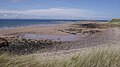
 Broad Sands (view west) - geograph.org.uk - 5547567.jpg 1,024 × 768; 201 KB
-
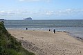
 Broad Sands - geograph.org.uk - 2290278.jpg 640 × 427; 166 KB
-
 Broad Sands - geograph.org.uk - 2295531.jpg 640 × 370; 158 KB
-
 Broad Sands - geograph.org.uk - 5257798.jpg 1,024 × 680; 201 KB
-
 Broad Sands - geograph.org.uk - 5532513.jpg 1,024 × 683; 256 KB


.jpg)


.jpg)


_-_geograph.org.uk_-_5547567.jpg)


