Category:Spanish-language SVG maps of Western Sahara
Jump to navigation
Jump to search
Countries of Africa: Algeria · Angola · Benin · Burkina Faso · Chad · Democratic Republic of the Congo · Republic of the Congo · Djibouti · Equatorial Guinea · Ethiopia · Gabon · Guinea · Liberia · Libya · Mali · Morocco · Mozambique · Nigeria · Sierra Leone · Somalia · South Sudan · Tanzania · Zimbabwe
Other areas: Western Sahara
Other areas: Western Sahara
Media in category "Spanish-language SVG maps of Western Sahara"
The following 11 files are in this category, out of 11 total.
-
Empire almoravide-es.svg 362 × 457; 1.01 MB
-
Expansión Marruecos 1956.svg 532 × 600; 654 KB
-
ExpansiónAlmorávide.svg 1,748 × 2,059; 2.14 MB
-
Map Almoravid empire-es.svg 546 × 702; 40 KB
-
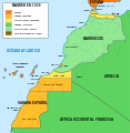
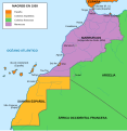
Mapa del Magreb (1956).svg 1,700 × 1,750; 573 KB
-
Mapa del Magreb (1958).svg 1,700 × 1,750; 545 KB
-
Mapa del Magreb (1959).svg 1,700 × 1,750; 553 KB
-
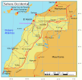
MapaSaharaOccidental.svg 600 × 584; 148 KB
-
Muro Sahara.svg 1,676 × 1,302; 201 KB
-
Saharaoccidentales.svg 627 × 599; 149 KB
-
Western sahara walls moroccan map-es.svg 1,676 × 1,302; 193 KB


