Category:Spanish-language SVG maps of Libya
Jump to navigation
Jump to search
Countries of Africa: Algeria · Angola · Benin · Burkina Faso · Chad · Democratic Republic of the Congo · Republic of the Congo · Djibouti · Equatorial Guinea · Ethiopia · Gabon · Guinea · Liberia · Libya · Mali · Morocco · Mozambique · Nigeria · Sierra Leone · Somalia · South Sudan · Tanzania · Zimbabwe
Other areas: Western Sahara
Other areas: Western Sahara
Media in category "Spanish-language SVG maps of Libya"
The following 9 files are in this category, out of 9 total.
-
Great Man Made River schematic es.svg 651 × 634; 156 KB
-
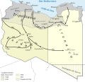
Karte Zweiter Italienisch-Libyscher Krieg 1922–1927-es.svg 969 × 313; 296 KB
-
Karte Zweiter Italienisch-Libyscher Krieg 1928–1931-es.svg 969 × 929; 348 KB
-
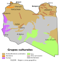
Libya ethnic-es.svg 673 × 685; 351 KB
-
Libya map of Köppen climate classification-es.svg 1,900 × 1,900; 129 KB
-
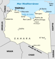
Libya-kart3-es.svg 1,190 × 1,271; 210 KB
-
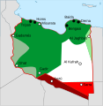
Libyan Uprising-es.svg 690 × 715; 63 KB
-
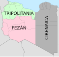
Map of traditional provinces of Libye-es.svg 969 × 929; 120 KB
-
Territorial growth of Italian Libya-es.svg 771 × 790; 146 KB

