Category:Shotley Bridge
Jump to navigation
Jump to search
English: Shotley Bridge is a village in the Derwent Valley, adjoining the town of Consett in County Durham, England. Shotley Bridge was once the heart of Britain's swordmaking industry.
village in County Durham, England  | |||||
| Upload media | |||||
| Instance of | |||||
|---|---|---|---|---|---|
| Location | County Durham, North East England, England | ||||
 | |||||
Subcategories
This category has the following 3 subcategories, out of 3 total.
C
S
Media in category "Shotley Bridge"
The following 34 files are in this category, out of 34 total.
-
 A chunky road block - geograph.org.uk - 396955.jpg 640 × 480; 69 KB
-
 Arch Under the Shotley Grove Road - geograph.org.uk - 630569.jpg 480 × 600; 92 KB
-
 Blackhill Cemetery South - geograph.org.uk - 74474.jpg 480 × 640; 80 KB
-
 Bridge at Shotley Bridge - geograph.org.uk - 31497.jpg 500 × 640; 403 KB
-
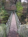
 Footbridge over the River Derwent - geograph.org.uk - 630570.jpg 640 × 427; 102 KB
-
 Mary Costella - Flickr - Tyne & Wear Archives & Museums.jpg 148 × 204; 26 KB
-
 Methodist Church - geograph.org.uk - 102923.jpg 480 × 640; 87 KB
-

-
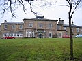
 Shotley Bridge Hospital - geograph.org.uk - 74467.jpg 640 × 480; 82 KB
-

-
 Summerhill House - geograph.org.uk - 102901.jpg 640 × 480; 56 KB
-
 Blackhill Cemetery - geograph.org.uk - 74475.jpg 480 × 640; 174 KB
-
 Blackhill Main Street - geograph.org.uk - 74469.jpg 480 × 640; 66 KB
-
 Bridgehill - geograph.org.uk - 32595.jpg 640 × 338; 222 KB
-
 Concealed Crossing - geograph.org.uk - 74994.jpg 480 × 640; 152 KB
-
 Crossroads near Shotley Bridge - geograph.org.uk - 396941.jpg 640 × 480; 80 KB
-
 Derwent Dale, Shotley Bridge - geograph.org.uk - 397323.jpg 640 × 480; 67 KB
-
 Footbridge over the River Derwent - geograph.org.uk - 630560.jpg 427 × 640; 74 KB
-

-

-
 Lane Leading up to Shotley Grove Road - geograph.org.uk - 630562.jpg 640 × 427; 88 KB
-
 Layby by the B6278 - geograph.org.uk - 396935.jpg 640 × 480; 90 KB
-
 Pike Hill - geograph.org.uk - 396953.jpg 640 × 480; 94 KB
-
 River Derwent at Shotley Grove - geograph.org.uk - 630567.jpg 640 × 427; 85 KB
-
 Shotley Bridge - geograph.org.uk - 279342.jpg 640 × 434; 92 KB
-
 Shotley Bridge - geograph.org.uk - 33350.jpg 640 × 397; 264 KB
-
 Shotley Bridge - geograph.org.uk - 74996.jpg 640 × 480; 61 KB
-
 Shotley Bridge Hospital - geograph.org.uk - 74465.jpg 640 × 480; 80 KB
-
 Shotley Grove Lane - geograph.org.uk - 74990.jpg 480 × 640; 164 KB
-
 Shotley Park Home - geograph.org.uk - 102916.jpg 640 × 480; 110 KB
-
 Spring Wood, Panshield, Northumberland. - geograph.org.uk - 278403.jpg 640 × 424; 125 KB
-
 Stile Over Wall - geograph.org.uk - 630563.jpg 640 × 427; 109 KB
-
 Waskerleyedge Plantation - geograph.org.uk - 396942.jpg 640 × 480; 88 KB
-
 Waskerleyedge Plantation - geograph.org.uk - 396945.jpg 480 × 640; 103 KB


_-_geograph.org.uk_-_411011.jpg)


