Category:Sea maps of Italy
Jump to navigation
Jump to search
Subcategories
This category has the following 4 subcategories, out of 4 total.
Media in category "Sea maps of Italy"
The following 24 files are in this category, out of 24 total.
-
Relief Map of Mediterranean Sea (cropped).png 655 × 520; 590 KB
-
Aeneae exsilia.png 1,347 × 746; 130 KB
-
Aeneae exsilia.svg 1,230 × 656; 459 KB
-
Arcipelago siciliano nel Mar Mediterraneo.svg 1,754 × 862; 1.2 MB
-
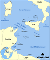
Canal du Cap Bon (moyen).png 768 × 922; 197 KB
-
Canal du Cap Bon (petit).png 600 × 720; 140 KB
-
Carte vierge Italie.png 329 × 353; 35 KB
-
It-map.jpg 1,142 × 709; 207 KB
-
It-map.PNG 1,128 × 707; 1.32 MB
-
Italy relief location map-2.png 1,034 × 1,299; 2.23 MB
-
Kartenn morioù Italia.svg 3,713 × 3,948; 162 KB
-
Map of Greater Italia.svg 940 × 860; 822 KB
-
Map of Mediterranean seas surrounding Italy with no legends.png 500 × 680; 226 KB
-
Mapa de la mar Tirrena ca.png 441 × 599; 223 KB
-
MerLigure.jpg 877 × 498; 130 KB
-
Mers-Italie-fr.svg 3,960 × 4,211; 164 KB
-
Mers-Italie.jpg 900 × 709; 172 KB
-
Strait of Sicily map it.PNG 1,502 × 1,802; 383 KB
-
Strait of Sicily map-ar.png 2,000 × 2,400; 710 KB
-
Strait of Sicily map-sr.png 500 × 607; 68 KB
-
Strait of Sicily map.png 1,500 × 1,800; 147 KB
-
מצר סיציליה.svg 3,810 × 4,571; 1.16 MB


