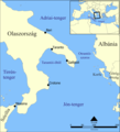
Category:Maps of the Ionian Sea
Jump to navigation
Jump to search
Subcategories
This category has the following 2 subcategories, out of 2 total.
M
O
Media in category "Maps of the Ionian Sea"
The following 35 files are in this category, out of 35 total.
-
Admiralty Chart No 2701 Gulf of Kotor to Corfu, Published 1878, New Edition 1973.jpg 11,203 × 16,319; 24.03 MB
-
AegeanIslands.png 1,276 × 804; 19 KB
-
Alkyonides de.png 500 × 508; 35 KB
-
Ambrakian Gulf - Satellite Image Named - DE 01.jpg 4,030 × 4,030; 7.38 MB
-
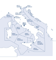
Area SAR IT.svg 3,713 × 3,948; 494 KB
-
Echinades de.png 800 × 1,231; 139 KB
-
Echinades-el.svg 1,134 × 1,740; 355 KB
-
Echinades-nn.svg 1,134 × 1,740; 303 KB
-
Euripus Strait map he.svg 1,489 × 1,052; 116 KB
-
Golfo de Tarento.svg 1,200 × 1,321; 173 KB
-
Gulf of Taranto map hr.svg 778 × 857; 501 KB
-
Gulf of Taranto map hu.svg 1,600 × 1,761; 341 KB
-
Gulf of Taranto map it.png 1,200 × 1,321; 331 KB
-
Gulf of Taranto map.png 1,200 × 1,321; 348 KB
-
Ionian Sea borders.png 975 × 678; 952 KB
-
Ionian Sea map el.png 600 × 680; 110 KB
-
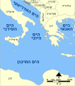
Ionian Sea map he.svg 745 × 845; 233 KB
-
Ionian Sea map hr.svg 733 × 831; 411 KB
-
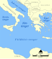
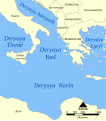
Ionian Sea map hu.svg 795 × 901; 142 KB
-
Ionian Sea map it.png 596 × 676; 147 KB
-
Ionian Sea map ku.png 596 × 676; 151 KB
-
Ionian Sea map ku.svg 596 × 676; 137 KB
-
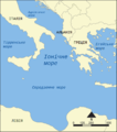
Ionian Sea map uk.png 2,000 × 2,267; 833 KB
-
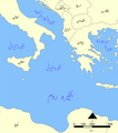
Ionian Sea map Urdu.png 2,483 × 2,816; 1.34 MB
-
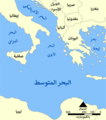
Ionian Sea map-ar.png 795 × 901; 224 KB
-
Ionian Sea map-rus.png 600 × 680; 185 KB
-
Ionian Sea map.png 596 × 676; 131 KB
-
Locatie Ionische Zee.PNG 473 × 430; 17 KB
-
Map of Otranto hungarian.png 1,135 × 1,249; 412 KB
-
Matapan map.png 261 × 246; 16 KB
-
Mediterraneo centrale 300 a.C. - epoca di Agatocle.png 1,639 × 1,072; 1.72 MB
-
Mer Ionienne.png 600 × 680; 146 KB
-
Messiniakes Inousses de.png 600 × 605; 47 KB
-
Tilevoides de.png 750 × 600; 96 KB
-
Отрантска Врата.svg 1,200 × 1,321; 181 KB


