Category:Satellite pictures of Kazakhstan
Jump to navigation
Jump to search
Subcategories
This category has the following 9 subcategories, out of 9 total.
Media in category "Satellite pictures of Kazakhstan"
The following 169 files are in this category, out of 169 total.
-
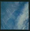
51B-42-005 - STS-51B - 51B earth observation - DPLA - 0becade9d780f2fb55770de549dcd109.jpg 5,700 × 5,900; 2.08 MB
-
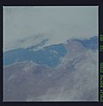
51F-35-086 - STS-51F - 51F earth observations - DPLA - 8db5198fbdbf2bed29488e3373b4fb42.jpg 5,700 × 5,900; 2.99 MB
-
51F-44-017 - STS-51F - 51F earth observations - DPLA - 19d4adec55cdc71136921227127d476b.jpg 5,700 × 5,900; 2.59 MB
-
A massive dust storm blew through central Asia on May 7, 2007.jpg 9,784 × 6,224; 5.22 MB
-
Aktobe (Kazakhstan), satellite image 2017-09-07.jpg 3,119 × 3,551; 3.2 MB
-
Altay Mountains.500m.jpg 5,200 × 4,000; 3.36 MB
-
Area and Volume Contrast in Central Asia Lakes (NESDIS 2017-11-09).jpg 1,920 × 1,080; 483 KB
-
Astana (Kazakhstan), satellite image 2017-07-24.jpg 5,064 × 4,607; 7.92 MB
-
Astana, Kazakhstan (ASTER).jpg 1,600 × 3,000; 955 KB
-
Barsakelmes Nature Reserve in the Aral Sea in Kazakhstan (iss071e462182).jpg 4,928 × 2,768; 1.18 MB
-
Caspian Sea from orbit-NoRedLines.jpg 4,400 × 5,600; 9.04 MB
-
Caspian Sea from orbit.jpg 4,400 × 5,600; 3.44 MB
-
Chiyli Crater, Kazakhstan.jpg 2,400 × 2,400; 3.19 MB
-
Chiyli Crater.jpg 720 × 480; 273 KB
-
DS1048-1071DA017 b.png 35,506 × 10,032; 240.79 MB
-
Dzungarian Gate.png 927 × 707; 1.24 MB
-
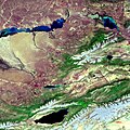
Envisat image of Kazakhstan and Kyrgyzstan ESA203758.jpg 595 × 595; 368 KB
-
Envisat image of Kazakhstan and Kyrgyzstan ESA203758.tiff 2,241 × 2,241; 14.37 MB
-
ISS067-E-133135 - View of Kazakhstan.jpg 5,568 × 3,712; 1.77 MB
-
ISS067-E-133142 - View of Kazakhstan.jpg 3,712 × 5,568; 3.83 MB
-
Iss071e139808.jpg 8,256 × 5,504; 5.43 MB
-
Kashagan Oil and Gas Field, Kazakhstan.jpg 720 × 960; 139 KB
-
Kashagan Oil Field, Kazakhstan by Planet Labs.jpg 3,772 × 2,830; 1.94 MB
-
Kazak-Chinese border near Tacheng.jpg 720 × 480; 242 KB
-
Kazakhstan and the Caspian Sea as seen by Envisat ESA231708.jpg 1,010 × 700; 911 KB
-
Kazakhstan and the Caspian Sea as seen by Envisat ESA231708.tiff 2,241 × 2,241; 10.52 MB
-
Kazakhstan BMNG.jpg 3,803 × 2,179; 6.23 MB
-
Kazakhstan.A2001150.0615.500m.jpg 2,000 × 1,500; 660 KB
-
Kazakhstan.jpg 5,568 × 3,712; 4.53 MB
-
Kyzyl Kum.png 1,278 × 728; 1.54 MB
-
Lake Balkhash satellite.jpg 3,000 × 2,300; 1.17 MB
-
LakeBalkhash NASA 2003 1010600-250m.jpg 3,600 × 2,800; 2.71 MB
-
LakeBalkhash NASA 2003 1120545-250m.jpg 3,600 × 2,800; 2.64 MB
-
Lakes Balkhash and Alakol, southern uplands of Kazakhstan by NASA Johnson.jpg 6,000 × 4,626; 17.7 MB
-
Landsat turkestan.jpg 1,280 × 948; 299 KB
-
Nura village and Almaly copper deposits site (Qaraǵandy region, Kazakhstan).jpg 1,263 × 1,374; 657 KB
-
SaryShaganSpaceRadar.jpg 2,544 × 3,560; 3.83 MB
-
Saryshaganspaceradar2-cropped.jpg 2,492 × 756; 366 KB
-
Shunak crater (Kazakhstan), Sentinel-2 satellite image 2018-SEP-14.jpg 633 × 578; 252 KB
-
SpaceX Dragon 16 (cropped).jpg 1,866 × 1,253; 692 KB
-
SpaceX Dragon 16.jpg 5,568 × 3,712; 3.31 MB
-
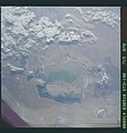
STS039-87-115moje.jpg 456 × 451; 87 KB
-
STS112-E-6007 - View of Kazakhstan.jpg 3,032 × 2,064; 1.27 MB
-
STS112-E-6008 - View of Kazakhstan.jpg 3,032 × 2,064; 1.2 MB
-
STS112-E-6009 - View of Kazakhstan.jpg 3,032 × 2,064; 1.49 MB
-
STS112-E-6010 - View of Kazakhstan.jpg 3,032 × 2,064; 1.38 MB
-
STS112-E-6011 - View of Kazakhstan.jpg 3,032 × 2,064; 1.46 MB
-
STS112-E-6012 - View of Kazakhstan.jpg 3,032 × 2,064; 1.42 MB
-
STS112-E-6013 - View of Kazakhstan.jpg 3,032 × 2,064; 1.46 MB
-
STS112-E-6014 - View of Kazakhstan.jpg 3,032 × 2,064; 1.38 MB
-
STS112-E-6015 - View of Kazakhstan.jpg 3,032 × 2,064; 1.36 MB
-
STS112-E-6028 - View of Kazakhstan.jpg 3,032 × 2,064; 1.43 MB
-
STS112-E-6029 - View of Kazakhstan.jpg 3,032 × 2,064; 1.23 MB
-
STS112-E-6030 - View of Kazakhstan.jpg 3,032 × 2,064; 1.33 MB
-
STS112-E-6031 - View of Kazakhstan.jpg 3,032 × 2,064; 1.29 MB
-
STS112-E-6032 - View of Kazakhstan.jpg 3,032 × 2,064; 1.33 MB
-
STS112-E-6033 - View of Kazakhstan.jpg 3,032 × 2,064; 1.6 MB
-
STS112-E-6034 - View of Kazakhstan.jpg 3,032 × 2,064; 1.37 MB
-
SyrDaryaRiverFloodplain.jpg 1,440 × 960; 614 KB
-
The city lights of Almaty, Kazakhstan's largest city (iss072e445670).jpg 8,256 × 5,504; 11.1 MB
-
Uralsk.ISS011-E-6712.jpg 648 × 1,000; 457 KB
-
Ushtogay Square is at 50.832933°N 65.326276°E drawing.jpg 1,200 × 597; 340 KB
-
Ushtogay Square is at 50.832933°N 65.326276°E no scale.jpg 1,421 × 1,011; 1.1 MB
-
Ushtogay Square is at 50.832933°N 65.326276°E scale.jpg 800 × 681; 421 KB
-
Ustyurt Plateau.png 613 × 460; 514 KB
-
Zhamanshin - Landsat OLI 161.jpg 1,350 × 1,350; 159 KB


