Category:Satellite pictures of Ireland
Jump to navigation
Jump to search
Pictures of Ireland taken from satellites and spacecraft.
Subcategories
This category has the following 4 subcategories, out of 4 total.
*
Media in category "Satellite pictures of Ireland"
The following 84 files are in this category, out of 84 total.
-
Space radar image of Dublin.jpg 2,300 × 1,617; 1.32 MB
-
Topography Ireland.jpg 6,587 × 8,336; 6.49 MB
-
Cork and Kinsale from the International Space Station 2013-03-17.jpg 679 × 1,023; 108 KB
-
Dublin, December 2017, from ISS by Randy Bresnik.jpg 3,276 × 2,180; 1.94 MB
-
A cloudless view of Ireland on the first day of the meteorological spring.jpg 4,000 × 4,060; 18.29 MB
-
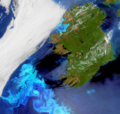
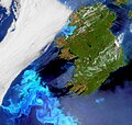
A plankton bloom across Ireland captured by Envisat ESA225550.jpg 2,312 × 2,265; 1.15 MB
-
A plankton bloom across Ireland captured by Envisat ESA225550.tiff 2,312 × 2,265; 12.03 MB
-
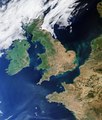
A rare cloud-free view of Ireland, Great Britain and northern France ESA285511.jpg 4,003 × 2,312; 1.75 MB
-
A View of Ireland for St Patrick’s Day (NESDIS 2020-03-17).png 1,920 × 1,080; 1.73 MB
-
Algal bloom off Ireland ESA275928.tiff 2,803 × 2,670; 11.2 MB
-
Algal bloom off Ireland.jpg 2,803 × 2,670; 2.18 MB
-
Atlantic Archipelago.jpg 3,600 × 4,400; 1.45 MB
-
Blooms around Ireland (4441096624).png 622 × 1,039; 1.4 MB
-
Blooms off Western Europe (MODIS 2024-05-12).jpg 5,226 × 4,440; 1.92 MB
-
Britain and Ireland satellite image bright.png 1,024 × 1,177; 2.21 MB
-
British Isles North Sea satellite photo 2018.jpg 720 × 480; 401 KB
-
British Isles on 7 January 2010.jpg 1,053 × 1,326; 995 KB
-
Clare Island (NASA Geocover 2000).jpg 1,024 × 768; 468 KB
-
Cliffs of Moher peaking out of the cloud shadow, Ireland (51322815812).png 8,732 × 5,090; 62.49 MB
-
Cloud-free Europe ESA17486464 (British Isles).jpeg 2,600 × 2,600; 1.96 MB
-
Cloud-free image of Ireland, June 2023.jpg 2,496 × 2,543; 3.58 MB
-
Cloud-free view of Ireland and western Great Britain.jpg 3,670 × 2,540; 3.72 MB
-
Cloudless view of Ireland (cloudless-view-ireland).jpg 1,947 × 2,530; 1.33 MB
-
Coccolithophore Bloom Southwest of Ireland (4441096572).png 597 × 900; 1.02 MB
-
Dublin SPOT 1023.jpg 500 × 500; 115 KB
-
Dublin, Ireland ESA24382436.jpeg 4,724 × 3,149; 5.48 MB
-
Dublin, Ireland ESA24382436.tiff 4,724 × 3,149; 42.59 MB
-
England and Wales (MODIS 2017-05-28).jpg 3,198 × 2,182; 755 KB
-
Final data captured by the Copernicus Sentinel-1B satellite ESA501277.jpg 1,920 × 1,920; 2.13 MB
-
Fires in Ireland (MODIS 2017-05-15).jpg 1,600 × 2,200; 452 KB
-
Great Britain and Ireland - Envisat.jpg 1,500 × 1,353; 1.19 MB
-
Great Britain and Ireland ESA232582 (southern Great Britain cropped out).jpg 1,464 × 2,937; 7.01 MB
-
Great Britain and Ireland ESA232582.jpg 3,271 × 3,648; 23.58 MB
-
Great Britain and Ireland ESA232582.tiff 3,271 × 3,648; 30.97 MB
-
Großbritannien 2.jpg 3,666 × 4,278; 9.58 MB
-
Heatwave on the Irish Island (Copernicus).jpg 3,799 × 2,540; 7.17 MB
-
Ireland (4440319873).jpg 1,600 × 2,200; 478 KB
-
Ireland (6841846440).jpg 1,600 × 2,200; 416 KB
-
Ireland (MODIS 2017-07-26).jpg 1,600 × 2,200; 420 KB
-
Ireland (MODIS 2018-07-02).jpg 2,884 × 2,878; 673 KB
-
Ireland (MODIS 2019-04-21).jpg 2,658 × 2,249; 914 KB
-
Ireland (MODIS 2020-04-19).jpg 2,681 × 2,260; 577 KB
-
Ireland (MODIS 2021-08-29).jpg 3,297 × 2,570; 4.53 MB
-
Ireland (MODIS 2024-11-30).jpg 2,494 × 1,917; 1.92 MB
-
Ireland (MODIS).jpg 1,600 × 2,200; 2.69 MB
-
Ireland (with filter) @NASAGoddardPix (16639811747).jpg 1,600 × 2,200; 503 KB
-
Ireland - NASA Earth Observatory.jpg 720 × 960; 251 KB
-
Ireland amo 2010284 geo.tif 1,600 × 2,200; 4.2 MB
-
Ireland and the United Kingdom (MODIS).jpg 6,027 × 4,741; 6.34 MB
-
Ireland Aqua 2010 336.jpg 1,600 × 2,200; 1.01 MB
-
Ireland by Proba-V.jpg 1,218 × 1,708; 804 KB
-
Ireland from space edit.jpg 1,800 × 2,095; 2.48 MB
-
Ireland from space edit2.jpg 1,800 × 2,095; 1,012 KB
-
Ireland from the Copernicus Sentinel-3 mission 01.tif 3,053 × 2,246; 91.58 MB
-
Ireland from the Copernicus Sentinel-3 mission.jpg 1,527 × 1,123; 1.02 MB
-
Ireland Terra MODIS March 17 2017 (33364447321).jpg 1,899 × 2,557; 1.15 MB
-
Ireland, the Emerald Island (MODIS 2021-04-07).jpg 1,772 × 1,443; 264 KB
-
Ireland.A2003004.jpg 2,400 × 3,200; 1.58 MB
-
Ireland.jpg 1,600 × 2,200; 490 KB
-
Ireland.NASA.jpg 540 × 540; 112 KB
-
Irish mosaic ESA358799.jpg 1,595 × 2,000; 1.87 MB
-
Irish mosaic ESA358799.tiff 9,795 × 12,285; 199.38 MB
-
Irish Sea 4.82844W 53.54821N.png 992 × 653; 912 KB
-
Irish Sea satellite image.jpg 436 × 576; 54 KB
-
ISS-56 Cork, Ireland with the River Lee and surrounding areas.jpg 5,568 × 3,712; 3.11 MB
-
Killary Harbour.png 1,024 × 702; 576 KB
-
Lough Derravaragh.jpg 500 × 452; 23 KB
-
Low clouds over Ireland (MODIS 2015-02-20).jpg 1,600 × 2,200; 803 KB
-
Low pressure system off Ireland (18835922156).jpg 5,600 × 7,200; 7.43 MB
-
NASA Geocover 2000 Inistrahull.png 671 × 550; 1.06 MB
-
NIsat.jpg 1,010 × 796; 607 KB
-
Phytoplankton Bloom off Ireland.jpg 3,400 × 4,400; 1.97 MB
-
Phytoplankton Bloom off of England and Wales (MODIS 2022-06-03).jpg 1,869 × 1,448; 686 KB
-
Satellite image of Ireland.jpg 1,613 × 2,071; 474 KB
-
Satellite view of northwestern Europe.jpg 7,200 × 5,600; 5.4 MB
-
Scotland and Northern Ireland.jpg 2,155 × 2,730; 4.61 MB
-
Sediment in the Irish Sea (MODIS 2022-03-22).jpg 3,074 × 2,384; 526 KB
-
The UK and Ireland at night ESA237880.jpg 1,024 × 679; 221 KB
-
UK heatwave ESA24436827.jpeg 4,345 × 5,104; 16.59 MB
-
UK heatwave ESA24436827.tiff 4,345 × 5,104; 126.92 MB
-
United Kingdom satellite image.png 934 × 1,284; 1.85 MB
-
Unusual weather in Europe (Copernicus 2024-01-07).jpg 5,586 × 5,645; 12.84 MB


