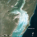
Category:Satellite pictures of Belize
Jump to navigation
Jump to search
Countries of North America: Antigua and Barbuda · The Bahamas · Barbados · Belize · Canada · Costa Rica · Cuba · Dominica · Dominican Republic · El Salvador · Grenada · Guatemala · Haiti · Honduras · Jamaica · Mexico · Nicaragua · Panama · Saint Kitts and Nevis · Saint Lucia · Saint Vincent and the Grenadines · Trinidad and Tobago‡ · United States of America‡
Other territories: Anguilla · Bermuda · British Virgin Islands · Cayman Islands · Florida Keys · Greenland · Guadeloupe · Martinique · Montserrat · Puerto Rico · Saint Barthélemy · Saint-Martin · Saint Pierre and Miquelon · Turks and Caicos Islands · United States Virgin Islands
‡: partly located in North America
Subcategories
This category has the following 4 subcategories, out of 4 total.
Media in category "Satellite pictures of Belize"
The following 30 files are in this category, out of 30 total.
-
Belize 321.jpg 5,951 × 6,273; 21.69 MB
-
Belize satellite image 2003.jpg 1,000 × 1,333; 484 KB
-
Central America (MODIS 2019-02-22).jpg 3,096 × 2,402; 856 KB
-
Chetumal Bay satellite image.jpg 1,018 × 1,357; 702 KB
-
Chetumal Bay.jpg 540 × 540; 351 KB
-
Envisat image of Central America ESA238704.jpg 1,066 × 1,066; 941 KB
-
Envisat image of Central America ESA238704.tiff 1,066 × 1,066; 3.27 MB
-
Great Blue Hole Belize.jpg 2,048 × 1,280; 331 KB
-
Great Blue Hole, Belize (ASTER).jpg 1,218 × 2,818; 411 KB
-
Gulf of Honduras.jpg 2,602 × 3,352; 1.71 MB
-
Lighthouse Reef Belize.jpg 2,743 × 4,072; 3.88 MB
-
Mundo Maya, Meso-America.png 1,793 × 1,488; 4.76 MB
-
Sarstoon Island L8.jpg 300 × 300; 60 KB
-
Satellite image of Belize in March 31, 2002.jpg 780 × 1,190; 330 KB
-
Satellite image of Belize in May 2001.jpg 759 × 1,176; 205 KB
-
STS004-39-925 - View of Belize (Raw scan).tif 4,393 × 4,600; 57.82 MB
-
STS004-39-925 - View of Belize.jpg 4,393 × 4,600; 1.17 MB
-
STS004-39-926 - View of Belize (Raw scan).tif 4,393 × 4,600; 57.82 MB
-
STS004-39-926 - View of Belize.jpg 4,393 × 4,600; 1.21 MB
-
STS005-37-770 - View of Belize (Raw scan).tif 4,393 × 4,600; 57.82 MB
-
STS005-37-770 - View of Belize.jpg 4,393 × 4,600; 1.63 MB
-
STS006-39-199 - View of Belize (Raw scan).tif 4,393 × 4,600; 57.82 MB
-
STS006-39-199 - View of Belize.jpg 4,393 × 4,600; 1.23 MB
-
STS006-39-200 - View of Belize (Raw scan).tif 4,393 × 4,600; 57.82 MB
-
STS006-39-200 - View of Belize.jpg 4,393 × 4,600; 908 KB
-
Study Uses MODIS Data to Determine Belize Coral Reef Risk (PIA25861).jpg 4,579 × 2,083; 1.29 MB
-
Study Uses MODIS Data to Determine Belize Coral Reef Risk (PIA25861).tif 4,579 × 2,083; 21.47 MB
-
Yucatan peninsula 250m.jpg 3,600 × 4,800; 2.76 MB
-
Yucatan Peninsula on January 25, 2017.jpg 5,600 × 4,400; 3.5 MB


