Category:SVG images with embedded raster graphics:Maps
Jump to navigation
Jump to search
Many maps in this category contain various types of terrain cartography to show their topographic structures.
When used for that purpose, embedding raster graphics is an option of SVG too difficult to be replaced by other methods;
it is neither an error, nor something needing cleanup.
Such files should be categorized to SVG maps with topographic raster graphics.
Subcategories
This category has the following 38 subcategories, out of 38 total.
M
Media in category "SVG images with embedded raster graphics:Maps"
The following 200 files are in this category, out of 460 total.
(previous page) (next page)-
103973-Map3.3-map-Report-Annual-Annual-mean-PM2.5-concentrations-2017 v2-it.svg 7,135 × 5,625; 5.5 MB
-
1346-1353 spread of the Black Death in Europe map.svg 992 × 866; 1.87 MB
-
1886 Minnesota gubernatorial election results map by county.svg 800 × 915; 955 KB
-
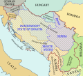
1941-1943 Axis occupation of Yugoslavia map.svg 1,613 × 1,471; 2.42 MB
-
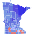
1982 Minnesota gubernatorial election results map by county.svg 810 × 810; 46 KB
-
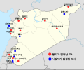
2011 Syria protests-ko.svg 1,219 × 1,009; 121 KB
-
2011 Venezuela - Población mayoritaria Extranjera por Municipios.svg 1,052 × 744; 4.92 MB
-
2011 Venezuela Census - Top Foreign Population by Municipalities.svg 1,052 × 744; 4.92 MB
-
2013 FIFA U-17 World Cup qualified teams.svg 1,350 × 625; 43 KB
-
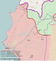
2014 Latakia Offensive Map.svg 1,333 × 1,443; 3.31 MB
-
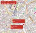
2015-11-13 France attacks Paris 10 fr.svg 680 × 620; 7.77 MB
-
2018 United States attorney general elections results map.svg 959 × 593; 383 KB
-
2023 Czech Presidential election, 2nd round.svg 1,492 × 800; 434 KB
-
A370 road map.svg 2,213 × 1,050; 2.13 MB
-
Aareschlaufe Bern-East.svg 2,453 × 1,908; 4.66 MB
-
ACTV-5.svg 744 × 1,052; 459 KB
-
Adderley Street map.svg 546 × 629; 1.95 MB
-
Adriatic Sea map hr.svg 673 × 916; 417 KB
-
Africa mark Wikipedia 15 in Maithili.svg 744 × 1,052; 773 KB
-
Alboran Sea map hr.svg 1,004 × 1,028; 242 KB
-
Alboran Sea map mk.svg 1,000 × 1,028; 289 KB
-
Algeria regions map.svg 575 × 587; 1.68 MB
-
AMPS World Sectors.svg 512 × 253; 587 KB
-
Amtrak Northeast Regional.svg 1,301 × 980; 1.15 MB
-
Amundsen Map 2 ru.svg 697 × 732; 583 KB
-
Anboto mendiaren kokapena mapan.svg 241 × 195; 181 KB
-
Ancient Epirus & Modern Borders zh (Colored).svg 860 × 1,252; 252 KB
-
Ancient Orient History Map basis.de.svg 2,102 × 1,510; 8.63 MB
-
AqpCHA.svg 512 × 683; 5.59 MB
-
Arabian Sea map hr.svg 674 × 636; 279 KB
-
Aree protette della Lombardia.svg 1,175 × 1,123; 289 KB
-
Artaxiad Armenia 80BC-fr.svg 2,960 × 2,140; 11.09 MB
-
Ashfield parish map.svg 899 × 826; 2.38 MB
-
Asia Minor ca 740 AD ZH.svg 1,317 × 687; 1.45 MB
-
Asia Minor ca 780 AD ZH.svg 1,317 × 687; 1.45 MB
-
Asia Minor ca 842 AD zh.svg 1,317 × 687; 1.46 MB
-
Asturias in 800.svg 1,296 × 661; 1.08 MB
-
Austria Hungary ethnic.svg 1,360 × 1,052; 1.56 MB
-
Autobahnkreuz Neersen.svg 1,568 × 1,299; 1.76 MB
-
Average Julytemperature LGM East Europe 1.svg 1,056 × 816; 1.65 MB
-
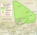
Azawad Tuareg rebellion 2012 - 2.svg 1,315 × 1,254; 719 KB
-
Bahn Retenice-Liberec (Nordboehmische Transversalbahn) (1901).svg 537 × 370; 1.69 MB
-
Bahnstrecke Aschaffenburg - Höchst (Odenwald).svg 343 × 379; 11.11 MB
-
Bahnstrecke Holzhausen-Damme.svg 1,767 × 1,968; 4.63 MB
-
Bahnstrecke Ludwigsstadt - Lehesten.svg 1,997 × 1,160; 10.01 MB
-
Bahnstrecke Obernburg-Heimbuchenthal.svg 724 × 382; 4.18 MB
-
Balkans 6th century-zh.svg 1,400 × 755; 1.42 MB
-
Baltic Sea map hr.svg 1,005 × 1,076; 414 KB
-
Baltic Sea map2 hr.svg 1,005 × 1,811; 559 KB
-
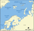
Barents Sea map hr.svg 512 × 466; 375 KB
-
Bath2010Constituency.svg 744 × 558; 458 KB
-
Battle of Baghuz (2019)-ar.svg 1,779 × 1,226; 824 KB
-
Battle of Daraa City.svg 1,500 × 1,500; 2.8 MB
-
Battle of Delium detail map-es.svg 1,200 × 900; 487 KB
-
Battle of Delium detail map-fr.svg 1,200 × 900; 486 KB
-
Battle of Delium general map-de.svg 1,300 × 1,100; 480 KB
-
Battle of Delium general map-es.svg 1,300 × 1,100; 493 KB
-
Battle of Delium general map-fr.svg 1,300 × 1,100; 479 KB
-
Battle of Quiberon Bay - 1759-11-20 - map-fr.svg 1,820 × 1,265; 790 KB
-
Battle of Western Qalamoun.svg 2,430 × 2,463; 3.8 MB
-
Battleoftumbledown.svg 928 × 460; 252 KB
-
Bay of Bengal map hr.svg 1,035 × 1,054; 244 KB
-
Begatalbahn.svg 1,063 × 479; 5.22 MB
-
Beowulf Tribes.svg 392 × 271; 55 KB
-
Beringia CCSM4 snow depth 1.svg 1,650 × 1,275; 1.49 MB
-
Besancon map with districts numbers.svg 701 × 823; 2.46 MB
-
Besancon map with districts.svg 701 × 823; 2.46 MB
-
BHPward2-Woodingdean.svg 2,100 × 1,400; 5.75 MB
-
Biomes of Last Glacial Maximum, Crowley JGR 1.svg 1,067 × 543; 97 KB
-
Black Sea map hr.svg 1,004 × 766; 465 KB
-
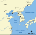
Bohai Sea map hr.svg 1,004 × 982; 394 KB
-
Boundaries in the Arctic - map-fr.svg 1,335 × 1,335; 969 KB
-
Bouvettriplenarrow3d.svg 1,020 × 609; 505 KB
-
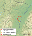
Breuschstellung-map-de.svg 1,047 × 1,167; 497 KB
-
Breuschstellung-map-en.svg 1,047 × 1,167; 498 KB
-
Breuschstellung-map-fr.svg 1,047 × 1,167; 497 KB
-
Breuschstellung-map-hu.svg 1,047 × 1,167; 497 KB
-
BritishAntarcticTerritory.svg 960 × 640; 100 KB
-
Burj phase sites 1.svg 652 × 487; 404 KB
-
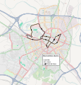
Bus Turístico Diurno (TUZSA).svg 504 × 525; 2.57 MB
-
Bus Turístico Nocturno y Megabús (TUZSA).svg 504 × 525; 2.58 MB
-
Byzantine Greece ca 900 AD ZH.svg 797 × 632; 447 KB
-
Byzantine-Arab wars, 837-838-zh.svg 1,437 × 787; 1.31 MB
-
Cabezo de Alcalá aerial view-fr.svg 1,577 × 1,018; 137 KB
-
Cambridge-Openstreetmap-11-05-27.svg 1,254 × 1,093; 5.31 MB
-
Cambridge-OpenStreetMap-2008-06-13.svg 644 × 576; 404 KB
-
CAN QC 01 Communauté maritime des Îles-de-la-Madeleine.svg 1,026 × 1,072; 1.53 MB
-
Canadian Rocky Moutain parks map hr.svg 408 × 424; 176 KB
-
Canaveral.svg 1,000 × 1,750; 362 KB
-
Canton-Loiret-2014-Gien.svg 1,452 × 1,117; 830 KB
-
Capri and Ischia map hr.svg 1,004 × 655; 275 KB
-
Caria map-zh.svg 1,850 × 1,206; 2.43 MB
-
Carn Brea.svg 1,030 × 844; 505 KB
-
Carte des domaines de Chōshū, Saga, Tosa et Satsuma.svg 570 × 570; 1.94 MB
-
Carte du Comté (Grands Smials).svg 725 × 500; 200 KB
-
CCSM 3 Trace21ka July Temperature of France 21000 BP 1.svg 1,204 × 989; 936 KB
-
CCSM3 12000BP JulyT 1.svg 1,650 × 1,275; 1.6 MB
-
CCSM3 12500BP JulyT 1.svg 1,650 × 1,275; 1.61 MB
-
CCSM3 17000BP JulyT 1.svg 1,650 × 1,275; 1.42 MB
-
CCSM3 19000BP JulyT 1.svg 1,650 × 1,275; 1.12 MB
-
CCSM3 July 16000BP 1.svg 1,650 × 1,275; 1.53 MB
-
Ccsm3 trace21k tjuly 21000bp europe 1.svg 1,650 × 1,275; 1.55 MB
-
Ccsm3 trace21k tjuly 21000bp europe 2.svg 1,236 × 1,052; 12.54 MB
-
Ccsm4 annual average temperature lgm east europe 1.svg 1,056 × 816; 2.31 MB
-
CCSM4 annual average temperature LGM Esast Beringia 1.svg 1,056 × 709; 1.12 MB
-
Ccsm4 annual average temperature LGM West Europe 1.svg 1,056 × 816; 2.49 MB
-
Ccsm4 annual average temperature LGM West Europe 2.svg 1,056 × 816; 1.13 MB
-
Ccsm4 annual precipitation lgm sibiria 1.svg 1,056 × 816; 2.22 MB
-
Ccsm4 annual precipitation lgm west europe 1.svg 990 × 765; 3.66 MB
-
Ccsm4 annual temperature lgm sibiria 1.svg 1,056 × 816; 1.17 MB
-
Ccsm4 average july termerature LGM East Beringia.svg 1,650 × 1,275; 1.01 MB
-
Ccsm4 east beringia lgm temperature july 2.svg 917 × 517; 5.18 MB
-
CCSM4 Inner Beringia snow depth cm lgm 1.svg 1,650 × 1,275; 2.98 MB
-
Ccsm4 january average temperature lgm east beringia 1.svg 1,056 × 816; 877 KB
-
Ccsm4 January average temperature LGM East Europe 1.svg 1,056 × 816; 1.58 MB
-
Ccsm4 january precipitation lgm east beringia 1.svg 1,056 × 816; 660 KB
-
Ccsm4 january precipitation lgm sibiria 1.svg 1,056 × 816; 763 KB
-
Ccsm4 january precipitation lgm west europe 1.svg 1,056 × 816; 1.59 MB
-
Ccsm4 january temperature lgm sibiria 1.svg 1,056 × 816; 1.3 MB
-
Ccsm4 July average temperature LGM ukraine 1.svg 1,056 × 816; 1.51 MB
-
Ccsm4 july precipitation lgm east beringia 1.svg 1,056 × 816; 1.12 MB
-
Ccsm4 july precipitation lgm west europe 1.svg 1,056 × 816; 1.07 MB
-
Ccsm4 july temperature lgm sibiria 1.svg 1,056 × 816; 1.74 MB
-
Ccsm4 july temperature south and middle europe lgm 1.svg 1,236 × 1,052; 7.12 MB
-
Ccsm4 LGM annual average temperature south france 1.svg 1,056 × 816; 1.06 MB
-
Ccsm4 LGM January average temperature West Europe 1.svg 990 × 765; 2.04 MB
-
Ccsm4 LGM july average temperature south france 1.svg 1,056 × 816; 885 KB
-
Ccsm4 lgm july temperature dordogne 1d.svg 838 × 765; 1.17 MB
-
Ccsm4 lgm usa precipitation annual 1.svg 1,056 × 816; 1.49 MB
-
Ccsm4 lgm usa precipitation january 1.svg 1,056 × 816; 1.36 MB
-
Ccsm4 lgm usa precipitation july 1.svg 1,056 × 816; 1.53 MB
-
Ccsm4 lgm usa temperature annual 1.svg 1,056 × 816; 946 KB
-
Ccsm4 lgm usa temperature january 1.svg 1,056 × 816; 812 KB
-
Ccsm4 lgm usa temperature july 1.svg 1,056 × 816; 1.63 MB
-
Central African Republic 2012 Battles-en.svg 1,606 × 1,109; 5.72 MB
-
Central London Andh.svg 1,153 × 691; 5.03 MB
-
Centro Histórico de Arequipa (vectorial).svg 512 × 683; 6.28 MB
-
Chukchi Sea hr.svg 1,004 × 639; 317 KB
-
Cluse de Chambéry - Carte de l'occupation des sols (CORINE).svg 1,898 × 2,050; 12.71 MB
-
Cluse de Chambéry - Carte des infrastructures de transport.svg 1,898 × 2,050; 6.59 MB
-
Constantinople area map zh.svg 1,625 × 909; 917 KB
-
Constantinople center-zh.svg 892 × 1,017; 235 KB
-
Constantinople center.svg 717 × 825; 422 KB
-
Copa Africana de Naciones 2015 Partido 24 Grupo D Guinea-Malí.svg 534 × 738; 64 KB
-
Copa Africana de Naciones 2015 Partido 8 Grupo D Malí-Camerún.svg 534 × 738; 64 KB
-
Corfu topographic map-de.svg 2,100 × 2,345; 2.43 MB
-
Cotton Belt Rail Line Map.svg 512 × 242; 133 KB
-
Covid-19 cases in Finland by municipality, weeks 11-12, 2021.svg 900 × 1,440; 359 KB
-
CPH-map.svg 2,152 × 2,091; 627 KB
-
CTS ancien réseau 1, 1878-1886.svg 1,093 × 1,073; 3.37 MB
-
CTS ancien réseau 2, 1895-1899.svg 1,093 × 1,073; 3.37 MB
-
CTS ancien réseau 3, 1899-1907.svg 1,093 × 1,073; 3.39 MB
-
CTS ancien réseau 4, 1908-1914.svg 1,093 × 1,073; 3.42 MB
-
CTS ancien réseau 5, 1915-1927.svg 1,093 × 1,073; 3.44 MB
-
CTS ancien réseau 6, 1937-1947.svg 1,093 × 1,073; 3.43 MB
-
Cuenca-030-031-032-033-B.svg 1,868 × 1,720; 4.91 MB
-
Cuenca-106-B.svg 631 × 875; 4.26 MB
-
Cuenca-109-B.svg 1,379 × 1,608; 4.63 MB
-
Cuenca-112-B.svg 1,307 × 1,484; 2.16 MB
-
Cuenca-116-117-118-119-B.svg 2,728 × 1,200; 6.42 MB
-
Cuenca-127-B.svg 2,031 × 1,070; 1.64 MB
-
Cyclades map-fr with bug.svg 512 × 603; 2.77 MB
-
Dakar Rally 2011 map-fr.svg 1,513 × 1,584; 3.42 MB
-
Dakar Rally 2011 map-mk.svg 1,513 × 1,584; 3.43 MB
-
Dccirculator.svg 461 × 483; 3.14 MB
-
Deir ez-Zor clashes (17 september 2017).svg 1,880 × 1,351; 1.64 MB
-
Deir ez-Zor clashes (2017).svg 1,880 × 1,351; 1.63 MB
-
Densité Guangdong 2006.svg 762 × 600; 562 KB
-
Detailed Domain of Soissons.svg 1,052 × 744; 663 KB
-
Digital-elevation-map-so california.svg 611 × 319; 316 KB
-
Distribuição do Bis-bis.svg 1,000 × 858; 64 KB
-
Distribution map of Eleutherodactylus bilineatus.svg 484 × 374; 1.1 MB
-
DOC Bucelas.svg 842 × 457; 474 KB
-
Duchy of Svaneti, XIII c.svg 1,872 × 944; 1.49 MB
-
Dyatlov pass incident accurate fancy map 3.svg 708 × 410; 88 KB
-
Dyatlov pass incident accurate fancy map 4.svg 634 × 378; 49 KB
-
Dyatlov pass incident accurate mountain and tent map 2.svg 730 × 776; 189 KB
-
Dyatlov pass incident avalanche possibility map 1.svg 730 × 503; 488 KB
-
Dyatlov pass incident avalanche possibility map 2.svg 730 × 430; 501 KB
-
Dyatlov pass incident fancy map 3.svg 1,071 × 980; 8.48 MB
-
Dyatlov pass incident satellite height map 1.svg 1,029 × 508; 1,008 KB
-
Dyatlov pass incident slope map 1.svg 730 × 503; 4.33 MB
-
E58 route.svg 2,094 × 1,479; 109 KB
-
Early early Harappan map 1.svg 652 × 487; 478 KB
-
Early Harappan cultures map 1.svg 696 × 520; 558 KB
-
Early Late harappan 1899-1600 bc.svg 674 × 807; 1.46 MB
-
Early Late or Early Post Harappan sites by culture 1.svg 652 × 516; 1.55 MB
-
Early phase Indus valley sites 3200 2600bc.svg 674 × 807; 1.44 MB
-
East Siberian Sea map hr.svg 997 × 554; 413 KB
-
East sibiria at lgm 1.svg 967 × 348; 917 KB
-
East sibiria at lgm 2.svg 1,053 × 744; 930 KB
-
Ebroko sakonunea.svg 819 × 622; 704 KB
-
EBSL host countries.svg 8,579 × 6,969; 619 KB
-
Ecclesfield Open Street Map.svg 1,323 × 1,126; 1.31 MB
-
Egejsko more.svg 580 × 765; 210 KB


