Category:SVG maps of the Syrian Civil War
Jump to navigation
Jump to search
Media in category "SVG maps of the Syrian Civil War"
The following 59 files are in this category, out of 59 total.
-
2011 Syria protests.svg 922 × 762; 287 KB
-
Territorial control of the ISIS.svg 1,654 × 1,264; 1.39 MB
-
2012 Hama Offensive.svg 1,430 × 1,173; 2.15 MB
-
2013 Hama Offensive.svg 3,493 × 1,755; 4.43 MB
-
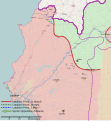
2014 Latakia Offensive Map.svg 1,333 × 1,443; 3.31 MB
-
Siege of Kobane.svg 1,850 × 1,229; 466 KB
-
Siege of Kobanê.svg 1,263 × 745; 1.02 MB
-
2015 Hama Offensive.svg 2,170 × 2,834; 7.42 MB
-
2015 Idlib offensive map.svg 1,040 × 735; 497 KB
-
Rif Aleppo2.svg 1,293 × 655; 7.13 MB
-
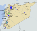
Anti-ISIS coalition air bases.svg 1,050 × 700; 224 KB
-
Battle of Aleppo map.svg 1,450 × 975; 194 KB
-
Battle of Damascus map.svg 1,335 × 789; 212 KB
-
Battle of Hasakah.svg 2,999 × 2,079; 2.5 MB
-
Battle of Qamishli.svg 2,770 × 2,254; 4.64 MB
-
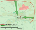
Battle of Raqqa (2017) for Templates.svg 841 × 581; 1.27 MB
-
Battle of Raqqa.svg 897 × 752; 1.35 MB
-
Battle of Raqqa2.svg 841 × 705; 1.19 MB
-
Battle of Tadmur.svg 863 × 448; 544 KB
-
Battle of Western Qalamoun.svg 2,430 × 2,463; 3.8 MB
-
Between Aleppo and Euphrates River.svg 3,840 × 2,165; 11.44 MB
-
CombinedTaskForce.svg 2,560 × 1,314; 1.67 MB
-
CountriesRecognizingSNC.svg 863 × 443; 1.6 MB
-
Damascus districts and suburbs.svg 1,075 × 718; 852 KB
-
Damascus offensive (February 2013).svg 1,856 × 1,214; 9.32 MB
-
Damascus offensive (November 2012).svg 1,856 × 1,214; 9.32 MB
-
Deir ez-Zor clashes (17 september 2017).svg 1,880 × 1,351; 1.64 MB
-
Deir ez-Zor clashes (2017).svg 1,880 × 1,351; 1.63 MB
-
Deir ez-Zor clashes (February 2014).svg 1,880 × 1,351; 1.6 MB
-
Deir ez-Zor clashes (January 2016).svg 1,880 × 1,351; 2.2 MB
-
Deir ez-Zor clashes (March 2014).svg 2,005 × 1,441; 1.52 MB
-
Hama offensive map.svg 995 × 605; 308 KB
-
Homs offensive (November 2015).svg 2,429 × 2,534; 6.02 MB
-
Idlib July 2020.svg 1,647 × 2,740; 9.43 MB
-
Northern Raqqa Offensive (November 2016).svg 4,000 × 2,400; 6.85 MB
-
Rif Hasakah.svg 2,999 × 2,079; 2.6 MB
-
Siege of Homs Map.svg 883 × 900; 4.91 MB
-
Syria military involvement.svg 863 × 443; 1.61 MB
-
Syria Vienna Peace Talks.svg 863 × 443; 1.61 MB
-
Syria.svg 922 × 762; 10.93 MB
-
Syrian Civil War map (March 16, 2024).svg 922 × 762; 3.55 MB
-
Syrian Civil War map (November 24, 2023).svg 922 × 762; 3.56 MB
-
Syrian civil war number of estimated damaged educational facilities.svg 1,008 × 718; 3.74 MB
-
Syrian civil war number of estimated damaged health sector.svg 1,021 × 807; 10.03 MB
-
Syrian civil war number of estimated damaged units.svg 1,007 × 750; 3.81 MB
-
Syrian civil war number of incidences of conflict 2011 2017.svg 513 × 892; 3.19 MB
-
Syrian Civil War-zh-cn.svg 1,000 × 827; 845 KB
-
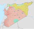
Syrian Civil War.svg 1,000 × 827; 852 KB
-
Syrian National Coalition recognition.svg 863 × 443; 1.6 MB
-
Syrian opposition map 2024.svg 921 × 761; 213 KB
-
Syrian opposition map.svg 921 × 761; 212 KB
-
Syrian refugees in the Middle East map en.svg 692 × 524; 88 KB
-
Syrian refugees in the Middle East map fi.svg 839 × 552; 110 KB
-
Syrian refugees in the Middle East map-ar.svg 839 × 552; 101 KB
-
SyrianCivilWarMap.svg 287 × 277; 1.22 MB
-
The situation in Afrin district.svg 437 × 600; 127 KB
-
The Situation in Hasakah.svg 600 × 313; 524 KB
-
Turkish Northern Syria.svg 922 × 762; 295 KB
-
Turkish occupied Syria.svg 922 × 762; 309 KB


