Category:Maps of the Syrian Civil War
Jump to navigation
Jump to search
Wikimedia category | |||||
| Upload media | |||||
| Instance of | |||||
|---|---|---|---|---|---|
| Category combines topics | |||||
| Syrian civil war | |||||
ongoing multi-sided civil war in Syria since 2011 | |||||
| Instance of | |||||
| Part of | |||||
| Location |
| ||||
| Has part(s) |
| ||||
| Start time |
| ||||
| Significant event |
| ||||
| Number of deaths |
| ||||
 | |||||
Subcategories
This category has the following 3 subcategories, out of 3 total.
Media in category "Maps of the Syrian Civil War"
The following 30 files are in this category, out of 30 total.
-
Syrieinvasie.png 1,500 × 775; 38 KB
-
Al-Hasakah MS 21 Jan 2022.png 705 × 491; 669 KB
-
Camino de fuga yihadista entre Tal Afar en Irak y Deir ez-Zor en Siria.png 2,080 × 1,632; 210 KB
-
Claimed and de facto territory of Rojava.png 2,000 × 1,653; 277 KB
-
De facto cantons of Rojava1.png 2,000 × 1,653; 339 KB
-
De Facto Regions of the Autonomous Administration of North and East Syria.png 2,000 × 1,653; 211 KB
-
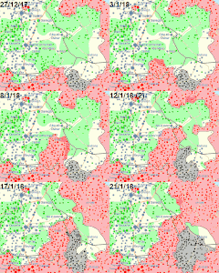
GIFMaker.org UVlVFF.gif 360 × 300; 964 KB
-
GifmapIdlib.gif 360 × 300; 1.66 MB
-
Integrated Attack on al Qusayr (estimated).tiff 961 × 722; 679 KB
-
Milaja frontline 26-27 August 2023.png 591 × 433; 539 KB
-
National Front for Liberation–Tahrir al-Sham conflict frontline gif.gif 360 × 420; 899 KB
-
Northern Syria de facto.png 2,000 × 1,653; 205 KB
-
Russia–Syria–Iran–Iraq Coalition.jpg 7,030 × 3,834; 1.25 MB
-
Syria and Iraq 2014-onward War map-.png 4,501 × 3,439; 1.89 MB
-
Syria and Iraq 2014-onward War map.png 4,501 × 3,439; 1.75 MB
-
Syrian civil war 04 02 2020.png 1,450 × 1,199; 744 KB
-
Syrian Civil War map (ISW-CTP).svg 922 × 762; 3.52 MB
-
Syrian Civil War map.svg 922 × 762; 3.48 MB
-
Syrian civil war September 2015.png 2,504 × 2,107; 1.04 MB
-
Syrian civil war.png 2,502 × 2,107; 1,020 KB
-
Syrian, Iraqi, and Lebanese insurgencies Color edit.png 4,501 × 3,439; 1.39 MB
-
Syrian, Iraqi, and Lebanese insurgencies-3.jpg 4,501 × 3,439; 1.43 MB
-
Syrian, Iraqi, and Lebanese insurgencies.png 4,509 × 3,449; 1.74 MB
-
SyrianCivilWarMap.png 842 × 580; 23 KB
-
Tadmur offensive (2015).jpg 1,139 × 577; 377 KB
-
Turkish Northern Syria 4.svg 922 × 762; 287 KB
-
UNGA resolution on Syria (Aug2012).png 1,357 × 628; 49 KB
-
UNGA resolution on Syria.png 1,357 × 628; 48 KB
-
YPG Kurdisch kontrollierte Gebiete.jpg 1,011 × 417; 80 KB
-
Беларусь у сiрыйскiм канфлiкце.png 3,713 × 2,036; 1.54 MB


