Category:SVG maps of the Kerguelen Islands
Jump to navigation
Jump to search
Media in category "SVG maps of the Kerguelen Islands"
The following 9 files are in this category, out of 9 total.
-
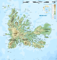
 Kerguelen administrative map-fr.svg 1,840 × 1,915; 939 KB
-
 Kerguelen blank map v2.svg 1,840 × 1,915; 433 KB
-
 Kerguelen blank map.svg 1,840 × 1,915; 751 KB
-
 Kerguelen geologic map-fr.svg 1,832 × 1,832; 110 KB
-
 Kerguelen topographic blank map.svg 1,840 × 1,915; 2.11 MB
-
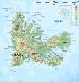
 Kerguelen topographic map-bg.svg 1,840 × 1,915; 2.33 MB
-
 Kerguelen topographic map-fr.svg 1,840 × 1,915; 2.33 MB
-
 KERGUELEN.svg 1,705 × 1,497; 438 KB
-
 Île de Croÿ locator map.svg 1,840 × 1,915; 519 KB


