Category:Maps of the Kerguelen Islands
Jump to navigation
Jump to search

Subcategories
This category has the following 4 subcategories, out of 4 total.
Media in category "Maps of the Kerguelen Islands"
The following 25 files are in this category, out of 25 total.
-
 Admiralty Chart Catalogue 1967 Page 055 Index H3.jpg 8,578 × 6,893; 8.82 MB
-
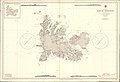 Admiralty Chart No 2398 Iles de Kerguelen, Published 1951.jpg 16,269 × 11,122; 40.84 MB
-
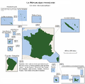
 France-Constituent-Lands.png 3,337 × 3,300; 382 KB
-
 France-Terres-Emergées.png 3,337 × 3,300; 299 KB
-
 Ile de croy.png 1,432 × 810; 438 KB
-
 Iles Kerguelen 76.jpg 857 × 891; 170 KB
-
 Iles Kerguelen.jpg 7,686 × 7,457; 2.98 MB
-
 Iles kerguelen2.png 1,152 × 891; 786 KB
-
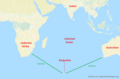
 Indian ocean and Kerguelen Islands.png 809 × 530; 139 KB
-
 Indischer Ozean mit Kerguelen.png 809 × 530; 144 KB
-
 Ker Islands.png 2,644 × 2,509; 435 KB
-
 Ker Peninsulas.png 2,644 × 2,509; 417 KB
-
 Kerguelen administrative map-fr.png 1,840 × 1,915; 907 KB
-
 Kerguelen Island.png 518 × 541; 8 KB
-
 Kerguelen Map-fr.png 1,964 × 1,906; 1.05 MB
-
 Kerguelen Map.png 1,964 × 1,906; 337 KB
-
 Kerguelen mit deutschen Angaben.png 767 × 686; 376 KB
-
 Kerguelen topographic be.png 1,840 × 1,915; 1.55 MB
-
 Kerguelen topographic blank map.png 1,840 × 1,915; 1.65 MB
-
 Kerguelen topographic map-fr.png 1,840 × 1,915; 2.08 MB
-
 Kerguelen-en.png 767 × 686; 376 KB
-
 Kerguelen-Plateau-Topography.jpg 380 × 400; 37 KB
-
 KerguelenPlateau v1.png 1,009 × 1,200; 135 KB
-
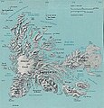
 Reliefkarte Kerguelen.png 4,336 × 3,611; 5.65 MB
-
 Rivière de l'Est Bassin versant.png 1,235 × 753; 1.07 MB


