Category:Russia Row
Jump to navigation
Jump to search
street in the City of London | |||||
| Upload media | |||||
| Instance of | |||||
|---|---|---|---|---|---|
| Location | City of London, London, England | ||||
| Connects with | |||||
 | |||||
Subcategories
This category has only the following subcategory.
Media in category "Russia Row"
The following 11 files are in this category, out of 11 total.
-
City of London Bomb Damage Map Trump Street & Russia Row.jpg 414 × 340; 100 KB
-
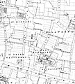
Honey Lane Market on Richard Horwood's 1799 map.jpg 546 × 546; 173 KB
-
Milk Street 1875 Ordnance Survey map.jpg 3,467 × 3,860; 2.54 MB
-
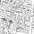
Russia Row & Trump Street map cropped.jpg 723 × 723; 144 KB
-
Russia Row & Trump Street map.jpg 1,094 × 740; 234 KB
-
Russia Row and Trump Street 1910s Ordnance Survey map.jpg 2,235 × 2,171; 2.04 MB
-
Russia Row off Milk Street - geograph.org.uk - 921884.jpg 570 × 463; 79 KB
-
Russia Row, January 2018 01.jpg 4,608 × 3,456; 6.39 MB
-
Russia Row, January 2018 02.jpg 3,456 × 4,608; 5.85 MB
-
Russia Row, January 2018 03.jpg 2,884 × 4,405; 1.97 MB
-
Site of the City of London School - Milk Street London EC2V 6DN.jpg 1,202 × 1,647; 577 KB


