Category:Milk Street, London
Jump to navigation
Jump to search
street in the City of London, England | |||||
| Upload media | |||||
| Instance of | |||||
|---|---|---|---|---|---|
| Location | City of London, London, England | ||||
| Connects with | |||||
 | |||||
Milk Street, London
Subcategories
This category has only the following subcategory.
Media in category "Milk Street, London"
The following 14 files are in this category, out of 14 total.
-
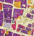
City of London Bomb Damage Map Wood Street and Milk Street.jpg 550 × 587; 368 KB
-
Eleventh-century axe from Milk Street on display in the Museum of London.jpg 4,534 × 3,004; 7.24 MB
-
Gresham Street - Milk Street, EC2 - geograph.org.uk - 1096753.jpg 480 × 640; 78 KB
-
Milk St, London - geograph.org.uk - 1043349.jpg 640 × 480; 70 KB
-
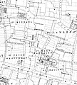
Milk Street 1875 Ordnance Survey map.jpg 3,467 × 3,860; 2.54 MB
-
Milk Street area.jpg 600 × 660; 195 KB
-
Milk Street, January 2018 04.jpg 3,456 × 4,608; 5.59 MB
-
Morley's warehouses, corner of Milk Street and Gresham Street, c. 1840.jpg 1,024 × 958; 217 KB
-
Sir Thomas More - 20 Milk Street London EC2V 6DN.jpg 1,500 × 2,000; 974 KB
-
Site of St Mary Magdalen, Milk Street - geograph.org.uk - 921877.jpg 480 × 640; 70 KB
-
Site of the City of London School - Milk Street London EC2V 6DN.jpg 1,202 × 1,647; 577 KB
-
View down Milk Street from Gresham Street - geograph.org.uk - 4585926.jpg 3,872 × 2,592; 2.88 MB


