Category:Roads in Ipswich
Jump to navigation
Jump to search
Subcategories
This category has the following 4 subcategories, out of 4 total.
Media in category "Roads in Ipswich"
The following 49 files are in this category, out of 49 total.
-
 55-71 Portman Road - geograph.org.uk - 3874335.jpg 800 × 600; 105 KB
-
 55-71 Portman Road sign - geograph.org.uk - 3874346.jpg 800 × 600; 79 KB
-
 A1156 crossed by High Street - geograph.org.uk - 3548327.jpg 3,648 × 2,736; 1.69 MB
-
 A1156, Grimwade Street - geograph.org.uk - 3886268.jpg 640 × 430; 61 KB
-
 A1189 - geograph.org.uk - 3251016.jpg 640 × 430; 65 KB
-
 A1189 Nacton Road - geograph.org.uk - 2648166.jpg 3,072 × 2,304; 1.29 MB
-
 A1189 near Ransomes Europark - geograph.org.uk - 3251018.jpg 640 × 430; 44 KB
-
 A1189, Heath Rd - geograph.org.uk - 3875968.jpg 640 × 430; 58 KB
-

-
 A1214 - geograph.org.uk - 3885672.jpg 640 × 390; 55 KB
-
 A1214 - geograph.org.uk - 3886260.jpg 640 × 375; 62 KB
-
 A1214 crosses A1075 - geograph.org.uk - 3547846.jpg 3,598 × 2,609; 1.35 MB
-
 A1214 Woodbridge Road East - geograph.org.uk - 2713944.jpg 3,072 × 2,304; 1.3 MB
-
 A1214 Woodbridge Road East - geograph.org.uk - 2713985.jpg 3,072 × 2,304; 1.33 MB
-
 A1214 Woodbridge Road East ^ Playford Road George V Postbox - geograph.org.uk - 2713946.jpg 3,072 × 2,304; 1.26 MB
-
 A1214 ^ A1071 pass The Mermaid - geograph.org.uk - 3548228.jpg 3,648 × 2,736; 1.47 MB
-
 A1214, B1067 junction - geograph.org.uk - 3886263.jpg 640 × 430; 55 KB
-
 A1214, Colchester Rd - geograph.org.uk - 3908385.jpg 640 × 430; 75 KB
-
 A1214, Colchester Rd - geograph.org.uk - 3908386.jpg 640 × 430; 92 KB
-
 A14 approaches interchange with A1189 - geograph.org.uk - 3580657.jpg 3,648 × 2,736; 1.46 MB
-
 A14 Approaching Junction 53 (Whitehouse) - geograph.org.uk - 3852280.jpg 640 × 480; 305 KB
-
 A14 approaching Whitehouse Junction - geograph.org.uk - 3868092.jpg 640 × 480; 250 KB
-
 A14 Bridge - geograph.org.uk - 3900457.jpg 3,072 × 2,304; 1.44 MB
-
 A14 bridge over the A1189 - geograph.org.uk - 3251022.jpg 640 × 430; 63 KB
-
 A14 bridge over the A1189 - geograph.org.uk - 3251026.jpg 640 × 430; 46 KB
-
 A14 climbs into the sky - geograph.org.uk - 3580726.jpg 3,446 × 2,540; 907 KB
-
 A14 near the Shell Service Station - geograph.org.uk - 3102460.jpg 3,072 × 2,304; 1.42 MB
-
 A14 north of Orwell Meadows Caravan Site - geograph.org.uk - 3580673.jpg 3,540 × 2,585; 1.07 MB
-
 A14 westbound - geograph.org.uk - 3885541.jpg 640 × 480; 38 KB
-
 A14 westbound - geograph.org.uk - 3885543.jpg 640 × 485; 49 KB
-
 A14 westbound - geograph.org.uk - 3885546.jpg 640 × 461; 55 KB
-
 A14 westbound - geograph.org.uk - 3885548.jpg 640 × 480; 39 KB
-
 A14 westbound - geograph.org.uk - 3885551.jpg 640 × 480; 48 KB
-
 A14 westbound - geograph.org.uk - 3885554.jpg 640 × 457; 42 KB
-
 A14, Bramford - geograph.org.uk - 3852277.jpg 640 × 480; 248 KB
-
 A14, eastbound - geograph.org.uk - 3249140.jpg 640 × 430; 53 KB
-
 A14, Ipswich bypass - geograph.org.uk - 3262666.jpg 640 × 389; 38 KB
-
 A14, northbound - geograph.org.uk - 3262669.jpg 640 × 430; 45 KB
-
 A14, Orwell Bridge - geograph.org.uk - 3885559.jpg 640 × 485; 41 KB
-
 A14, Orwell Bridge - geograph.org.uk - 3885564.jpg 640 × 444; 42 KB
-
 A14, westbound - geograph.org.uk - 3249139.jpg 640 × 430; 56 KB
-
 Aberdeen Way - geograph.org.uk - 3899148.jpg 640 × 430; 47 KB
-
 Access Road to Orwell Country Park - geograph.org.uk - 3249147.jpg 640 × 430; 55 KB
-
 Gainsborough Lane - geograph.org.uk - 1308035.jpg 640 × 480; 101 KB
-

-
 New riverside flats on Ranelagh Road - geograph.org.uk - 1467688.jpg 640 × 450; 91 KB
-
 Road tunnel - geograph.org.uk - 1148990.jpg 640 × 480; 90 KB
-
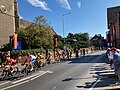 The peloton passing St Peter's Church - Tour of Britain 2023 (geograph 7589904).jpg 4,032 × 3,024; 3.48 MB
-
 Warren Heath Road - geograph.org.uk - 1105579.jpg 640 × 480; 64 KB


_-_geograph.org.uk_-_4003967.jpg)


_-_geograph.org.uk_-_3852280.jpg)


.jpg)
