Category:Roads in Ipswich, Queensland
Jump to navigation
Jump to search
English: City of Ipswich
Roads in Ipswich Local Government Area (LGA), Queensland.
Subcategories
This category has only the following subcategory.
S
Media in category "Roads in Ipswich, Queensland"
The following 15 files are in this category, out of 15 total.
-
 Beethams Road Ironbark.jpg 2,048 × 1,536; 2.1 MB
-
 Bicentennial National Trail Pine Mountain.jpg 2,048 × 1,536; 1.98 MB
-
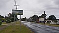
 Camira Queensland.jpg 4,455 × 2,590; 7.15 MB
-
 Hughes Road Purga.jpg 3,264 × 2,448; 3.91 MB
-
 Moores Pocket 2023.jpg 4,032 × 2,268; 3.04 MB
-
 North Station Road, North Booval, Queensland.jpg 3,264 × 2,448; 5.43 MB
-
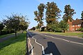
 Pine Mountain Road Pine Mountain.jpg 2,048 × 1,536; 1.88 MB
-
 Purga School Road Purga.jpg 3,264 × 2,448; 3.95 MB
-

-
 Russells Road corner Boyles Road Pine Moutain.jpg 2,048 × 1,536; 1.75 MB
-
 Russells Road Pine Moutain.jpg 2,048 × 1,536; 2.09 MB
-
 StateLibQld 1 235089 Floodwaters in Brisbane Road Ipswich, January 1887.jpg 1,000 × 716; 107 KB
-
 StateLibQld 1 235637 Government Dam on Gowrie Road near Ipswich.jpg 1,000 × 803; 125 KB
-
 Valley Road Ipswich.jpg 5,472 × 3,648; 8.52 MB
-
 Warrego Highway Haigslea.jpg 2,048 × 1,536; 1.84 MB


