Category:Rail transport maps of South Australia
Jump to navigation
Jump to search
States of Australia: New South Wales · Queensland · South Australia · Western Australia
Internal territories of Australia:
External territories of Australia:
Internal territories of Australia:
External territories of Australia:
Media in category "Rail transport maps of South Australia"
The following 40 files are in this category, out of 40 total.
-
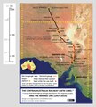
Central Australia Railway location map.png 441 × 800; 226 KB
-
Chronology of railway gauge changes that affected Port Pirie.jpg 4,960 × 6,865; 4.16 MB
-
GawlerRailwayLineRouteMap1.jpg 503 × 640; 375 KB
-
GawlerRailwayLineRouteMap2.jpg 504 × 640; 310 KB
-
GawlerRailwayLineRouteMap3.jpg 504 × 640; 267 KB
-
GawlerRailwayLineTerminalStations.jpg 504 × 640; 252 KB
-
Lake MacDonnell-Thevenard gypsum line mini map.png 291 × 238; 71 KB
-
Map (stylised) of Gawler railway line, South Australia.jpg 352 × 445; 37 KB
-
Map -- evolution of the Adelaide-Darwin rail corridor, 1855-2004.png 2,135 × 3,239; 330 KB
-
Map -- Port Pirie Junction and the new railway yards, 1937 (cropped).tif 1,739 × 1,608; 10.67 MB
-
Map of Central Australia Railway and Marree line.tif 1,071 × 1,194; 3.66 MB
-
Map of Eyre Peninsula railway lines in 2017.png 3,044 × 2,164; 1.19 MB
-
Map of Eyre Peninsula railway lines in 2019.png 2,002 × 1,441; 605 KB
-
Map of One Rail Australia facilities and serviced lines.png 3,327 × 2,144; 869 KB
-
Map of Port Pirie railways, stations and Coonamia stopping place.png 1,706 × 1,536; 2.19 MB
-
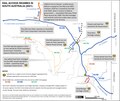
Map of rail access regimes in South Australia, 2021.tif 1,946 × 1,640; 9.14 MB
-
Map of Steamtown Peterborough Railway Preservation Society sites.jpg 1,434 × 1,437; 621 KB
-
Map of the Adelaide–Darwin rail route and the former Central Australia Railway.png 2,338 × 1,653; 1.25 MB
-
Map of the five lines comprising the Adelaide–Darwin rail corridor.png 1,157 × 2,338; 445 KB
-
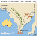
Map of the railways of Eyre Peninsula, South Australia, past and present.png 1,305 × 1,250; 345 KB
-
MTT map of Adelaide's metropolitan public transport routes, 28 May 1952.png 1,653 × 2,338; 6.11 MB
-
Penong-Kevin-Thevenard (Eyre Peninsula) rail maps 1919-2019.tif 1,284 × 2,255; 11.05 MB
-
Port Pirie Junction railway station -- track layout.tif 2,330 × 1,345; 11.96 MB
-
Port Pirie South track layout (narrow gauge), 1920.tif 2,313 × 854; 7.54 MB
-
Port Pirie's six railway stations from 1876 to the 2010s.png 3,507 × 2,480; 883 KB
-
Rail map -- Port Augusta, Port Pirie routes before and after 1937.png 1,242 × 1,517; 2.22 MB
-
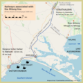
Railways associated with the Milang line.tif 1,585 × 1,588; 9.61 MB
-
Satellite map of Eyre Peninsula with all railway lines.tif 5,600 × 4,514; 96.44 MB
-
Schematic of the four commodities carried by rail on Eyre Peninsula, 2017.png 4,570 × 3,269; 917 KB
-
South Australia railway lines map, November 1910.jpg 5,000 × 8,419; 18.69 MB
-
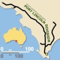
South Australian Railways Port Lincoln Division mini map.png 169 × 169; 24 KB
-
Track diagram -- Port Pirie South and Ellen Street, South Australia, from 1937 to 1982.png 2,002 × 3,506; 2.45 MB
-
Track layout diagram -- Pooraka -- South Australian Railways.tif 1,965 × 1,328; 9.96 MB
-
Track layout Port Pirie main yard and Mary Elie Street station 1970-1989.tif 2,266 × 1,334; 11.54 MB
-
Whyalla-Port Augusta steel products line mini map.png 214 × 168; 19 KB


