Category:Rail transport in Carmarthenshire
Jump to navigation
Jump to search

Wikimedia category | |||||
| Upload media | |||||
| Instance of | |||||
|---|---|---|---|---|---|
| Category combines topics | |||||
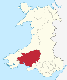
| Carmarthenshire | |||||
principal area in south-west Wales | |||||
| Instance of | |||||
| Location | Wales | ||||
| Located in or next to body of water | |||||
| Visitor center |
| ||||
| Capital | |||||
| Highest point | |||||
| Population |
| ||||
| Area |
| ||||
| Different from | |||||
| official website | |||||
 | |||||
Subcategories
This category has the following 13 subcategories, out of 13 total.
Media in category "Rail transport in Carmarthenshire"
The following 14 files are in this category, out of 14 total.
-
Blues and greens- Carmarthen (28507735955).jpg 4,665 × 3,061; 9.18 MB
-
Brynmawr & Nantyglo Llandilo & Llandovery RJD 99.jpg 2,861 × 1,890; 645 KB
-
Coastal Railway at Llanelli (geograph 3841944).jpg 1,200 × 806; 1.18 MB
-
Cycle path near Cynheidre - geograph.org.uk - 651944.jpg 640 × 480; 117 KB
-
Ferryside, the railway approaches - geograph.org.uk - 1179288.jpg 640 × 480; 77 KB
-
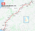
Heart of Wales line Map.png 4,500 × 4,000; 8.42 MB
-
Miniature railway at Pembrey Country Park - geograph.org.uk - 176596.jpg 640 × 480; 152 KB
-
Rails at Dolaucothi mine (8709).jpg 4,288 × 2,848; 6.41 MB
-
Rails at Dolaucothi mine (8769).jpg 4,288 × 2,848; 7 MB
-
Railtour excursion for GCG - geograph.org.uk - 1083512.jpg 640 × 418; 72 KB
-
Railway at Nantyrhebog - geograph.org.uk - 467130.jpg 640 × 480; 98 KB
-
Sugar Loaf Mountaineer railtour at Pantyffynon, 23rd September 2018 - Flickr - Dai Lygad.jpg 5,892 × 3,928; 15.05 MB
-
West Wales lines Map.png 3,750 × 2,250; 3.72 MB
-
Whitlandrailway lines map1952.jpg 2,912 × 1,648; 587 KB


