Category:Public transport maps of Toulouse
Jump to navigation
Jump to search
Subcategories
This category has the following 3 subcategories, out of 3 total.
M
- Maps of Toulouse Metro (24 F)
T
- Maps of Toulouse TER (15 F)
- Maps of Toulouse Tramway (28 F)
Media in category "Public transport maps of Toulouse"
The following 27 files are in this category, out of 27 total.
-
 BSP RN113.png 371 × 452; 9 KB
-
 Carte de Linéo de Toulouse.png 1,193 × 1,336; 63 KB
-
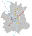
 Carte de Métro de Toulouse.png 1,193 × 1,336; 46 KB
-
 Carte de Tramway de Toulouse.png 1,193 × 1,336; 42 KB
-
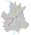
 Carte de Tramway et de Métro de Toulouse.png 1,193 × 1,336; 52 KB
-
 Carte de transport en commun de Toulouse.png 1,193 × 1,336; 78 KB
-
 Mapa del mètro de Tolosa.svg 500 × 464; 64 KB
-
 Metro Toulouse de.svg 750 × 902; 88 KB
-
 PDU Toulouse 2001.png 1,070 × 1,500; 903 KB
-
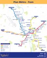 Plan Metro-Tram-ligne C.pdf 3,218 × 4,020; 235 KB
-
 Plan métro tramway Toulouse.svg 2,237 × 1,678; 351 KB
-
 Railway map of France - Toulouse - animated - fr.gif 2,150 × 1,561; 18.85 MB
-
 Toulouse - Tramway (24457444914).jpg 5,184 × 3,710; 8.93 MB
-
 Toulouse - Tramway (24720442119).jpg 3,250 × 4,172; 5.64 MB
-
 Toulouse line B map.png 800 × 253; 28 KB
-
 Toulouse line C map.png 628 × 509; 41 KB
-
 Toulouse line L1 map.svg 2,708 × 632; 676 KB
-
 Toulouse Metro Fond Infobox.svg 586 × 464; 65 KB
-
 Toulouse Reseau Lignes ABC.svg 586 × 464; 71 KB
-
 Toulouse Reseau Lignes ABCE.svg 586 × 548; 96 KB
-
 Toulouse Reseau Lignes ABCT1oc.svg 586 × 548; 96 KB
-
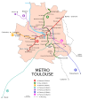
 Toulouse Reseau Metro.png 1,000 × 1,203; 187 KB
-
 Toulouse Reseau Metro.svg 750 × 902; 340 KB
-
 Toulouse-01.jpg 2,111 × 2,000; 2.93 MB
-
 Toulouse2-02.jpg 1,291 × 1,348; 650 KB
-
 Transpòrts en comun de Tolosa - Occitan.png 884 × 875; 59 KB
-
 Université Paul Sabatier (25079107676).jpg 5,032 × 3,741; 10.08 MB


.jpg)
.jpg)


.jpg)