Category:Maps of Toulouse Tramway
Jump to navigation
Jump to search
Media in category "Maps of Toulouse Tramway"
The following 28 files are in this category, out of 28 total.
-
 Carte de Tramway de Toulouse.png 1,193 × 1,336; 42 KB
-
 Carte de Tramway et de Métro de Toulouse.png 1,193 × 1,336; 52 KB
-
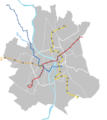
 Carte de transport en commun de Toulouse.png 1,193 × 1,336; 78 KB
-
 Envol.jpg 621 × 514; 21 KB
-
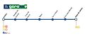 Garonne tram.jpg 922 × 389; 24 KB
-
 Garonne.jpg 803 × 503; 30 KB
-
 Map Tramway Toulouse line E.svg 744 × 1,052; 25 KB
-
 Map Tramway Toulouse line F.svg 1,300 × 500; 21 KB
-
 Metro Toulouse de.svg 750 × 902; 88 KB
-
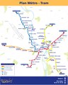 Plan Metro-Tram-ligne C.pdf 3,218 × 4,020; 235 KB
-
 Toulouse line E map.svg 1,492 × 425; 59 KB
-
 Toulouse line F map.svg 1,342 × 630; 68 KB
-
 Toulouse line G map final.svg 660 × 646; 49 KB
-
 Toulouse line G map.svg 1,031 × 909; 66 KB
-
 Toulouse line T1 map.svg 1,552 × 546; 54 KB
-
 Toulouse Metro Ligne E.svg 312 × 379; 198 KB
-
 Toulouse Reseau Lignes ABCE.svg 586 × 548; 96 KB
-
 Toulouse Reseau Lignes ABCT1oc.svg 586 × 548; 96 KB
-
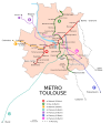
 Toulouse Reseau Metro.png 1,000 × 1,203; 187 KB
-
 Toulouse Reseau Metro.svg 750 × 902; 340 KB
-
 Toulouse T1 line geographic map.svg 332 × 367; 29 KB
-
 Toulouse tramway T1 carte sans fond.svg 903 × 1,150; 39 KB
-
 Toulouse tramway T2 tracé exact.svg 766 × 667; 34 KB
-
 Toulouse2-02.jpg 1,291 × 1,348; 650 KB
-
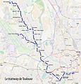
 Tram map of Toulouse 2014.svg 1,100 × 1,306; 3.32 MB
-
 Tramvai Tolosa (Aeroconstellacion).png 3,937 × 4,921; 1,018 KB
-
 Tramvai Tolosa (Pargue Exposicions).png 3,937 × 4,921; 1.04 MB
-
 Transpòrts en comun de Tolosa - Occitan.png 884 × 875; 59 KB


.png)
.png)