Category:Public transport maps of Strasbourg
Jump to navigation
Jump to search
Media in category "Public transport maps of Strasbourg"
The following 6 files are in this category, out of 6 total.
-
Railway map of France - Strasbourg - animated - fr.gif 1,856 × 1,729; 14.45 MB
-
Strasbourg public transport system map (with stations).png 7,998 × 6,202; 20.36 MB
-
StraßenbahnGleisplanStrasbourg2017.png 5,745 × 7,015; 1.28 MB
-
StraßenbahnGleisplanStrasbourg2019.png 5,745 × 7,015; 1.33 MB
-
Tracé projet ligne H BHNS Strasbourg.png 2,834 × 2,153; 7.31 MB
-
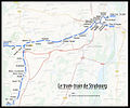
TramTrainStrasbourg-01.jpg 1,299 × 1,080; 658 KB


