Category:Maps of Strasbourg
Jump to navigation
Jump to search
Wikimedia category | |||||
| Upload media | |||||
| Instance of | |||||
|---|---|---|---|---|---|
| Category combines topics | |||||
| Strasbourg | |||||
capital and largest city of Grand Est, located in the historical region of Alsace | |||||
| Pronunciation audio | |||||
| Instance of | |||||
| Patron saint | |||||
| Location | |||||
| Located in or next to body of water | |||||
| Official language | |||||
| Head of government |
| ||||
| Inception |
| ||||
| Significant event | |||||
| Population |
| ||||
| Area |
| ||||
| Elevation above sea level |
| ||||
| Replaces | |||||
| Different from | |||||
| official website | |||||
 | |||||
Subcategories
This category has the following 6 subcategories, out of 6 total.
Media in category "Maps of Strasbourg"
The following 43 files are in this category, out of 43 total.
-
15 48.585 7.736.3507x4960.toner.png 3,507 × 4,960; 1.49 MB
-
376 of 'Die Erde. Eine allgemeine Erd- und Länderkunde, etc' (11234234276).jpg 1,685 × 1,336; 688 KB
-
67 BAS-RHIN carte grille communale densite INSEE.png 3,507 × 2,480; 2.8 MB
-
67-AAV2020-Strasbourg (partie française).png 3,519 × 3,197; 2.08 MB
-
67-Strasbourg (partie française)-AAV2020.png 3,519 × 2,930; 2.95 MB
-
67482-Strasbourg-Hydro.jpeg 5,846 × 4,133; 3.6 MB
-
67482-Strasbourg-Sols.png 3,270 × 2,598; 6.13 MB
-
Absolute plan strasbourg 01.jpg 1,645 × 1,896; 558 KB
-
Absolute routes strasbourg 01.jpg 942 × 684; 150 KB
-
Absolute Strasbourg CUS 01.jpg 848 × 1,156; 177 KB
-
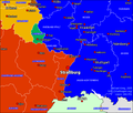
Absolute Strasbourg Europe 07.jpg 918 × 791; 97 KB
-
Arrondissement de Strasbourg-Campagne.PNG 388 × 480; 12 KB
-
Arrondissement de Strasbourg-Ville.PNG 388 × 480; 12 KB
-
Bistum Konstanz.jpg 428 × 600; 175 KB
-
Bistum Konstanz.png 428 × 600; 17 KB
-
CUS CUS DUAH QUART ILLUS.jpg 928 × 1,438; 69 KB
-
Diocèse Strasbourg 1789.svg 2,000 × 1,922; 801 KB
-
Hautepierre-ANRU.jpg 800 × 600; 201 KB
-
Hautepierre-schéma.jpg 800 × 497; 64 KB
-
Map commune FR insee code 67482.png 756 × 605; 185 KB
-
Map Strasbourg.jpg 1,589 × 2,464; 3.9 MB
-
Mk Strassburg.png 699 × 594; 22 KB
-
Panneaux d'expression libre Strasbourg.svg 500 × 525; 6.04 MB
-
Périmètre RNN Ile du Rohrschollen rnn133.png 1,238 × 824; 1.25 MB
-
Quartier des XV Strasbourg.jpg 612 × 526; 105 KB
-
Stations Vélhop.png 500 × 761; 592 KB
-
Stations Vélhop.svg 500 × 761; 10 MB
-
Strasbourg dot - LupinBot.png 1,804 × 1,689; 163 KB
-
Strasbourg dot.jpg 539 × 539; 172 KB
-
Strasbourg ferroviaire.png 1,589 × 2,464; 6.83 MB
-
Strasbourg map.png 200 × 189; 18 KB
-
Strasbourg Nasa.jpg 990 × 609; 200 KB
-
Strasbourg Neustadt.png 687 × 398; 588 KB
-
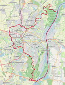
Strasbourg OSM 01.png 459 × 601; 510 KB
-
Strasbourg OSM 02.png 459 × 601; 702 KB
-
Strasbourg SIR-C-X-SAR PIA01859.png 1,269 × 1,473; 1.57 MB
-
Strasbourg SPOT 1163.jpg 500 × 500; 134 KB
-
Strasbourg-Campagne (Arrondissement) Plan.svg 450 × 509; 100 KB
-
Strasbourg-Ville (Arrondissement) Plan.svg 450 × 509; 100 KB
-
Strossburi Elsass.png 813 × 1,003; 39 KB
-
Traveaux barrage vauban.png 1,862 × 3,222; 6.6 MB
