Category:Portuguese-language maps showing history
Jump to navigation
Jump to search
Subcategories
This category has the following 3 subcategories, out of 3 total.
Media in category "Portuguese-language maps showing history"
The following 17 files are in this category, out of 17 total.
-
12 Tribes of Israel Map-pt.svg 2,168 × 3,300; 64 KB
-
América Portuguesa. Brasil Colônia.jpg 1,046 × 970; 152 KB
-
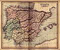
Ancient hispania 1849.jpg 925 × 768; 269 KB
-
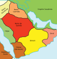
Arabian Peninsula-565-pt.svg 341 × 348; 12 KB
-
Califato de Córdoba - 1000-pt.svg 686 × 594; 322 KB
-
Francia occidentalis pt.svg 1,091 × 1,053; 194 KB
-
Francie-pt.svg 1,416 × 1,262; 50 KB
-
Italy and Illyria 1084 v2 pt.svg 588 × 735; 78 KB
-
Julian's campaign.pt.svg 2,580 × 1,684; 1.41 MB
-
Kingdom of Israel 1020 map-pt.svg 2,168 × 3,300; 67 KB
-
Map of Archaic Ancient Greece (750-490 BC) (Portuguese)v3.svg 994 × 795; 920 KB
-
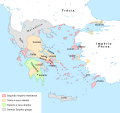
Map of Greece in 362 BCE - pt.svg 2,095 × 1,971; 871 KB
-
Mapa da crescente fértil.png 825 × 1,060; 185 KB
-
Mapa de calor da Toponímia celta na Europa.png 1,011 × 807; 642 KB
-
Mapa Império do Mali pt.png 2,993 × 2,139; 799 KB
-
Pre Islamic Arabia-pt.svg 1,479 × 1,513; 1.49 MB
-
ZiríesYHamadíes-pt.svg 628 × 401; 111 KB


