Category:Portuguese-language SVG maps showing history
Jump to navigation
Jump to search
Subcategories
This category has only the following subcategory.
Media in category "Portuguese-language SVG maps showing history"
The following 102 files are in this category, out of 102 total.
-
100 Years War France 1435-pt.svg 948 × 945; 58 KB
-
14 century BC Eastern-pt.svg 1,001 × 557; 377 KB
-
1stMithritadicwar89BC-pt.svg 1,501 × 1,186; 127 KB
-
6th-century Egypt-pt.svg 1,500 × 950; 3.15 MB
-
6th-century Middle East-pt.svg 1,500 × 950; 3.13 MB
-
Achaemenid Empire-pt.svg 1,500 × 680; 1.93 MB
-
Ancient peloponnese-pt.svg 778 × 800; 312 KB
-
Asia in 1335-pt.svg 1,100 × 837; 1.02 MB
-
Ataque em Haia 1940 pt.svg 600 × 453; 554 KB
-
Attila in Gaul 451CE-pt.svg 1,283 × 981; 170 KB
-
Austria Hungary ethnic-pt.svg 1,360 × 1,052; 911 KB
-
Aztec Empire 1519 map-pt.svg 1,898 × 1,462; 306 KB
-
Baltic Tribes c 1200 pt.svg 988 × 1,088; 278 KB
-
Battaglia dei Campi Catalaunici-pt.svg 840 × 745; 110 KB
-
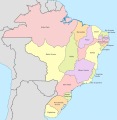
Brazil in 1534.svg 2,008 × 1,985; 1,016 KB
-
Brazil in 1572.svg 2,008 × 1,985; 913 KB
-
Brazil in 1709.svg 2,008 × 1,985; 1.18 MB
-
Brazil in 1750.svg 2,008 × 1,985; 1.29 MB
-
Brazil in 1817.svg 2,008 × 1,985; 1.37 MB
-
Brazil in 1822.svg 2,008 × 2,065; 1.45 MB
-
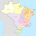
Brazil in 1889.svg 2,008 × 1,986; 1.43 MB
-
Brazil in 1943.svg 2,008 × 1,987; 1.5 MB
-
Brazil Provinces 1889.svg 2,008 × 1,984; 1.13 MB
-
BritishMandatePalestine1920-pt.svg 675 × 542; 19 KB
-
Byzantine beacon system-pt.svg 743 × 452; 265 KB
-
Caesar campaigns gaul-pt.svg 751 × 777; 73 KB
-
Campanha da Batalha de Ain Jalut 1260.svg 432 × 572; 68 KB
-
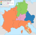
Carolingian empire 863-pt.svg 1,091 × 1,053; 149 KB
-
Carolingian empire 870-pt.svg 1,091 × 1,053; 143 KB
-
Carolingian empire 876-pt.svg 1,091 × 1,053; 148 KB
-
Chagatai Khanate map pt.svg 811 × 646; 243 KB
-
Cilicia-pt.svg 575 × 390; 3.15 MB
-
Cilician-Kingdom-pt.svg 1,500 × 950; 3.13 MB
-
Cimbrians and Teutons invasions-pt.svg 2,571 × 2,186; 91 KB
-
Countries of Europe-pt2.svg 2,457 × 2,049; 1.73 MB
-
Crusade of 1101 v1 pt.svg 1,039 × 726; 82 KB
-
Cyrus cylinder Mesopotamia-pt.svg 637 × 557; 84 KB
-
Cyrus' Empire-pt.svg 1,500 × 950; 490 KB
-
Czechoslovakia 1930 linguistic map - pt.svg 1,265 × 769; 630 KB
-
First Czechoslovak Republic pt.svg 1,001 × 472; 73 KB
-
DesmembramientoDelIljanato1337–1432-pt.svg 959 × 663; 156 KB
-
Dominios de Felipe II-pt.svg 927 × 573; 377 KB
-
Europa 1815-pt.svg 1,340 × 1,363; 559 KB
-
Europa en 1470 (SO)-pt.svg 306 × 291; 53 KB
-
European-middle-neolithic-pt.svg 1,111 × 953; 432 KB
-
Formative Era sites PT.svg 613 × 459; 61 KB
-
Frankish Empire 481 to 814-pt.svg 1,735 × 1,227; 314 KB
-
Genghis Khan empire-pt.svg 1,017 × 658; 89 KB
-
Genghis Khan empire-switch.svg 512 × 331; 275 KB
-
Golden Horde 1389-pt.svg 962 × 684; 155 KB
-
Hammurabi's Babylonia pt.svg 717 × 668; 88 KB
-
Hinduism Expansion in Asia-pt.svg 512 × 382; 826 KB
-
Iljanato1256-1353-pt.svg 982 × 685; 147 KB
-
Império Cuchana.svg 1,035 × 1,046; 495 KB
-
IndoScythianKingdom-pt.svg 970 × 981; 1.5 MB
-
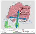
Isfahan-charbagh.svg 760 × 720; 97 KB
-
Karesi Beyliği haritası-pt.svg 1,209 × 1,196; 354 KB
-
Kingdom of Sicily 1154-pt.svg 712 × 807; 132 KB
-
Lazica in Late Antiquity-pt.svg 1,038 × 935; 1.91 MB
-
Lazica-pt.svg 770 × 520; 3.73 MB
-
Magalhães Elcano Circum-navegação-pt.svg 749 × 380; 112 KB
-
Magna Graecia ancient colonies and dialects-pt.svg 440 × 414; 121 KB
-
Majapahit Empire-pt.svg 512 × 297; 613 KB
-
Map Anatolia ancient regions-pt.svg 921 × 596; 278 KB
-
Map Crusader states 1102-pt.svg 591 × 690; 42 KB
-
Map Crusader states 1135-pt.svg 974 × 1,323; 119 KB
-
Map Crusader states 1165-pt.svg 955 × 1,315; 117 KB
-
Map Crusader states 1190-pt.svg 978 × 1,330; 91 KB
-
Map Crusader states 1240-pt.svg 507 × 690; 38 KB
-
Map Hittite rule pt.svg 1,890 × 1,194; 401 KB
-
Map Iberian Peninsula 1037-pt.svg 512 × 355; 101 KB
-
Map Macedonia 336 BC-pt.svg 992 × 794; 3.39 MB
-
Map of ancient Epirus and environs (Português).svg 1,303 × 1,500; 379 KB
-
Map of Ancient Rome 271 AD-pt.svg 2,050 × 1,213; 208 KB
-
Map of Assyria-pt.svg 2,145 × 1,474; 80 KB
-
Map of Lydia ancient times-pt.svg 400 × 277; 46 KB
-
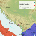
Map of the Kingdom of Agron of the Ardiaei (Portuguese).svg 1,600 × 1,600; 6.46 MB
-
Median Empire-pt.svg 1,500 × 950; 3.13 MB
-
Mongol raids in Syria and Palestine 1260-pt.svg 657 × 901; 173 KB
-
Mongol raids into Syria and Palestine ca 1300-pt.svg 657 × 901; 167 KB
-
Norman conquest 1066-pt.svg 851 × 769; 1.47 MB
-
Oriente Medio 600 adC-pt.svg 1,249 × 693; 234 KB
-
Otomano europa pt.svg 2,433 × 2,000; 703 KB
-
Peloponnese Middle Ages map-pt.svg 1,785 × 1,398; 1.16 MB
-
Principado de Quieve-pt.svg 1,400 × 1,382; 3.21 MB
-
Prussian clans 13th century-pt.svg 1,790 × 1,260; 185 KB
-
Reame di Siagrio (486) pt.svg 1,436 × 1,344; 112 KB
-
Reino de los visigodos-pt.svg 649 × 663; 18 KB
-
RepúblicaSoviéticaHúngara1919 pt.svg 652 × 516; 68 KB
-
Roman East 50-pt.svg 2,717 × 1,595; 851 KB
-
Roman Empire 460 CE-pt.svg 1,220 × 1,385; 2.5 MB
-
Roman Empire 600 ce-pt.svg 1,853 × 1,032; 218 KB
-
Safavid map ak.svg 1,052 × 732; 253 KB
-
Seljuk Empire locator map-pt.svg 1,024 × 627; 161 KB
-
Seljuk Sultanate of Rum 1190 Locator Map-pt.svg 1,440 × 750; 103 KB
-
The-Decapolis-map-pt.svg 519 × 749; 103 KB
-
TratadoDeSevres1920-pt.svg 1,273 × 764; 428 KB
-
Urartu 715 713-pt.svg 2,714 × 1,740; 878 KB
-
Viking Expansion-pt.svg 793 × 521; 869 KB
-
Visigothic Kingdom 586-711 pt.svg 1,246 × 975; 401 KB
-
WestAfrica1625-pt.svg 606 × 397; 637 KB
-
World War II in Europe, 1942-pt.svg 519 × 488; 676 KB


