Category:Population density maps of Turkey
Jump to navigation
Jump to search
Media in category "Population density maps of Turkey"
The following 11 files are in this category, out of 11 total.
-
-
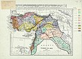
 Density of Population - excluding unliviable areas-1927.png 853 × 548; 742 KB
-
 Density of Population-Turkey-1927.png 835 × 586; 769 KB
-
 Istanbul 2023 population density map by neighborhood.svg 1,009 × 529; 2.78 MB
-
 Istanbul 2023 population map by neighborhood.svg 1,077 × 427; 2.8 MB
-
 Izmir 2023 population density map by neighborhood.svg 904 × 620; 4.19 MB
-
 Izmir 2023 population map by neighborhood.svg 904 × 620; 4.3 MB
-
 Population density of Turkey provinces.png 6,492 × 2,576; 1.11 MB
-
 Turkey population density by province 2014.png 1,200 × 515; 149 KB
-
 Turkey Population Density, 2000 (5457626906).jpg 2,503 × 3,264; 684 KB
-
 Turkey Population Density, 2000 (6171920879).jpg 2,397 × 3,160; 806 KB


.jpg)
.jpg)