Category:Population density maps of Europe
Jump to navigation
Jump to search
Subcategories
This category has the following 41 subcategories, out of 41 total.
B
C
F
G
I
L
N
P
R
S
T
U
Media in category "Population density maps of Europe"
The following 76 files are in this category, out of 76 total.
-
Gęstość zaludnienia Europy 1820 rok.png 893 × 719; 60 KB
-
WALLACE(1877) p1.022 Russia, Population Density.jpg 3,576 × 4,580; 3.92 MB
-
Europe and other continents (1901) (14577213967).jpg 2,400 × 1,828; 835 KB
-
Folkmängdstäthet i Europa, Nordisk familjebok.jpg 2,476 × 1,628; 854 KB
-
Map of Density of Population of Europe, 1923.jpg 1,878 × 1,491; 329 KB
-
Lange diercke sachsen europa dichte der bevoelkerung.jpg 1,253 × 1,584; 846 KB
-
Choropleth map.jpg 700 × 800; 228 KB
-
Population density Europe.png 800 × 450; 143 KB
-
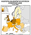
Population density european union.png 1,046 × 842; 101 KB
-
EU NUTS 2 population density 2007 Diagonal continental.svg 451 × 451; 2.32 MB
-
EU NUTS 2 population density 2007.svg 850 × 600; 2.09 MB
-
Density of Population in EU 2014-it.svg 609 × 600; 2.15 MB
-
Density of Population in EU 2014.svg 609 × 600; 2.15 MB
-
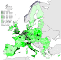
Population density by NUTS 3 region (2017).svg 950 × 830; 9.06 MB
-
62 of 'China in Transformation ... With ... maps and diagrams' (11245514394).jpg 1,430 × 1,665; 648 KB
-
Andorra Population Density, 2000 (5457616860).jpg 2,502 × 3,265; 557 KB
-
Andorra Population Density, 2000 (6171902441).jpg 2,335 × 3,161; 547 KB
-
Armenia Population Density, 2000 (5457617066).jpg 2,507 × 3,264; 624 KB
-
Armenia Population Density, 2000 (6171902839).jpg 2,366 × 3,160; 598 KB
-
Azerbaijan Population Density, 2000 (5457617338).jpg 2,550 × 3,260; 646 KB
-
Azerbaijan Population Density, 2000 (6171903391).jpg 2,367 × 3,160; 704 KB
-
Bevölkerungsdichte in Timisoara 2009.jpg 2,075 × 2,075; 1,004 KB
-
Bosnia and Herzegovina Population Density, 2000 (6171904141).jpg 2,396 × 3,161; 603 KB
-
Cities in Europe Central.png 1,344 × 743; 65 KB
-
Cities in Europe North.png 1,344 × 743; 60 KB
-
Cities in Europe South.png 1,344 × 743; 56 KB
-
Cities in Europe West.png 1,344 × 743; 62 KB
-
Cities in UK and France.png 1,344 × 743; 60 KB
-
Densitatea Populatiei Timisoara 09.jpg 2,075 × 2,075; 1 MB
-
Dutch provinces as European countries by population.jpg 6,273 × 4,230; 983 KB
-
Europe Population Density (5485513071).jpg 2,386 × 3,174; 908 KB
-
Europe Population Density, 2000 (5457012599).jpg 2,550 × 3,236; 1.05 MB
-
Europe Population Density, 2000 (6172437200).jpg 2,399 × 3,160; 865 KB
-
European countries by population density per sq km.jpg 4,095 × 2,850; 1.43 MB
-
Faeroe Islands Population Density, 2000 (5457012847).jpg 2,502 × 3,265; 554 KB
-
Faeroe Islands Population Density, 2000 (6172437706).jpg 2,324 × 3,161; 561 KB
-
Image taken from page 221 of '(Handbook of Commercial Geography.)' (11219807733).jpg 2,595 × 2,047; 1.27 MB
-
Image taken from page 221 of '(Handbook of Commercial Geography.)' (16403882279).jpg 2,418 × 1,811; 777 KB
-
Image taken from page 221 of 'Handbook of Commercial Geography' (11199685875).jpg 3,239 × 2,465; 1.54 MB
-
Image taken from page 221 of 'Handbook of Commercial Geography' (16403089510).jpg 2,408 × 1,805; 826 KB
-
Image taken from page 26 of '(Longmans' Junior School Geography, etc.)' (11208277363).jpg 2,704 × 2,001; 1.23 MB
-
Liechtenstein Population Density, 2000 (5457015371).jpg 2,513 × 3,194; 600 KB
-
Liechtenstein Population Density, 2000 (6171912443).jpg 2,324 × 3,161; 554 KB
-
Malta Population Density, 2000 (5457623212).jpg 2,525 × 3,249; 597 KB
-
Malta Population Density, 2000 (6171913687).jpg 2,324 × 3,161; 528 KB
-
Monaco Population Density, 2000 (5457015705).jpg 2,491 × 3,194; 543 KB
-
Monaco Population Density, 2000 (6172442518).jpg 2,324 × 3,161; 527 KB
-
Municipalities of Scandinavia.jpg 2,532 × 1,500; 320 KB
-
Population Density 1990, Europe (7242989466).jpg 2,383 × 3,153; 1.18 MB
-
Population Density 2000, Europe (7242991370).jpg 2,383 × 3,153; 1.19 MB
-
Population Density 2010, Europe (7242992932).jpg 2,383 × 3,153; 1.19 MB
-
Population density in Athens.jpg 1,180 × 612; 190 KB
-
Population density in Central Europe.png 2,500 × 1,820; 1.01 MB
-
Population density in Vrilissia 2.jpg 780 × 612; 140 KB
-
Population density in Vrilissia 3.jpg 1,384 × 612; 225 KB
-
Population density in Vrilissia.jpg 780 × 612; 141 KB
-
Population density of Armenia provinces.png 5,424 × 4,432; 660 KB
-
Population density of Azerbaijan districts.png 4,345 × 3,326; 841 KB
-
Population density of Bosnia and Herzegovina subdivisions.png 6,258 × 5,924; 1.1 MB
-
Population density of Georgia regions.png 4,870 × 2,305; 429 KB
-
Population density of Kosovo districts.png 3,594 × 3,536; 362 KB
-
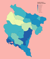
Population density of Montenegro municipalities.png 3,708 × 4,367; 638 KB
-
Population Density Pristina 2011.jpg 1,240 × 1,754; 260 KB
-
Population Density Timisoara 2009.jpg 2,075 × 2,075; 1,020 KB
-
San Marino Population Density, 2000 (6172447880).jpg 2,387 × 3,161; 588 KB
-
Subdivisions of the Russian Empire by urban population (1897).svg 1,162 × 686; 438 KB
-
Svalbard Population Density, 2000 (5457018585).jpg 2,502 × 3,261; 612 KB
-
Svalvard Islands Population Density, 2000 (5457626248).jpg 2,502 × 3,265; 638 KB
-
The early days of Christianity (1922) (14579317958).jpg 2,608 × 1,944; 470 KB


