Category:Population density maps of South Korea
Jump to navigation
Jump to search
Media in category "Population density maps of South Korea"
The following 10 files are in this category, out of 10 total.
-
 Cities in Asia East.png 1,344 × 743; 55 KB
-
 Korea Population Density, 2000 (5457622254).jpg 2,495 × 3,194; 663 KB
-
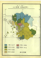 Population density of Gyeonggi-do (1940).png 2,196 × 3,106; 8.4 MB
-
 Population density of Gyeonggi-do (1949).png 2,197 × 3,107; 7.16 MB
-
 Population density of Gyeonggi-do per 1km2 farmland(1940).png 2,197 × 3,107; 7.48 MB
-
 Population density of South Korea provinces.png 3,700 × 3,597; 628 KB
-
 Population growth of Gyeonggi-do (1925-1930).png 2,197 × 3,107; 176 KB
-
 Population growth of Gyeonggi-do (1930-1935).png 2,197 × 3,107; 176 KB
-
 Population growth of Gyeonggi-do (1935-1940).png 2,197 × 3,107; 169 KB
-
 South Korea Population Density, 2000 (6171912037).jpg 2,392 × 3,160; 768 KB

.jpg)
.png)
.png)
.png)

.png)
.png)
.png)
.jpg)