Category:Plans of castles in France
Jump to navigation
Jump to search
Subcategories
This category has the following 23 subcategories, out of 23 total.
*
A
- Plans of Château d'Angers (5 F)
B
- Plans of the Château de Bellevue (11 F)
C
- Plans of Château de Chambord (6 F)
- Plans of château de Coucy (8 F)
L
- Plans of the medieval Louvre (17 F)
M
- Plans of the Château de Meudon (24 F)
P
- Plans of Palais des Papes (5 F)
V
Media in category "Plans of castles in France"
The following 154 files are in this category, out of 154 total.
-

-
 139 of 'Élincourt-Sainte-Marguerite. Notice historique et archéologique' (11197114766).jpg 4,655 × 2,740; 2.09 MB
-
 168 of 'Villeneuve-Loubet et ses seigneurs. (Illustrated.)' (11218730865).jpg 2,184 × 2,665; 609 KB
-
 169 of 'Villeneuve-Loubet et ses seigneurs. (Illustrated.)' (11215523213).jpg 2,242 × 2,637; 633 KB
-

-
 198 of 'The Historical Monuments of France' (11089971335).jpg 1,492 × 628; 159 KB
-

-

-
 235 of 'Châtel-sur-Moselle avant la Révolution ... Illustrations, etc' (11292320166).jpg 1,282 × 1,697; 464 KB
-

-
 Ancien château (Montereau-Fault-Yonne) - Plan (11091045555).jpg 1,609 × 1,162; 479 KB
-
 Ancien château de Vassy-sous-Pisy - Plan (11057922884).jpg 527 × 672; 56 KB
-
 Ancy-le-FrancGrundriss1576-79.jpg 2,755 × 1,355; 1.47 MB
-
 Ancylefranc.jpg 1,181 × 818; 224 KB
-
 Plan du château d'Andlau.jpg 4,000 × 3,000; 3.49 MB
-
 Bastiments v1 (Gregg 1972 p29) - Vincennes general plan.jpg 6,485 × 4,488; 4.92 MB
-
 Bastiments v1 (Gregg 1972 p36) - Madrid plan.jpg 6,436 × 2,710; 3.16 MB
-
 Bastiments v1 (Gregg 1972 p42) - Creil plan.jpg 6,529 × 2,982; 5.59 MB
-
 Bastiments v1 (Gregg 1972 p48) - Folembray plan.jpg 6,514 × 3,668; 3.28 MB
-
 Bastiments v1 (Gregg 1972 p55) - Montargis plan.jpg 4,465 × 4,275; 2.64 MB
-
 Bastiments v1 (Gregg 1972 p56) - St-Germain-en-Laye plan.jpg 5,247 × 3,111; 2.37 MB
-
 Bastiments v1 (Gregg 1972 p57) - St-Germain-en-Laye general plan.jpg 6,472 × 4,024; 6.83 MB
-

-
 Bastiments v1 (Gregg 1972 p66) - Vallery general plan.jpg 6,162 × 4,157; 5.08 MB
-
 Bastiments v1 (Gregg 1972 p70) - Verneuil plan first design.jpg 4,001 × 3,869; 2.76 MB
-
 Bastiments v1 (Gregg 1972 p71) - Verneuil plan second design.jpg 4,337 × 6,205; 4.33 MB
-
 Bastiments v1 (Gregg 1972 p72) - Verneuil general plan with first design.jpg 6,446 × 4,117; 6.36 MB
-
 Bastiments v1 (Gregg 1972 p79) - Ancy-le-Franc plan of the cellar.jpg 4,288 × 4,369; 5.48 MB
-
 Bastiments v1 (Gregg 1972 p80) - Ancy-le-Franc general plan.jpg 6,423 × 3,047; 3.5 MB
-
 BloisPiantaMedioevo.jpg 1,000 × 909; 182 KB
-
 Burg Petit Marzac.jpg 3,230 × 2,153; 837 KB
-
 Carte.chateau.La.Roche.Guyon.png 639 × 648; 165 KB
-
 Chambois.png 4,226 × 3,345; 17.71 MB
-
 ChamboisChateau.png 1,481 × 1,213; 664 KB
-
 ChamboisDonjo.png 2,040 × 3,624; 4.57 MB
-
 Chateau de Dampierre BM Troyes.jpg 2,444 × 1,568; 3.09 MB
-
 Chateau de Dourdan.svg 1,417 × 1,417; 16 KB
-
 Chateau de Gaillon Le Rouge 1750.jpg 3,860 × 2,728; 6.01 MB
-
 Chateau de Maison-Ponthieu Plan.jpg 3,838 × 4,461; 4.73 MB
-
 Chateau de Montceaux Plan.jpg 2,544 × 1,960; 3.51 MB
-
 Chateau de Saint-Moré (Plan, 1870) (11058177145).jpg 768 × 752; 156 KB
-
 Chateau de Tanlay - Grundrisse - Sauvageot.jpg 1,000 × 1,739; 268 KB
-
 Chateau du taureau avant 1689.jpg 698 × 480; 94 KB
-
 Chateau du Taureau plan.jpg 312 × 219; 23 KB
-
 Chateau Estissac 1840.jpg 1,519 × 1,007; 212 KB
-
 Chateau Gaillard.png 1,438 × 710; 55 KB
-
 Chauvigny, Chât. de Gouzon.jpg 2,213 × 3,320; 997 KB
-
 Château de Cisery (11245624974).jpg 848 × 1,291; 299 KB
-

-

-
 Château de Marly-3.jpg 758 × 511; 63 KB
-
 Château de Montaigne - tower - sketch of 2nd floor with library.svg 794 × 638; 64 KB
-

-

-
 Château de Pisy, Yonne - Plan (1870) (11092963696).jpg 1,571 × 1,413; 829 KB
-
 Château de Ragny, Savigny-en-Terre-Plaine, Yonne (11058912415).jpg 781 × 614; 73 KB
-
 Château de Vault-de-Lugny (Plan, 1870) (11059205724).jpg 773 × 894; 233 KB
-
 Château Franquemont.jpg 760 × 362; 114 KB
-
 Châtelet de Villarnoux (11092317485).jpg 1,575 × 1,606; 604 KB
-
 Description du chateau de pierrefonds Figure 01.png 1,185 × 2,028; 63 KB
-
 Château de Druyes, Yonne Workaround.svg 670 × 835; 6 KB
-
 Château de Druyes, Yonne.svg 670 × 835; 23 KB
-
 Détail des plans de la serre et de l'orangerie d'Ettevaux - coupe sur l'orangerie.jpg 2,850 × 3,553; 4.93 MB
-
 Détail du pan de la serre et de l'orangerie d'Ettevaux.jpg 4,624 × 1,996; 4.08 MB
-
 Détail du plan de l'orangerie d'Ettevaux - 1913.jpg 1,626 × 730; 863 KB
-
 Détail du plan de l'orangerie d'Ettevaux - vue en coupe - 1913.jpg 1,627 × 823; 1.03 MB
-

-
 Détail du plan de la serre d'Ettevaux.jpg 2,325 × 4,483; 4.85 MB
-
 Détail du plan de la serre et de l'orangerie d'Ettevaux - façade principale.jpg 3,985 × 1,717; 3.97 MB
-
 Esquisse de l'ancien château de Fitz-James (Oise).jpg 15,694 × 21,069; 322.87 MB
-
 F07 Ch t. Commarque 002.jpg 2,267 × 3,401; 986 KB
-
 Former Castle of Girolles, Yonne (11058592405).jpg 760 × 633; 91 KB
-
 FougeresGrundriss.png 1,682 × 1,246; 66 KB
-
 France Brie-Comte-Robert castle annotated floor plan.svg 779 × 978; 10 KB
-
 France-Guirbaden castle-Plan.svg 950 × 450; 88 KB
-
 Grondplan Palais Rihour.png 1,382 × 1,102; 719 KB
-
 Grundriss Burg Kaysersberg.svg 1,463 × 1,208; 59 KB
-
 Grundriss Schloss Bailleul.jpg 1,273 × 1,320; 237 KB
-
 Grundriss Schloss Cons-la-Grandville.jpg 1,104 × 1,407; 258 KB
-
 GrundrissSchlossBalleroy.png 2,155 × 1,516; 59 KB
-
 GrundrissSchlossBlois.png 3,061 × 2,615; 525 KB
-
 GrundrissSchlossBloisMittelalter.png 1,522 × 1,384; 221 KB
-
 GrundrissSchlossBloisMittelalterFr.png 1,522 × 1,384; 231 KB
-
 GrundrissSchlossLochesGesamt.png 956 × 1,516; 109 KB
-
 Burg Guedelon Plan Karte.png 1,200 × 870; 354 KB
-
 Plan du château de Guédelon.svg 1,020 × 765; 65 KB
-
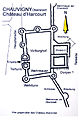 Harcourt.jpg 2,094 × 3,141; 787 KB
-
 Isle de Ré 1749. Plan de la redoute des portes - btv1b71005159 (1 of 2).jpg 6,747 × 5,133; 2.81 MB
-
 Lageplan La Bastie d'Urfé.svg 812 × 601; 1.25 MB
-
 Lageplan Schloss Assier.svg 1,430 × 907; 133 KB
-
 Lageplan Schloss Courances.svg 828 × 857; 74 KB
-
 Lageplan Schloss Montbras.svg 1,272 × 981; 33 KB
-
 Lageplan Schloss Valmer.svg 1,526 × 880; 190 KB
-
 Langoiran plan - Douyn 1862.jpg 637 × 805; 153 KB
-
 LeLudePlan1785.png 2,713 × 2,151; 3.86 MB
-
 LochesGrundrissLogisRoyal.png 1,361 × 788; 67 KB
-
 L’Architecture de la Renaissance - Fig. 46.PNG 630 × 868; 31 KB
-
 L’Architecture de la Renaissance - Fig. 54 (adjusted).jpg 986 × 768; 170 KB
-
 L’Architecture de la Renaissance - Fig. 54.PNG 982 × 762; 50 KB
-
 Map of Puilaurens castle without description.svg 744 × 438; 154 KB
-
 Map of Puilaurens castle.svg 750 × 431; 171 KB
-
 Marly-Bath.jpg 551 × 885; 144 KB
-
 Menou chateau 1825.JPG 1,024 × 724; 97 KB
-
 Bastiments v1 (Gregg 1972 p62) - La Muette plan.jpg 4,370 × 4,600; 4.03 MB
-
 Boissezon (Murat) Plan château.jpg 759 × 681; 73 KB
-
 Plan château de Boissezon (Murat).jpg 3,264 × 2,239; 802 KB
-
 Plan château de Canac (Murat-sur-Vèbre).jpg 366 × 387; 23 KB
-
 NOR 0002-2.jpg 2,223 × 3,128; 1.71 MB
-
 Palais Bourbon Hotel de Lassey Plan 1730.jpg 2,439 × 1,917; 1.92 MB
-
 PiantaBloisPTerra.png 3,061 × 2,615; 531 KB
-
 Plan du château de Pisy.jpg 753 × 654; 132 KB
-
 Plan 1693 Chateau du taureau.jpg 2,815 × 4,205; 7.75 MB
-
 Plan chateau Fere en Tardenois 08510.jpg 2,502 × 2,595; 1.88 MB
-
 Plan château dourdan.gif 277 × 218; 2 KB
-
 Plan csm.png 1,184 × 729; 99 KB
-
 Plan d'Azay-le-rideau.jpg 1,606 × 1,130; 74 KB
-
 Plan du château de Biron.JPG 3,346 × 2,223; 2.03 MB
-
 Plan du château de chatillon.jpg 6,000 × 6,500; 5.24 MB
-
 Plan du château de Guédelon-ru.svg 1,020 × 765; 58 KB
-
 Plan du château de la Rivière à Pontgoin (Photo prise aux A.D. 28).jpg 4,226 × 3,168; 2.96 MB
-
 Plan du château de la Roche (1694).jpg 8,500 × 5,428; 6.44 MB
-
 Plan du château de Latsaga à Ostabat-Asme.jpg 744 × 1,052; 77 KB
-
 Plan du château de Miglos - Barrière-Flavy - 1894.png 1,005 × 1,608; 55 KB
-
 Plan du château de Noyers.jpg 1,632 × 2,516; 1.08 MB
-
 Plan du château de Passy.jpg 431 × 459; 38 KB
-
 Plan du fort-la-Latte.jpg 2,338 × 1,647; 1.06 MB
-
 Plan du rez-de-chaussée du château de Renansart avant 1766.jpg 768 × 1,024; 59 KB
-
 Plan général Château de Sparre.jpg 1,357 × 1,054; 281 KB
-
 Plan of Maubourg Castle (Haute-Loire, France).jpg 2,848 × 2,136; 2.84 MB
-

-
 Plan-Noyers.jpg 686 × 471; 210 KB
-
 Plan.chateau.Arques.png 471 × 762; 151 KB
-
 Plan.chateau.Bonaguil.png 532 × 518; 62 KB
-
 Plan.chateau.Bury.png 666 × 522; 77 KB
-
 Plan.chateau.Chauvigny.png 585 × 615; 57 KB
-
 Plan.chateau.Falaise.2.png 447 × 414; 36 KB
-
 Plan.chateau.La.Roche.Guyon.png 450 × 510; 51 KB
-
 Plan.chateau.Montargis.png 685 × 642; 78 KB
-
 Plan.chateau.Pierrefonds.png 663 × 1,023; 220 KB
-
 Plan.Coucy.png 335 × 403; 34 KB
-
 Plan.donjon.chateau.Vez.png 614 × 746; 108 KB
-
 Plan.donjon.La.Roche.Guyon.png 630 × 765; 133 KB
-
 Plan.tour.Montlhery.png 450 × 600; 81 KB
-
 Plan.tours.Loches.et.Provins.png 663 × 369; 41 KB
-
 Plans of ground floor and second floor of the Chateau Neuf.jpg 2,970 × 1,870; 2.61 MB
-
 Ray-sur-Saône, Plan Bertrand, 1775.jpg 1,536 × 2,141; 1.2 MB
-
 Saint-Jeanvrin Plan du château.png 845 × 1,161; 73 KB
-
 Saint-Thégonnec (29) Château de Penhoat 09.JPG 1,488 × 1,984; 1.67 MB
-
 SainteMere-Chateau.svg 216 × 120; 4 KB
-
 Schloss La Guignardiere Trudaine-Atlas.jpg 428 × 316; 79 KB
-
 SchlossBloismitParkGrundriss.png 2,208 × 1,468; 764 KB
-
 Simiane-la-Rotonde, Grundriss.1.jpg 2,338 × 1,700; 755 KB
-
 Simiane-la-Rotonde, Grundriss.jpg 2,338 × 1,700; 771 KB
-
 Tanlay Lageplan - Sauvageot.jpg 1,713 × 976; 407 KB
.jpg)
.jpg)
%27_(11218730865).jpg)
%27_(11215523213).jpg)
%27_(11294333974).jpg)
.jpg)
%27_(11304013583).jpg)
.jpg)
.jpg)
%27_(11060306965).jpg)
_-_Plan_(11091045555).jpg)
.jpg)


_-_Vincennes_general_plan.jpg)
_-_Madrid_plan.jpg)
_-_Creil_plan.jpg)
_-_Folembray_plan.jpg)
_-_Montargis_plan.jpg)
_-_St-Germain-en-Laye_plan.jpg)
_-_St-Germain-en-Laye_general_plan.jpg)
_-_St-Germain-en-Laye_river_facade_and_partial_plan_of_the_new_chateau.jpg)
_-_Vallery_general_plan.jpg)
_-_Verneuil_plan_first_design.jpg)
_-_Verneuil_plan_second_design.jpg)
_-_Verneuil_general_plan_with_first_design.jpg)
_-_Ancy-le-Franc_plan_of_the_cellar.jpg)
_-_Ancy-le-Franc_general_plan.jpg)


_(11058177145).jpg)


.jpg)
,_plan_et_dessin_Sap01_mh009623_p.jpg)
,_plan_et_dessin_Sap01_mh009624_p.jpg)


_(11092963696).jpg)
.jpg)
_(11059205724).jpg)

.jpg)


.jpg)

.jpg)


.jpg)


.jpg)


_-_La_Muette_plan.jpg)
_Plan_ch%C3%A2teau.jpg)
.jpg)
.jpg)


.jpg)
.jpg)


.jpg)
_(11057993434).jpg)


_Ch%C3%A2teau_de_Penhoat_09.JPG)


