Category:OpenStreetMap maps of the Northern Territory
Jump to navigation
Jump to search
States of Australia: New South Wales · Queensland · South Australia · Tasmania · Victoria · Western Australia
Internal territories of Australia: Northern Territory
External territories of Australia:
Internal territories of Australia: Northern Territory
External territories of Australia:
Media in category "OpenStreetMap maps of the Northern Territory"
The following 7 files are in this category, out of 7 total.
-
Hidden valley station australia.png 681 × 719; 114 KB
-
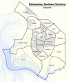
Map of the Suburbs of Palmerston, Northern Territory.png 1,188 × 1,423; 384 KB
-
Map of the Wards and Suburbs of Darwin, Northern Territory.png 3,060 × 3,375; 1.71 MB
-
Map of the Wards and Suburbs of Darwin, Northern Territory.svg 1,469 × 1,620; 1.54 MB
-
OSM-Darwin.png 1,971 × 1,889; 838 KB
-
OSM-Palmerston-NT.png 1,974 × 2,584; 770 KB
-
Surveyor Generals Corner.jpg 748 × 486; 22 KB


