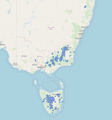
Category:OpenStreetMap maps of Tasmania
Jump to navigation
Jump to search
States of Australia: New South Wales · Queensland · South Australia · Tasmania · Victoria · Western Australia
Internal territories of Australia: Northern Territory
External territories of Australia:
Internal territories of Australia: Northern Territory
External territories of Australia:
Media in category "OpenStreetMap maps of Tasmania"
The following 7 files are in this category, out of 7 total.
-
Coprosma moorei Dist.png 2,080 × 1,194; 171 KB
-
Division of Bass 2016-OSM.png 290 × 290; 10 KB
-
Hobart Tasmania.png 600 × 450; 86 KB
-
Map baeckea.png 808 × 868; 219 KB
-
Pontville Tasmania.png 600 × 450; 99 KB
-
Port Arthur and Hobart map (NationalMap) -- 1830s routes.png 1,544 × 1,368; 1.84 MB
-
Street Map of Longford, Tasmania, Australia.png 754 × 1,175; 66 KB


