Category:OpenStreetMap maps of Zeeland
Jump to navigation
Jump to search
Provinces of the Netherlands: Drenthe · Flevoland · Friesland · Gelderland · Groningen · Limburg · North Brabant · North Holland · Overijssel · South Holland · Utrecht · Zeeland
Media in category "OpenStreetMap maps of Zeeland"
The following 27 files are in this category, out of 27 total.
-
Botshoofd Tholen OSM.jpg 891 × 841; 131 KB
-
Elektriciteitsopwekking Zeeland.jpg 1,718 × 1,396; 436 KB
-
Karte Oosterscheldekering und Neeltje Jans.png 1,900 × 2,470; 1.26 MB
-
Knooppunt Axelsche Gat N61-N62.png 770 × 500; 140 KB
-
Knooppunt N62-N254.png 685 × 486; 152 KB
-
Molenvliet Tholen OSM.jpg 887 × 723; 113 KB
-
NeeltjeJans-natuur-OpenTopo.jpg 2,632 × 3,524; 1.55 MB
-
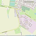
Onder de Molen Oud-Vossemeer Tholen.jpg 777 × 759; 102 KB
-
OSM - provincie Zeeland.PNG 2,405 × 2,307; 708 KB
-
Saeftinghe-natuur-OpenTopo.jpg 4,080 × 2,688; 3.97 MB
-
Steenenkruis Tholen OSM.jpg 986 × 686; 103 KB
-
Tramlijn Breskens - Maldegem.png 1,482 × 1,077; 1.67 MB
-
Tramlijn Breskens - Sluis.png 1,565 × 1,057; 1.27 MB
-
Tramlijn Cadzand - Cadzand Haven.png 1,534 × 1,089; 1.12 MB
-
Tramlijn Drieschouwen - Kloosterzande.png 1,505 × 1,073; 1.32 MB
-
Tramlijn Drieschouwen - Moerbeke.png 1,378 × 949; 1.25 MB
-
Tramlijn Goes - Wemeldinge.png 1,476 × 1,038; 1.41 MB
-
Tramlijn Goes - Wolphaartsdijk.png 1,457 × 1,006; 1.14 MB
-
Tramlijn Hansweert - Vlake.png 1,517 × 1,067; 1.25 MB
-
Tramlijn Hoofdplaat - Breskens.png 1,508 × 1,094; 755 KB
-
Tramlijn Hoofdplaat - Pyramide.png 1,348 × 950; 754 KB
-
Tramlijn Hulst - Walsoorden.png 1,542 × 1,097; 1.24 MB
-
Tramlijn IJzendijke - Drieschouwen.png 1,553 × 1,054; 1.68 MB
-
Tramlijn Koudekerke - Vlissingen.png 1,516 × 1,060; 1.74 MB
-
Tramlijn Vlissingen - Middelburg.png 1,431 × 1,042; 1.75 MB
-
Walcheren-natuur-OpenTopo.jpg 8,520 × 7,464; 21.45 MB
-
Zeeland energy production plus inset.jpg 1,458 × 1,349; 357 KB


