Category:OpenStreetMap maps of Groningen (province)
Jump to navigation
Jump to search
Provinces of the Netherlands: Drenthe · Flevoland · Friesland · Gelderland · Groningen · Limburg · North Brabant · North Holland · Overijssel · South Holland · Utrecht · Zeeland
Subcategories
This category has only the following subcategory.
O
Media in category "OpenStreetMap maps of Groningen (province)"
The following 6 files are in this category, out of 6 total.
-
 Elektriciteitsopwekking Groningen.jpg 1,586 × 1,631; 518 KB
-
 Kaart De Vosholen.png 1,648 × 1,091; 775 KB
-
 Kaart van Ten Post.png 1,289 × 1,132; 248 KB
-
 Rough location Stadsweg.png 926 × 527; 331 KB
-
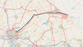
 Spoorlijn Stadskanaal - Ter Apel.png 1,449 × 1,132; 1.29 MB
-
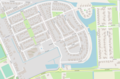
 Streetplan of Grijpskerk.png 781 × 692; 94 KB


