Category:OpenStreetMap maps of North West England
Jump to navigation
Jump to search
Subcategories
This category has the following 5 subcategories, out of 5 total.
C
L
M
O
Media in category "OpenStreetMap maps of North West England"
The following 33 files are in this category, out of 33 total.
-
AccringtonRossendaleBUA2011.png 1,116 × 850; 1,014 KB
-
Ashton Canal Map.png 982 × 1,254; 1.86 MB
-
Bridgewater Canal map.png 1,582 × 1,072; 2.14 MB
-
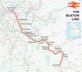
Buxton line.png 1,898 × 1,684; 2.18 MB
-
Calder Valley line.png 3,007 × 1,879; 4.55 MB
-
Glossop line.png 2,023 × 1,202; 2.37 MB
-
Hope Valley Line map.png 1,229 × 584; 791 KB
-
HS3-2017-map.png 2,157 × 1,440; 3.51 MB
-
Liverpool–Manchester lines.png 2,501 × 1,575; 3.39 MB
-
Location map Borough of Copeland.svg 1,044 × 1,346; 2.08 MB
-
Location map Manchester.jpg 2,043 × 1,931; 1.31 MB
-
Location map United Kingdom Allerdale.svg 1,015 × 1,345; 2.97 MB
-
Location map United Kingdom Borough of Barrow-in-Furness.svg 833 × 1,345; 1.96 MB
-
Location map United Kingdom Carlisle Central.png 2,048 × 1,946; 1.37 MB
-
Location map United Kingdom City of Carlisle.svg 1,252 × 1,346; 2.7 MB
-
Location map United Kingdom Eden.svg 1,425 × 1,303; 4.78 MB
-
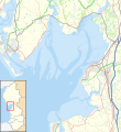
Location map United Kingdom Morecambe Bay.svg 823 × 899; 6.46 MB
-
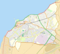
Location map United Kingdom Morecambe.svg 944 × 846; 1.22 MB
-
Location map United Kingdom South Lakeland.svg 1,425 × 1,174; 7.19 MB
-
Location relief and transport map Borough of Copeland.svg 1,044 × 1,346; 1.39 MB
-
Location relief and transport map United Kingdom Allerdale.svg 1,015 × 1,345; 1.85 MB
-
Location relief and transport map United Kingdom City of Carlisle.svg 1,252 × 1,346; 1.67 MB
-
Location relief and transport map United Kingdom Eden.svg 1,425 × 1,303; 3.29 MB
-
Location relief and transport map United Kingdom South Lakeland.svg 1,425 × 1,174; 4.2 MB
-
Map of rail routes between Liverpool and Manchester in 1960.svg 702 × 318; 1.33 MB
-
Moston Brook OpenStreetMap.png 2,017 × 1,292; 1.67 MB
-
North West Green Belt.svg 2,332 × 2,758; 8.22 MB
-
River Eden map.png 2,003 × 2,363; 18.1 MB
-
Stafford–Manchester line.png 1,546 × 1,868; 2.31 MB
-
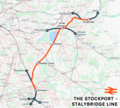
Stockport to Stalybridge Line map.png 4,942 × 4,435; 11.49 MB
-
Threlkeld Quarry and Mining Museum.png 502 × 586; 83 KB
-
WiganBUA.png 1,618 × 850; 1.82 MB
-
Woodhead line.png 2,994 × 1,739; 4.07 MB


