Category:OpenStreetMap maps of England
Jump to navigation
Jump to search

It has been suggested that the OpenStreetMap maps are sorted into sub-categories of the nine regions of England, where they can then be further sub-divided by counties etc. as needed.
Subcategories
This category has the following 9 subcategories, out of 9 total.
E
L
N
O
S
Y
Media in category "OpenStreetMap maps of England"
The following 43 files are in this category, out of 43 total.
-
A59 route.png 900 × 620; 495 KB
-
Bexhill Hastings.png 903 × 561; 471 KB
-
Blackthorn map.png 640 × 660; 89 KB
-
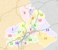
Borough of Burnley parishes map.svg 1,425 × 1,223; 1.72 MB
-
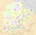
Borough of Chorley parishes map.svg 1,425 × 1,212; 3.32 MB
-
Borough of Fylde parishes map.svg 1,425 × 1,176; 2.4 MB
-
Borough of Hyndburn parishes map.svg 1,319 × 1,305; 1.97 MB
-
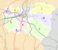
Borough of Pendle parishes map.svg 1,425 × 1,214; 1.63 MB
-
Borough of Ribble Valley parishes map.svg 1,327 × 1,305; 5 MB
-
Borough of Rossendale parishes map.svg 1,385 × 1,306; 2.46 MB
-
Borough of South Ribble parishes map.svg 1,425 × 1,038; 3.62 MB
-
Borough of Wyre parishes map.svg 1,425 × 981; 2.98 MB
-
Bowling map 2014.jpg 880 × 902; 641 KB
-
Bure Valley Railway (OpenStreetMap 1966414).jpg 564 × 455; 172 KB
-
C2c.png 1,391 × 782; 1.05 MB
-
ClevelandWay.png 555 × 354; 173 KB
-
Copdock roundabout.png 1,024 × 768; 441 KB
-
Debatable Map.png 1,718 × 1,451; 3.47 MB
-
Docks byways.001.png 1,024 × 768; 516 KB
-
Howgill Fells map.png 1,194 × 972; 1.9 MB
-
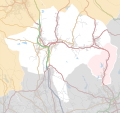
HS2 north ext Y.png 235 × 273; 63 KB
-
Lincoln's Inn Fields Map.jpeg 947 × 808; 170 KB
-
Little Venice overlay.svg 768 × 348; 592 KB
-
Location of clifton ings, York, UK.png 1,244 × 474; 444 KB
-
MediaCityUK Openstreetmap.png 1,728 × 763; 410 KB
-
Medlock.png 447 × 380; 250 KB
-
Newport map.png 909 × 1,004; 293 KB
-
Night Riviera Train Map.svg 1,600 × 699; 837 KB
-
Oxford map small.png 360 × 370; 156 KB
-
Penshaw Monument map.png 1,312 × 1,680; 398 KB
-
Position map of Rochdale Canal.png 844 × 837; 1.05 MB
-
Rackheath transport.jpg 1,014 × 688; 216 KB
-
Raf-wroughton-the-grand-tour-eboladrome-test-track-20161123.svg 861 × 374; 2.68 MB
-
River Ure overview map.png 1,440 × 812; 1.07 MB
-
Ruddington Parish.jpg 954 × 987; 584 KB
-
RushmereCommonCycling.PNG 993 × 615; 310 KB
-
Location map United Kingdom Borough of South Ribble.svg 1,425 × 1,038; 11.51 MB
-
Tadcaster transport links, 2015.png 800 × 733; 658 KB
-
Thames valley.png 1,006 × 486; 537 KB
-
Torry Hill Miniature Railway on OpenStreetMap.png 1,373 × 757; 265 KB
-
Upper Swaledale Kisdon.png 1,114 × 844; 1.09 MB


