Category:OpenStreetMap maps of Minsk
Jump to navigation
Jump to search
Media in category "OpenStreetMap maps of Minsk"
The following 17 files are in this category, out of 17 total.
-
Bangalor square, Minsk.svg 1,186 × 1,180; 341 KB
-
Dombrovka, Minsk.svg 710 × 441; 561 KB
-
Independence square, Minsk.svg 1,194 × 1,063; 717 KB
-
Map (4).svg 1,473 × 1,314; 2.37 MB
-
Map Minsk Center.svg 533 × 443; 2.4 MB
-
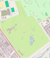
Map of Botanical garden, Minsk.svg 1,265 × 1,451; 1.06 MB
-
Minsk location map.svg 1,110 × 788; 5.83 MB
-
Minsk location map2.png 1,414 × 904; 321 KB
-
Minsk location maps.png 1,152 × 777; 1.05 MB
-
Minsk map3.png 4,278 × 1,829; 3.69 MB
-
Minsk trolley system 2014.gif 800 × 635; 4.71 MB
-
Minsk.png 914 × 739; 611 KB
-
Minskcentre osm be.png 790 × 683; 439 KB
-
State flag square, Minsk.svg 1,261 × 943; 271 KB
-
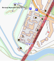
Trajeckaje pradmiescie.svg 542 × 611; 1.31 MB
-
Trinity Hill map (mini).png 916 × 1,021; 215 KB
-
Zapad, Minsk.svg 1,488 × 2,105; 3.2 MB


