Category:Maps of Minsk
Jump to navigation
Jump to search
Wikimedia category | |||||
| Upload media | |||||
| Instance of | |||||
|---|---|---|---|---|---|
| Category combines topics | |||||
| Minsk | |||||
capital and largest city of Belarus | |||||
| Instance of | |||||
| Location |
| ||||
| Located in or next to body of water |
| ||||
| Legislative body | |||||
| Executive body |
| ||||
| Official language |
| ||||
| Anthem |
| ||||
| Head of government |
| ||||
| Significant event |
| ||||
| Population |
| ||||
| Area |
| ||||
| Elevation above sea level |
| ||||
| official website | |||||
 | |||||
Subcategories
This category has the following 6 subcategories, out of 6 total.
M
- Maps of districts of Minsk (21 F)
O
- Old maps of Minsk (341 F)
- OpenStreetMap maps of Minsk (17 F)
P
S
- Street maps of Minsk (7 F)
Media in category "Maps of Minsk"
The following 55 files are in this category, out of 55 total.
-
Belarus provinces Minsk city.svg 850 × 725; 78 KB
-
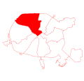
Districts of Minsk.png 1,876 × 800; 120 KB
-
Districts of Minsk.svg 1,052 × 744; 29 KB
-
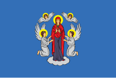
Flag-map of Minsk.svg 1,025 × 440; 321 KB
-
Map of the Minsk Ghetto.jpg 969 × 1,280; 1.28 MB
-
House-Museum of the First Congress of the Russian Social-Democratic Wokers' Party 36.JPG 2,455 × 3,800; 2.77 MB
-
Map of Miensk blank.svg 2,563 × 1,840; 53 KB
-
Minsk 1 Centralny district-2011-05-02.png 1,876 × 800; 117 KB
-
Minsk 1 Centralny district.svg 2,600 × 2,500; 52 KB
-
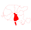
Minsk 2 Sovetsky district-2011-05-02.png 1,876 × 800; 117 KB
-
Minsk 2 Sovetsky district.svg 2,600 × 2,500; 52 KB
-
Minsk 3 Pervomaisky district-2011-05-02.png 1,876 × 800; 117 KB
-
Minsk 3 Pervomaisky district.svg 2,600 × 2,500; 52 KB
-
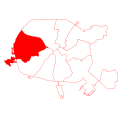
Minsk 4 Partisansky district-2011-05-02.png 1,876 × 800; 117 KB
-
Minsk 4 Partisansky district.svg 2,600 × 2,500; 52 KB
-
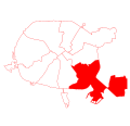
Minsk 5 Zavodskoy district-2011-05-02.png 1,876 × 800; 119 KB
-
Minsk 5 Zavodskoy district.svg 2,600 × 2,500; 52 KB
-
Minsk 6 Lenensky district.svg 2,600 × 2,500; 52 KB
-
Minsk 6 Leninsky district-2011-05-02.png 1,876 × 800; 118 KB
-
Minsk 7 Oktiabrsky district-2011-05-02.png 1,876 × 800; 119 KB
-
Minsk 7 Oktiabrsky district.svg 2,600 × 2,500; 52 KB
-
Minsk 8 Moscowsky district-2011-05-02.png 1,876 × 800; 117 KB
-
Minsk 8 Moscowsky district.svg 2,600 × 2,500; 52 KB
-
Minsk 9 Frunzensky district-2011-05-02.png 1,876 × 800; 118 KB
-
Minsk 9 Frunzensky district.svg 2,600 × 2,500; 52 KB
-
Minsk all districts bordered.svg 2,563 × 1,840; 53 KB
-
Minsk all districts color-2011-05-02.png 1,876 × 800; 201 KB
-
Minsk all districts color.svg 2,563 × 1,840; 67 KB
-
Minsk Belarus street map.svg 5,434 × 3,644; 16.15 MB
-
Minsk in Belarus.svg 1,623 × 1,447; 1.65 MB
-
Minsk metro growth by.gif 1,599 × 1,148; 1.1 MB
-
Minsk metropolitan area.png 735 × 818; 146 KB
-
Minsk National Airport location.png 1,955 × 800; 130 KB
-
Minsk province Minsk.svg 850 × 725; 78 KB
-
Minsk Uruche 01.svg 2,523 × 1,800; 54 KB
-
Minsk Zachad historic division.jpg 710 × 870; 150 KB
-
Minsk, Belarus - panoramio (530).jpg 4,288 × 2,848; 5.56 MB
-
Minsk-pos.jpg 966 × 797; 31 KB
-
Nemiga map.jpg 357 × 483; 61 KB
-
Perespa map.png 373 × 486; 389 KB
-
Plosca Jakuba Kolasa-be.svg 744 × 744; 1.9 MB
-
SH1.jpg 400 × 328; 35 KB
-
USSR map NN 35-8 -verso- Minsk, U.S.S.R.jpg 2,967 × 2,866; 2.44 MB
-
Генплан Мінска. 1965.jpg 625 × 550; 120 KB
-
Генплан Мінска. 1985.jpg 550 × 550; 99 KB
-
Генплан Мінска. 2010.jpg 738 × 550; 124 KB
-
Генплан Мінска. 2016.jpg 800 × 545; 114 KB
-
Карта з Мінскай мячэццю.jpg 600 × 315; 224 KB
-
Карта районов Минска.jpg 1,379 × 950; 684 KB
-
Минск Грушевка.jpg 854 × 604; 190 KB
-
Минск Микрорайон Грушевка.png 854 × 604; 123 KB
-
План Цэнтральнага батанічнага саду НАНБ.svg 1,128 × 1,370; 222 KB
-
Шабаны.png 2,100 × 2,736; 590 KB
-
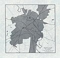
Эскіз планіроўкі Мінска. 1944.jpg 599 × 700; 104 KB
-
Яўрэйскія могілкі Мінска на карце 1873 г.jpeg 2,592 × 1,944; 1.08 MB
