Category:Old maps of St. Joseph County, Indiana
Jump to navigation
Jump to search
Subcategories
This category has the following 4 subcategories, out of 4 total.
S
Media in category "Old maps of St. Joseph County, Indiana"
The following 27 files are in this category, out of 27 total.
-
 Map of St. Joseph Co., Indiana LOC 2013593163.jpg 20,588 × 16,158; 48.69 MB
-
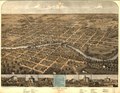
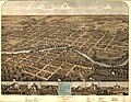 South Bend, Indiana 1866. LOC 73693388.jpg 8,816 × 6,848; 11.85 MB
-
 South Bend, Indiana 1866. LOC 73693388.tif 8,816 × 6,848; 172.73 MB
-
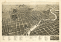
 South Bend, Indiana 1874. LOC 73693389.jpg 8,192 × 6,704; 9.81 MB
-
 St-Joseph.jpg 368 × 315; 59 KB
-
 South-Bend-1890.gif 3,176 × 2,176; 4.66 MB
-
 South Bend, Ind. 1890. LOC 75693227.tif 12,704 × 8,704; 316.36 MB
-

-

-

-

-

-

-

-

-

-

-

-

-

-

-

-

-

-

-

-
 South Bend, Ind. 1890. LOC 75693227.jpg 12,704 × 8,704; 21.7 MB


.jpg)
.jpg)
.jpg)
.jpg)
.jpg)
.jpg)
.jpg)
.jpg)
.jpg)
.jpg)
.jpg)
.jpg)
.jpg)
.jpg)
_-_St._Joseph_County_-_Mishawaka_-_ED_71-38_to_75_-_NARA_-_12059896.jpg)
_-_St._Joseph_County_-_South_Bend_-_ED_99-1_to_183_-_NARA_-_12059898.jpg)
_-_St._Joseph_County_-_South_Bend_Vicinity_-_ED_71-1_to_3,_71-8_to_21,_71-81,_71-85_to_93_-_NARA_-_12059901_(page_1).jpg)
_-_St._Joseph_County_-_South_Bend_Vicinity_-_ED_71-1_to_3,_71-8_to_21,_71-81,_71-85_to_93_-_NARA_-_12059901_(page_2).jpg)
_-_St._Joseph_County_-_St._Joseph_County_-_ED_71-1_to_99_-_NARA_-_12059903.jpg)
