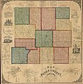
Category:Old maps of Henry County, Indiana
Jump to navigation
Jump to search
Subcategories
This category has the following 4 subcategories, out of 4 total.
Media in category "Old maps of Henry County, Indiana"
The following 11 files are in this category, out of 11 total.
-
Map of Henry County, Indiana LOC 2013593186.jpg 13,095 × 13,183; 29.73 MB
-
Map of Henry County, Indiana LOC 2013593186.tif 13,095 × 13,183; 493.9 MB
-
New Castle, Indiana (2673829485).jpg 2,000 × 1,569; 2.8 MB
-
Soil map of Henry County. - DPLA - fda98ba9be689f6cbccfd53fd1bb8af1.jpg 3,407 × 3,413; 1.4 MB


