Category:Old maps of Bonaire
Jump to navigation
Jump to search
Media in category "Old maps of Bonaire"
The following 20 files are in this category, out of 20 total.
-
Admiralty Chart No 1966 Tortuga to Cabo le Vela, Published 1960.jpg 16,371 × 11,354; 34.5 MB
-
AMH-8033-KB Map of the northern part of South America.jpg 2,400 × 1,701; 874 KB
-
Bonaire - Encyclopaedie van Nederlandsch West-Indië-Antilles part 1, left.gif 1,968 × 2,419; 2.37 MB
-
Bonaire map 1915 (general view).jpg 4,368 × 5,360; 15.12 MB
-
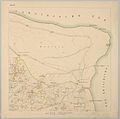
Bonaire map 1915 sheet 1 B.jpg 1,472 × 1,456; 920 KB
-
Bonaire map 1915 sheet 1.jpg 1,500 × 1,483; 244 KB
-
Bonaire map 1915 sheet 10.jpg 1,500 × 1,492; 214 KB
-
Bonaire map 1915 sheet 11.jpg 1,500 × 1,492; 264 KB
-
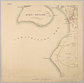
Bonaire map 1915 sheet 2.jpg 1,500 × 1,495; 187 KB
-
Bonaire map 1915 sheet 3.jpg 1,500 × 1,494; 446 KB
-
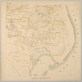
Bonaire map 1915 sheet 4.jpg 1,500 × 1,494; 230 KB
-
Bonaire map 1915 sheet 5.jpg 1,500 × 1,491; 247 KB
-
Bonaire map 1915 sheet 6.jpg 1,500 × 1,496; 357 KB
-
Bonaire map 1915 sheet 7.jpg 1,500 × 1,487; 366 KB
-
Bonaire map 1915 sheet 8.jpg 1,500 × 1,490; 271 KB
-
Bonaire map 1915 sheet 9.jpg 1,500 × 1,497; 392 KB
-
South American States. New Granada & Venezuela. (IA bp 33154).pdf 3,327 × 2,752; 2.81 MB
-
Encyclopaedie van Nederlandsch West-Indië-Antilles part 1+2.gif 4,032 × 5,430; 9.37 MB
-
Encyclopaedie van Nederlandsch West-Indië-Antilles part 1-Benj004ency01ill04.gif 4,035 × 3,400; 6.53 MB


