
Category:Oklahoma State Highway 82
 | number: | (eighty-two) |
|---|---|---|
| State highways in Oklahoma: | 63 · 65 · 66 · 71 · 72 · 73 · 74 · 76 · 78 · 82 · 87 · 91 · 95 · 99 · 100 · 101 · 102 |
state highway in Oklahoma, United States, with two disconnected sections   | |||||
| Upload media | |||||
| Instance of | |||||
|---|---|---|---|---|---|
| Location | |||||
| Transport network | |||||
| Owned by | |||||
| Maintained by | |||||
| Length |
| ||||
| Terminus |
| ||||
| |||||
English: Media related to Oklahoma State Highway 82, a 142.4-mile (229.2 km) state highway in Oklahoma, United States, that has two disconnected sections. The 43.2-mile (69.5 km) southern section connects Oklahoma State Highway 1/Oklahoma State Highway 62 (west of Talihina) with Oklahoma State Highway 9 (in Stigler). The 99.2-mile (159.6 km) northern section connects Interstate 40 (south of Vian) with U.S. Route 60/Historic U.S. Route 66/U.S. Route 69 (east of Vinita).
Subcategories
This category has only the following subcategory.
Media in category "Oklahoma State Highway 82"
The following 4 files are in this category, out of 4 total.
-
 Ok-82 path.png 1,712 × 1,015; 532 KB
-
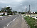 Oklahoma State Highway 82 northbound, Vian Oklahoma.jpg 2,816 × 2,112; 1.52 MB
-
 Oklahoma State Highway 82.svg 385 × 385; 15 KB
-
 US62wRoad-OK51-OK82-OK10signsTalequah (31261075090).jpg 2,400 × 1,600; 1.53 MB
.jpg)