Category:October 2008 in Highland (council area)
Jump to navigation
Jump to search
Council areas (municipalities) of Scotland: Aberdeenshire · Argyll and Bute · Dumfries and Galloway · Edinburgh · Falkirk · Fife · Glasgow · Highland · Moray · Perth and Kinross · Scottish Borders ·
Deutsch: Bilder, die im Oktober 2008 in Highland (council area) aufgenommen worden sind. Bitte beachten Sie, dass dies weder das Datum des Uploads noch das Datum des Scannens eines Fotos ist.
English: Images/pictures taken in Highland (council area) during October 2008. Note this is not the date of the upload, nor the date a photo was scanned.
Español: Fotografías o imágenes tomadas en Highland (council area) durante octubre 2008. No es la fecha de subida ni escaneo, sino la fecha en que las fotografías o imágenes se crearon.
Esperanto: Bildoj faritaj en Highland (council area) en oktobro 2008. Tio ne estas la dato, kiam la bildoj estis alŝutitaj aŭ skanitaj.
Français : Photographies ou images prises en Highland (council area) durant octobre 2008. Ce n'est pas la date du téléchargement ou du scan.
Galego: Fotografías ou imaxes tomadas en Highland (council area) durante outubro 2008. Non é a data de subida nin escaneamento, senón a data na que se crearon as fotografías ou imaxes.
Italiano: Fotografie o immagini scattate a Highland (council area) nel ottobre 2008. Nota bene: la data non si riferisce né a quella di upload né a quella in cui la foto è stata digitalizzata.
Norsk bokmål: Bilder tatt i Highland (council area) i løpet av oktober 2008. Merk at dette ikke er datoen for opplasting, eller når et bilde har blitt skannet.
Norsk nynorsk: Bilete teke i Highland (council area) i løpet av oktober 2008. Merk at dette ikkje er datoen for opplasting, eller når eit bilete har vorte skanna.
Русский: Изображения, сделанные в Highland (council area) в течение октябрь 2008 (не дата загрузки изображения).
Українська: Зображення, зроблені в Highland (council area) протягом жовтень 2008. Зауважте, що це не дата завантаження чи дата сканування фотографії.
| October 2007 | ← | October 2008 | → | October 2009 | |||||||
| Jan | Feb | Mar | Apr | May | Jun | Jul | Aug | Sep | Oct | Nov | Dec |
| 116 | 42 | 69 | 103 | 136 | 81 | 131 | 74 | 185 | 73 | 69 | 176 |
|---|---|---|---|---|---|---|---|---|---|---|---|
Subcategories
This category has the following 3 subcategories, out of 3 total.
G
- October 2008 in Glenfinnan (1 F)
I
- October 2008 in Inverness (2 F)
Media in category "October 2008 in Highland (council area)"
The following 70 files are in this category, out of 70 total.
-
-
 The road through Roag - geograph.org.uk - 994675.jpg 480 × 640; 177 KB
-

-
 Achnacarnin and Cnoc na Buaile - geograph.org.uk - 989741.jpg 640 × 425; 128 KB
-
 An t-Òrd, stranded water horse - geograph.org.uk - 1030610.jpg 640 × 427; 550 KB
-
 Ardroag from Roag - geograph.org.uk - 994667.jpg 640 × 480; 71 KB
-
 Ballachulish railway - geograph.org.uk - 1004418.jpg 640 × 425; 58 KB
-
 Balmore Forest (No trees) - geograph.org.uk - 1014622.jpg 640 × 480; 88 KB
-
 Balmore Forest (No trees) - geograph.org.uk - 1015146.jpg 640 × 480; 78 KB
-

-
 Balmore Forest to Beinn a'Chairein - geograph.org.uk - 1015299.jpg 640 × 480; 80 KB
-
 Balmore Forest to Kerrow - geograph.org.uk - 1015194.jpg 640 × 480; 43 KB
-
 Balmore to Buntait - geograph.org.uk - 1015262.jpg 640 × 480; 66 KB
-
 Cannich - geograph.org.uk - 1013238.jpg 640 × 480; 112 KB
-
 Carn an t-Sionnaich - geograph.org.uk - 1015241.jpg 640 × 480; 76 KB
-

-
 Carn Dubh-chromagach Across Moorland - geograph.org.uk - 1010407.jpg 640 × 480; 72 KB
-

-
 Carn Gorm to Kerrow, Strathglass - geograph.org.uk - 1014994.jpg 640 × 480; 71 KB
-
 Carn Gorm to Loch Mullardoch - geograph.org.uk - 1014959.jpg 640 × 480; 44 KB
-
 Cromarty Lighthouse - geograph.org.uk - 1037436.jpg 425 × 640; 56 KB
-
 Easan na Gaibhrie Waterfall - geograph.org.uk - 952108.jpg 640 × 480; 97 KB
-
 Easan na Gaibhrie Waterfall - geograph.org.uk - 952113.jpg 640 × 480; 105 KB
-
 Edge of the forestry in Gleann Bharcasaig - geograph.org.uk - 997296.jpg 640 × 480; 152 KB
-
 Fall on the River Cannich - geograph.org.uk - 998377.jpg 640 × 480; 198 KB
-
 Falls on River Cannich - geograph.org.uk - 998382.jpg 640 × 480; 229 KB
-
 Falls on the River Cannich - geograph.org.uk - 998297.jpg 640 × 480; 208 KB
-
 Falls on the River Cannich - geograph.org.uk - 998374.jpg 640 × 480; 184 KB
-
 Falls on the River Cannich - geograph.org.uk - 998380.jpg 640 × 480; 207 KB
-
 Falls on the River Cannich - geograph.org.uk - 998386.jpg 640 × 480; 215 KB
-
 Forest Walk near B862 - geograph.org.uk - 1006437.jpg 480 × 640; 84 KB
-
 Former station - geograph.org.uk - 1004413.jpg 640 × 427; 75 KB
-
 From Healabhal Bheag - geograph.org.uk - 997320.jpg 640 × 480; 151 KB
-
 From the Mullardoch dam - geograph.org.uk - 998328.jpg 640 × 480; 221 KB
-
 Gate in the Bharcasaig deer fence - geograph.org.uk - 997285.jpg 640 × 470; 196 KB
-
 Gleann Bharcasaig - geograph.org.uk - 997291.jpg 640 × 480; 175 KB
-
 Greylag Geese flying into Nigg Bay - geograph.org.uk - 1014825.jpg 640 × 480; 62 KB
-
 Hall High Street, Cromarty - geograph.org.uk - 1037456.jpg 640 × 425; 70 KB
-

-
 Loch Carrie - geograph.org.uk - 998533.jpg 640 × 450; 183 KB
-

-
 Near the River Cannich - geograph.org.uk - 998313.jpg 640 × 480; 200 KB
-
 Rainbow near Mullardoch Dam - geograph.org.uk - 998494.jpg 640 × 480; 191 KB
-
 Rainbow over Coire Eoghinn - geograph.org.uk - 998506.jpg 640 × 480; 163 KB
-
 Rainbow over Loch na Cairidh - geograph.org.uk - 998352.jpg 640 × 480; 64 KB
-
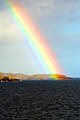 Rainbow over Scalpay - geograph.org.uk - 1062175.jpg 427 × 640; 39 KB
-
 River Cannich - geograph.org.uk - 998244.jpg 640 × 480; 223 KB
-
 River Cannich - geograph.org.uk - 998416.jpg 640 × 458; 238 KB
-
 River Cannich - geograph.org.uk - 998417.jpg 640 × 456; 231 KB
-
 River Cannich from the "Bailey" Bridge - geograph.org.uk - 998306.jpg 640 × 480; 212 KB
-
 River Horneval - geograph.org.uk - 1019275.jpg 640 × 480; 95 KB
-
 River Horneval - geograph.org.uk - 1019292.jpg 640 × 480; 91 KB
-
 River Horneval - geograph.org.uk - 993633.jpg 640 × 480; 114 KB
-
 River Horneval - geograph.org.uk - 993651.jpg 640 × 480; 126 KB
-
 River Horneval in spate - geograph.org.uk - 1020765.jpg 640 × 480; 100 KB
-
 River Horneval, Lonmore - geograph.org.uk - 1020801.jpg 640 × 475; 102 KB
-
 River Ness and canal below B862 - geograph.org.uk - 1006441.jpg 640 × 480; 73 KB
-
 Rosemarkie Bay - geograph.org.uk - 1037465.jpg 640 × 425; 80 KB
-
 South east slopes of Healabhal Bheag - geograph.org.uk - 997317.jpg 640 × 480; 157 KB
-
 Tarskavaig, Halloween 2008 - geograph.org.uk - 1029655.jpg 640 × 427; 496 KB
-
 Tarskavaig, Halloween 2008 - geograph.org.uk - 1029660.jpg 640 × 427; 388 KB
-
 The Mullardoch dam - with rainbow - geograph.org.uk - 998325.jpg 640 × 480; 206 KB
-
 The road to Glendale - geograph.org.uk - 1019268.jpg 640 × 480; 84 KB
-
 Train crossing bridge at Banavie - geograph.org.uk - 1224706.jpg 640 × 480; 165 KB
-
 Undercut banks of River Horneval - geograph.org.uk - 1019288.jpg 640 × 480; 90 KB
-
 Watchful Buzzard, near Nigg - geograph.org.uk - 996276.jpg 640 × 455; 224 KB
-
 A87 in Strollamus - geograph.org.uk - 991223.jpg 640 × 480; 96 KB
-
 A87 in Strollamus - geograph.org.uk - 991235.jpg 640 × 478; 101 KB
-
 Allt na Bodachan - geograph.org.uk - 1056804.jpg 480 × 640; 109 KB
-
 Anaheilt and Scotstown - geograph.org.uk - 1054840.jpg 640 × 480; 61 KB


_-_geograph.org.uk_-_1014622.jpg)
_-_geograph.org.uk_-_1015146.jpg)


