Category:July 2008 in Highland (council area)
Jump to navigation
Jump to search
Council areas (municipalities) of Scotland: Aberdeenshire · Angus · Argyll and Bute · Dumfries and Galloway · Edinburgh · Glasgow · Highland · Moray · Perth and Kinross · Scottish Borders · South Lanarkshire ·
Deutsch: Bilder, die im Juli 2008 in Highland (council area) aufgenommen worden sind. Bitte beachten Sie, dass dies weder das Datum des Uploads noch das Datum des Scannens eines Fotos ist.
English: Images/pictures taken in Highland (council area) during July 2008. Note this is not the date of the upload, nor the date a photo was scanned.
Español: Fotografías o imágenes tomadas en Highland (council area) durante julio 2008. No es la fecha de subida ni escaneo, sino la fecha en que las fotografías o imágenes se crearon.
Esperanto: Bildoj faritaj en Highland (council area) en julio 2008. Tio ne estas la dato, kiam la bildoj estis alŝutitaj aŭ skanitaj.
Français : Photographies ou images prises en Highland (council area) durant juillet 2008. Ce n'est pas la date du téléchargement ou du scan.
Galego: Fotografías ou imaxes tomadas en Highland (council area) durante xullo 2008. Non é a data de subida nin escaneamento, senón a data na que se crearon as fotografías ou imaxes.
Italiano: Fotografie o immagini scattate a Highland (council area) nel luglio 2008. Nota bene: la data non si riferisce né a quella di upload né a quella in cui la foto è stata digitalizzata.
Norsk bokmål: Bilder tatt i Highland (council area) i løpet av juli 2008. Merk at dette ikke er datoen for opplasting, eller når et bilde har blitt skannet.
Norsk nynorsk: Bilete teke i Highland (council area) i løpet av juli 2008. Merk at dette ikkje er datoen for opplasting, eller når eit bilete har vorte skanna.
Русский: Изображения, сделанные в Highland (council area) в течение июль 2008 (не дата загрузки изображения).
Українська: Зображення, зроблені в Highland (council area) протягом липень 2008. Зауважте, що це не дата завантаження чи дата сканування фотографії.
| July 2007 | ← | July 2008 | → | July 2009 | |||||||
| Jan | Feb | Mar | Apr | May | Jun | Jul | Aug | Sep | Oct | Nov | Dec |
| 116 | 42 | 69 | 103 | 136 | 81 | 131 | 74 | 185 | 73 | 69 | 176 |
|---|---|---|---|---|---|---|---|---|---|---|---|
Subcategories
This category has the following 2 subcategories, out of 2 total.
G
- July 2008 in Glenfinnan (1 F)
I
- July 2008 in Inverness (4 F)
Media in category "July 2008 in Highland (council area)"
The following 129 files are in this category, out of 129 total.
-
 Old Kylesku ferry - geograph.org.uk - 972573.jpg 640 × 480; 118 KB
-

-
 A link to James Bond - geograph.org.uk - 1255756.jpg 640 × 480; 90 KB
-
 A832 - geograph.org.uk - 905753.jpg 640 × 480; 84 KB
-
 A838 near Fiag Bridge - geograph.org.uk - 888969.jpg 640 × 437; 70 KB
-
 Abhainn Rath - geograph.org.uk - 1347950.jpg 640 × 359; 49 KB
-
 Abhainn Rath - geograph.org.uk - 1347959.jpg 640 × 359; 45 KB
-
 Abhainn Rath - geograph.org.uk - 903706.jpg 640 × 359; 44 KB
-
 Abhainn Rath - geograph.org.uk - 903719.jpg 640 × 480; 67 KB
-
 Abhainn Rath, Staoinaig - geograph.org.uk - 1333965.jpg 640 × 359; 80 KB
-
 Achnahaird Bay - geograph.org.uk - 894328.jpg 640 × 480; 78 KB
-
 Achnahaird Beach - geograph.org.uk - 894315.jpg 640 × 480; 87 KB
-

-
 Aird Point pier (2) - geograph.org.uk - 921099.jpg 640 × 480; 67 KB
-
 Aird Point pier - geograph.org.uk - 921098.jpg 480 × 640; 49 KB
-
 Airigh Fhionndail - geograph.org.uk - 894835.jpg 640 × 359; 111 KB
-
-
 Allt Cam Bàn Below Grouse Moor - geograph.org.uk - 884237.jpg 640 × 480; 66 KB
-

-
 Allt Cam Bàn Crossing Grouse Moor - geograph.org.uk - 884224.jpg 640 × 480; 40 KB
-

-
 Allt Coire Giubhsachan - geograph.org.uk - 919466.jpg 640 × 480; 189 KB
-
 Allt Coire Giubhsachan - geograph.org.uk - 919472.jpg 640 × 480; 201 KB
-
 Allt Coire Giubhsachan - geograph.org.uk - 919473.jpg 640 × 480; 208 KB
-
 Allt Coire Giubhsachan - geograph.org.uk - 919481.jpg 480 × 640; 179 KB
-
 Allt Loch a Choire - geograph.org.uk - 920296.jpg 640 × 480; 64 KB
-
 An old Ballachulish Kirk - geograph.org.uk - 874715.jpg 640 × 480; 78 KB
-

-
 Ath a' Chaolais - geograph.org.uk - 899655.jpg 640 × 480; 93 KB
-

-
 Birch woods, Airigh Fhionndail - geograph.org.uk - 894836.jpg 480 × 640; 148 KB
-
 Boardwalk, Ariundle - geograph.org.uk - 1139459.jpg 480 × 640; 123 KB
-
 Boat of Garten Rail Station - geograph.org.uk - 883465.jpg 640 × 480; 94 KB
-
 Boat of Garten Railway - geograph.org.uk - 883476.jpg 640 × 480; 87 KB
-
-

-
 Burn draining Loch na Glaic Tarsuinn - geograph.org.uk - 887038.jpg 640 × 480; 81 KB
-
 Burn draining Loch na Glaic Tarsuinn - geograph.org.uk - 891818.jpg 640 × 480; 66 KB
-
 Burn draining Loch na Glaic Tarsuinn - geograph.org.uk - 891827.jpg 640 × 480; 66 KB
-
 By the Lock Inn, Fort Augustus - geograph.org.uk - 890145.jpg 640 × 480; 106 KB
-
 Caledonian Canal at Fort Augustus - geograph.org.uk - 890128.jpg 640 × 480; 100 KB
-
 Caledonian Canal at Kytra Lock - geograph.org.uk - 890086.jpg 640 × 480; 109 KB
-
 Canal Mouth at Fort Augustus - geograph.org.uk - 890121.jpg 640 × 480; 95 KB
-
 Cattle, Lairig Leacach - geograph.org.uk - 1358393.jpg 640 × 480; 116 KB
-
 Clò Kearvaig - geograph.org.uk - 886265.jpg 480 × 640; 81 KB
-
 Clò Kearvaig - geograph.org.uk - 890491.jpg 640 × 477; 73 KB
-
 Clò Mòr - geograph.org.uk - 886278.jpg 480 × 640; 76 KB
-
 Clò Mòr - geograph.org.uk - 886291.jpg 640 × 480; 66 KB
-
 Clò Mòr - geograph.org.uk - 886294.jpg 640 × 480; 68 KB
-
 Clò Mòr - geograph.org.uk - 890553.jpg 640 × 480; 66 KB
-
 Clò Mòr - geograph.org.uk - 890568.jpg 363 × 640; 72 KB
-
 Coire nan Capull - geograph.org.uk - 1148069.jpg 640 × 480; 96 KB
-
 Corran Ferry, sheep in the road - geograph.org.uk - 921963.jpg 640 × 480; 117 KB
-
 Crater, Cnoc Càrn an Lèim - geograph.org.uk - 890605.jpg 640 × 480; 109 KB
-
 Dam at the head of Loch Shurrery. - geograph.org.uk - 901375.jpg 640 × 427; 249 KB
-
 Damp fields, Ariundle - geograph.org.uk - 894763.jpg 640 × 480; 55 KB
-
 Disused sheepfold in Balmeanach - geograph.org.uk - 891405.jpg 640 × 426; 151 KB
-
 Ditch, Ariundle - geograph.org.uk - 894813.jpg 640 × 480; 93 KB
-
 Driving sheep - geograph.org.uk - 889272.jpg 640 × 480; 62 KB
-
 Duntulm & Cairn Macarthur.JPG 4,000 × 3,000; 5.35 MB
-
 Dunvegan Castle,Isle Of Skye - geograph.org.uk - 908711.jpg 640 × 444; 81 KB
-
 Dyke, Àirigh Fhionndail - geograph.org.uk - 1139563.jpg 480 × 640; 163 KB
-
 East side of Loch Scye. - geograph.org.uk - 900746.jpg 640 × 427; 224 KB
-
 Eilean Donan Castle - geograph.org.uk - 908643.jpg 640 × 427; 75 KB
-
 Entering Muirtown Basin - geograph.org.uk - 885513.jpg 640 × 480; 63 KB
-
 Eroded track, Farrmheall - geograph.org.uk - 892693.jpg 359 × 640; 86 KB
-
 Farmland, Ariundle - geograph.org.uk - 894765.jpg 640 × 480; 73 KB
-
 Farrmheall - geograph.org.uk - 887757.jpg 640 × 430; 62 KB
-
 Fingal Entering Cullochy Lock - geograph.org.uk - 890018.jpg 640 × 480; 103 KB
-
 Forest trees - geograph.org.uk - 876836.jpg 640 × 480; 137 KB
-
 Glen Nevis - Corrour path - geograph.org.uk - 1333971.jpg 640 × 480; 102 KB
-
 Heather in the forest - geograph.org.uk - 876794.jpg 640 × 480; 128 KB
-
 Inverianvie River - geograph.org.uk - 894189.jpg 640 × 480; 109 KB
-
 Inverie Bay - geograph.org.uk - 908634.jpg 640 × 427; 41 KB
-
 Jet skiing, Inverie Bay - geograph.org.uk - 908629.jpg 640 × 454; 36 KB
-
 Just another evening, Loch Shieldaig. - panoramio.jpg 2,008 × 1,482; 1.21 MB
-
 Kingussie, Highland - geograph.org.uk - 875137.jpg 640 × 480; 74 KB
-
 Kinlochleven - Lùibeilt road - geograph.org.uk - 1347955.jpg 640 × 480; 52 KB
-
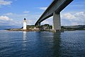 Kyleakin lighthouse and Skye Bridge - geograph.org.uk - 908638.jpg 640 × 427; 64 KB
-
 Lady Bighouse.jpg 640 × 480; 98 KB
-
 Lairig Leacach - geograph.org.uk - 1353099.jpg 640 × 359; 68 KB
-
 Lairig Leacach - geograph.org.uk - 1353103.jpg 640 × 480; 75 KB
-
 Lairig Leacach - geograph.org.uk - 1358396.jpg 640 × 480; 86 KB
-
 Lairig Leacach - geograph.org.uk - 1358408.jpg 640 × 480; 75 KB
-
 Lairig Leacach - geograph.org.uk - 1358453.jpg 640 × 480; 92 KB
-
 Lairig Leacach, beneath Sgùrr Innse - geograph.org.uk - 1358403.jpg 640 × 480; 105 KB
-
 Lambsdale Leans and Loch Shurrery - geograph.org.uk - 881953.jpg 640 × 480; 47 KB
-
 Leaving Rùm. - Flickr - Graham Grinner Lewis.jpg 3,648 × 2,736; 2.55 MB
-
 Level crossing control - geograph.org.uk - 920195.jpg 640 × 480; 106 KB
-
 Linne na Cloiche - geograph.org.uk - 910599.jpg 640 × 480; 101 KB
-
 Loch Beannach - geograph.org.uk - 868701.jpg 640 × 480; 60 KB
-
 Loch Beannach - geograph.org.uk - 868707.jpg 640 × 480; 52 KB
-
 Loch Ness - geograph.org.uk - 890136.jpg 640 × 480; 87 KB
-
 Loch Ness Cruiser - geograph.org.uk - 890113.jpg 640 × 480; 98 KB
-
 Loch Oich - geograph.org.uk - 890001.jpg 640 × 480; 92 KB
-
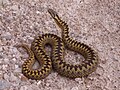 Loch Shin adder.JPG 2,052 × 1,539; 1.02 MB
-
 Loch Shin Hydro Dam - geograph.org.uk - 868499.jpg 640 × 480; 102 KB
-
 Lochan na Faoileige - geograph.org.uk - 880464.jpg 640 × 428; 92 KB
-
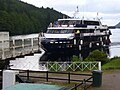 Lord of the Glens - geograph.org.uk - 888953.jpg 640 × 480; 85 KB
-
 Moorland alongside A832 - geograph.org.uk - 913039.jpg 525 × 394; 52 KB
-
 Mossy boulder, Ariundle - geograph.org.uk - 1139542.jpg 640 × 480; 168 KB
-
 Northeast ridge of Farrmheall - geograph.org.uk - 887777.jpg 638 × 310; 60 KB
-
 Northern slopes of Farrmheall - geograph.org.uk - 887774.jpg 640 × 413; 57 KB
-
 Oak woods, Airigh Fhionndail - geograph.org.uk - 894821.jpg 640 × 480; 143 KB
-
 On the path to the lead mines - geograph.org.uk - 919581.jpg 640 × 480; 61 KB
-
 On the Strathspey Railway - geograph.org.uk - 882451.jpg 480 × 640; 112 KB
-
 Path in the Strontian Glen - geograph.org.uk - 1139583.jpg 640 × 480; 88 KB
-
 Red deer - geograph.org.uk - 931053.jpg 640 × 480; 110 KB
-
 Road , Ariundle - geograph.org.uk - 1139435.jpg 640 × 480; 117 KB
-
 Road bridge over the Inverianvie River - geograph.org.uk - 894175.jpg 640 × 480; 101 KB
-
 Sango Bay campsite - geograph.org.uk - 889281.jpg 640 × 359; 50 KB
-
 Sea Mist over the loch - geograph.org.uk - 921116.jpg 640 × 361; 26 KB
-
 Sgeir Maol Mhoraidh - geograph.org.uk - 927252.jpg 640 × 480; 82 KB
-
 Sheepfold by Allt Mama - geograph.org.uk - 911219.jpg 640 × 480; 93 KB
-
 Sheepfold near Loch Shurrery. - geograph.org.uk - 901331.jpg 640 × 427; 282 KB
-
 South ridge of Farrmheall - geograph.org.uk - 887763.jpg 640 × 359; 63 KB
-
 South ridge of Farrmheall - geograph.org.uk - 887779.jpg 640 × 359; 51 KB
-
 Stack Clò Kearvaig - geograph.org.uk - 890311.jpg 640 × 490; 60 KB
-
 Strontian River - geograph.org.uk - 1139451.jpg 640 × 480; 109 KB
-
 Strontian River - geograph.org.uk - 894824.jpg 640 × 480; 99 KB
-
 Temperature inversion on the Storr - geograph.org.uk - 903794.jpg 640 × 427; 111 KB
-

-
 The New Road through Glen Docherty - geograph.org.uk - 908784.jpg 640 × 344; 63 KB
-

-
 Train leaving Corrour - geograph.org.uk - 1331985.jpg 640 × 480; 72 KB
-
 Tributaries joining Glenmarkie Burn - geograph.org.uk - 874484.jpg 640 × 480; 122 KB
-
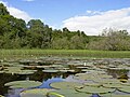 Water Lilies on Loch Ussie - geograph.org.uk - 1018226.jpg 640 × 480; 111 KB
-
 Welcome to Invershin - geograph.org.uk - 903675.jpg 640 × 480; 74 KB
-
 Àirigh Fhionndail - geograph.org.uk - 1139552.jpg 640 × 359; 135 KB


_-_geograph.org.uk_-_921099.jpg)


